Chef Boutonne
History
Chef-Boutonne, formerly known as Caput Wulton, takes its name from the river that rises there, the Boutonne.
Today, as the administrative centre of the canton, the town has a population of 2,217. It is a town steeped in history.
Several historical remains bear witness to times gone by, such as Gallo-Roman settlements at Javarzay and Pouzac, and a Merovingian cemetery where a terracotta jewellery box, pottery and coins were discovered.
From the Middle Ages onwards, several lordships succeeded one another here: Gontaut-Biron, La Rochefoucauld and then Lamoignon. The last Marquis of Chef-Boutonne was the Marquis Lamoignon de Malesherbes, known for having been Louis XVI’s lawyer.
At the time of the French Revolution, Javarzay and Lussais, which had been independent communes, were incorporated into the town of Chef-Boutonne.
A native of Chef-Boutonne, Jean-François Cail (find out more), born in 1804, did the town proud by becoming not only one of the most brilliant industrialists of the 19th century, but also a pioneer in many fields.
The history of the town and its inhabitants is also closely linked to developments in agricultural techniques. The decline in agricultural activity has seen local economic development shift towards the service sector and tourism.
The stone buildings, monuments and streets bear witness to this rich historical past.
Javarzay Castle
listed as a Historic Monument since 1862
The site of Javarzay has been occupied since antiquity by a Gallo-Roman farm, the estate of Gavarcius, from which the name Javarzay derives.
It became a Merovingian royal farm in the 6th century. Clothaire I, son of Clovis and husband of Radegonde, stayed there in 559, and Saint Junien, the legendary hermit, was welcomed there.
The castle we see today is one of the earliest Renaissance castles in Poitou.
Built by François de Rochechouart (a comrade-in-arms of François I) around 1515, it originally featured 12 defensive towers.
Among its illustrious owners were: the de la Rochefoucault family; the Count of Ponchartrain, minister to Louis XIV; and Chrétien Guillaume de Lamoisgnon de Malesherbes, lawyer to Louis XVI.
Having passed through the hands of various families since the Revolution, it was more or less left to fall into ruin. The château was given a new lease of life from 1982 following its purchase by the municipality of Chef-Boutonne.
Thanks to the efforts of the association ‘Les Amis du Château de Javarzay’ since 1983 and a major restoration project carried out by the Historic Monuments department in 1995, the château has regained its former splendour.
The interior fit-out of the rooms is the work of ‘Les Amis du Château’, joined in 2003 by the ‘C.A.I.L. association’.
Architecture
Built by an architect from Tours at the very beginning of the 16th century, constructed of white stone and roofed with slate, it has the silhouette of a small Loire Valley château.
The entrance gatehouse combines both feudal and Renaissance features. Its square tower, flanked by corbelled turrets, dominates the site. On both its façades, the walkways are interrupted by a bay of mullioned windows featuring meticulously crafted Renaissance decorations.
Its porch still bears traces of the drawbridge and the cart passage. It leads to the inner courtyard, now symbolised by a hedge of yews. The feudal-style spiral staircase turret provides access to all the rooms in the castle. The chapel features a beautiful carved door. The large corner tower that remains is topped by a very slender conical roof and surrounded by a parapet walk with wide battlements.
It is particularly impressive for its machicolations resting on long corbels. During the tour, visitors can see its original roof structure.
Adjoining the main building, between the two towers, the 19th-century orangery welcomes visitors.
The right-hand wing, added in 1820, provides an exhibition space for artists.
Saint-Chartier Church in Javarzay
Listed as a historic monument in 1840, this Romanesque church dedicated to Saint-Chartier was built in the mid-12th century and houses around a hundred sculptures as well as a funerary slab engraved in 1211.
Situated on a secondary route of the Way of St James, it was extended in the 16th century to accommodate pilgrims; as a result, the chancel and the portal lend a Renaissance touch to the building.
Notre-Dame Church
Built between 1824 and 1830, the Church of Notre-Dame stands on the site of the former Château de Chef-Boutonne. The architect, Pierre-Théophile Segretain, based his plans on the Neoclassical style, which was very much in vogue at the time. This is why it resembles the Church of La Madeleine in Paris.
Chef-Boutonne Castle
The castle stood on a rocky outcrop overlooking the source of the River Boutonne, but all that remains are the ruins of two towers and part of the surrounding wall. Place Malesherbes is named after the last Marquis of Chef-Boutonne, who was Louis XVI’s lawyer at the time of the French Revolution. A stroll along the ramparts behind the church offers visitors a panoramic view of the town.
In the footsteps of Jean-François Cail
Jean-François Cail was born in Chef-Boutonne in 1804. Self-taught, he quickly became an inventor and then a mechanical engineer. He later set up his workshops in Chaillot, where he built locomotives – including the famous Crampton high-speed locomotives – and metal structures (such as the Fades viaduct). He played a part in modernising techniques used in the sugar industry. He also revolutionised the agricultural sector with his industrial farm, ‘La Briche’, in Indre-et-Loire – the only one of its kind in Europe. He died in 1871, having filed 51 patents, and was one of the key figures of the Industrial Revolution.
At Javarzay Castle, visitors can explore an exhibition room dedicated to Jean-François Cail, organised by the C.A.I.L. Association (Comité Autour d’un Inventeur Local).
The market square in the town centre and the vocational college are named after Jean-François Cail. You can see his birthplace whilst strolling down the ‘venelle’ at the corner of Rue René Coynault.
The Boutonne
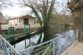
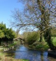
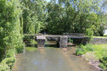
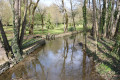
The Boutonne rises in Chef-Boutonne, beneath the wash house on Rue de la Fontaine, then flows through parts of the Deux-Sèvres and Charente-Maritime departments over a distance of 99 km. It flows into the Charente at Carillon, near Tonnay-Charente. Its tributaries are the Brédoire, the Nie, the Sandrenne and the Trezence.
It was developed in the 18th century to facilitate commercial navigation and the transport of Pineau, and is navigable for 31 kilometres from St Jean d’Angély.
At Chef-Boutonne, several small springs and resurgences emerge on either side of the river right down to its bed; these include: Coupeaume, Pytareau, the Fontaine de la Faiencererie, the Rossignol, Pouvareau, Chandant, the Pouzac, Pyroli, the Fontaine du Château, the Fontaine à Marion and the Fontaine du Pont-Neuf.
The mills
There are 41 mills on the Boutonne in Deux-Sèvres, 14 of which are no longer in operation in Chef-Boutonne.
The mills in Chef-Boutonne, listed from the source downstream, are the Moulin des Bessons, the Moulin d’Epaillard, the Moulin de Pouillet, the Pouvareau Mill, the Chandant Mill, the Javarzay Mill, the Payré Mill, the Gonds Mill, the Neuf Mill, the Guibou Mill, the Treneuillet Mill, the Planier Mill, the Lussais Mill and the Lusseau Mill.
The wash houses at Chef-Boutonne
In days gone by, laundry was done in the River Boutonne, and women would gather around the washhouses in the various neighbourhoods of the village to wash their clothes.
The edges around the wash houses were therefore paved with stones, to allow the washerwomen to kneel on their ‘genouillon’ – a sort of wooden tub lined with a cushion. They would wash and beat their laundry with a ‘battou’ or ‘tapou’ to remove any remaining soap suds, and scrub the laundry with a couch grass brush on the stone tables built for this purpose.
Chef-Boutonne has several washhouses, including the one at the spring, at Javarzay near the Washerwomen’s House, at Moulin Neuf, and at Pouvareau, amongst others.



 Country:
 City:
City:






 Visorando Member

 Easy
Easy