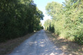
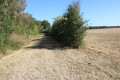
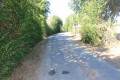
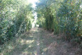
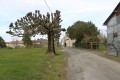
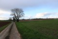
Around La Bellesebonne near Villefollet

A pleasant walk across the plains, partly along the course of the Bellesebonne. The route is particularly flat (less than 9 m elevation gain). It passes through the villages of Villefollet and Maillé.

Details

1381911
Creation:
Last update:
Last review:
  • Walking
    Activity: Walking
  • ↔
    Distance: 6.82 mi
  • ◔
    Average duration: 3h 10 
  • ▲
    Difficulty: Moderate

  • ⚐
    Back to start: Yes
  • ↗
    Ascent: + 33 ft
  • ↘
    Descent: - 33 ft

  • ▲
    Highest point: 184 ft
  • ▼
    Lowest point: 148 ft
  • ⚐ Country: France
  • ⚐ City: Villefollet (79170)
  • ⚑
    Start/End: N 46.123412° / W 0.265817°
  • ❏
    IGN map(s): Ref. 1629SB
  • Hour-by-hour weather

Photos

Description of the walk

Park in the stadium car park near the D1.

(S/E) Walk to the junction of the Route de Chizé (D1) and Rue du Buisson Laurent. Turn right into the first street, passing the town hall. At the next junction, turn left into Rue de l’Église.
Carry straight on. The road turns into a track and, a little further on, crosses the River Ponthioux. Follow this track until you reach a T-junction.

(1) Turn left. Follow the track until it reaches a junction with other tracks, including the Chemin de Chante Gros (on the right-hand side). Continue straight ahead with caution along the small road opposite. Carry on along this road, known as the Chemin du Grand Pas, until you reach a five-way junction.

(2) Turn onto the road immediately on the left (Chemin de la Croix des Bannes).

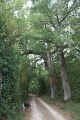
(3) Turn left onto the first track that runs through the Chichillons area. Further on, the track runs alongside the River Bellesébonne, forming a lovely shaded avenue. Carry on straight ahead until you reach a small road. At this point, turn left and proceed with caution along this road until the next junction.

(4) At this four-way junction, turn right and continue with care until you reach the first junction in Maillé.

(5) Turn left and immediately take the path on the left heading south. Carry on straight ahead until you reach the first path on the left-hand side. Follow this path until you reach the first grassy path on the right, between two rows of trees.

(6) At this point, turn right heading south. A little further on, the grassy track joins a dirt track: carry on straight ahead until you reach the D1 road. Cross it carefully and continue along the track opposite.

(7) A little further on, a path branches off at a right angle on the left-hand side: follow it until you reach a small road. When you reach the small road, turn left and follow it carefully until you reach the first path on the right.

(8) Turn right onto the track. Further on, the track takes a right-angle bend to the right. At this point, turn left onto a track heading north.

(9) At the edge of a small copse, turn right onto a track running along the left-hand edge of the copse. Continue until you reach a small ‘road’ (a track that was once tarmac-surfaced). Turn left and follow this small ‘road’ carefully until you reach the first track on the right.

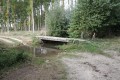
(10) Turn right onto the track that crosses the fields in the hamlet of La Jardon. A short distance further on, on the left-hand side, a hedge marks the site of a seasonal stream.

(11) At the first crossroads, take the left-hand path (GR® 655), which is one of the routes to Santiago de Compostela. Continue straight on towards Villefollet. On arrival, the path runs alongside the stadium on your right. As soon as you’ve passed the stadium, turn right to reach the car park (S/E).


Waypoints

  1. S/E : mi 0 - alt. 180 ft - Stadium car park near the D1
  2. 1 : mi 0.68 - alt. 167 ft - T-junction
  3. 2 : mi 1.62 - alt. 161 ft - Crossroads of 5 roads
  4. 3 : mi 1.96 - alt. 157 ft - Road–path junction
  5. 4 : mi 3.15 - alt. 154 ft - Crossroads
  6. 5 : mi 3.38 - alt. 148 ft - Road–path junction
  7. 6 : mi 3.94 - alt. 151 ft - Crossroads
  8. 7 : mi 4.59 - alt. 151 ft - T-junction
  9. 8 : mi 5.05 - alt. 157 ft - Road–path junction
  10. 9 : mi 5.43 - alt. 164 ft - T-junction
  11. 10 : mi 5.86 - alt. 167 ft - Road–path junction
  12. 11 : mi 6.23 - alt. 171 ft - T-junction
  13. S/E : mi 6.82 - alt. 180 ft - Stadium car park near the D1

Notes

The car park is located behind the town hall in Villefollet.

This walk across varied terrain requires suitable footwear.

This walk is signposted at the start and end of the route: GR® 655, signposted in red and white (the Way of St James). The rest of the route is unmarked. Consequently, it is advisable to follow the directions in the description and on the map, whilst keeping a close eye on the landscape. The waypoints (with their GPS coordinates and the distance from the starting point) serve as aids for walkers exploring the route for the first time.

Hike completed by the author on 11 September 2018.

Worth a visit

Villefollet

A pleasant rural commune, situated between plains and marshes, forests and rivers. The two villages that make up this commune, Villefollet and Maillé, are both built on the banks of the small river ‘La Bellesébonne’, which runs right through the commune. Watermills are also a feature of the landscape.
In the Middle Ages, a church was built, along with a priory, a manor and a chaplaincy, which at that time conferred a certain importance upon the village. The name Villefollet is thought to derive from the combination of the two Latin names ‘Villa’ and ‘Foullons’, which means ‘mills’, thus signifying ‘village of the mills’.
The village is also crossed by the Roman road leading from Poitiers to Saintes, which is very busy in summer with pilgrims on the Way of St James.
The forest, which still exists today, once formed the link between the Benon and Couture d’Argenson forests, and was therefore an integral part of the Argenson Forest.

History
As part of the local community, Villefollet is situated in the heart of the Pays Mellois, a ‘Land of Art and History’.
A small stream called La Bellesébonne, a tributary of the Boutonne, runs the length of the village. Villefollet is also characterised by a landscape of woods and plains, as this area once linked the Benon Forest to the Aulnay-de-Saintonge Forest, which together formed ‘the Argenson Massif’.
Villefollet is one of the oldest villages in the canton of Brioux-sur-Boutonne; the remains of a Gallo-Roman villa can still be found on the banks of La Bellesébonne.
In the Middle Ages, this village was called “Villa-Foletti”; this name derived from the Latin for “fuller’s mill”, as mills were built along the watercourse to grind grain for making bread. In 1716, the village still had twelve dairy farms; the plain produced wheat, whilst the marshy lands to the west yielded good hay and pasture for rearing brood mares and livestock. Two houses still stand today, bearing clear witness to the village’s age and renown.
Before the late 1880s (the arrival of phylloxera), the south-western slopes of the commune were planted with vines and formed part of the Cognac appellation.
From its highest point, ‘La Butte de Chantegros’, the villagers could see the enemy approaching from the east and the north.
Source: website of the Val de Boutonne Community of Communes (excerpts)

Bellesebonne Stream
A watercourse 16.9 km long which flows into the Boutonne after passing through eight communes within the Deux-Sèvres department alone. In recent years, this stream has experienced low-water periods lasting between two and four months during the summer.
Source: Wikipedia (excerpts) and the National Low-Water Observatory (ONDE)

Always be cautious and plan ahead when you're outdoors. Visorando and the author of this route cannot be held responsible for any accidents occurring on this route.

The GR® and PR® markings are the intellectual property of the Fédération Française de Randonnée Pédestre.

Reviews and comments

4.3 / 5
Based on 2 reviews

Reliability of the description
4.5 / 5
Ease of following the route
5 / 5
Route interest
3.5 / 5
larochenet
larochenet

Overall rating : 4.7 / 5

Date of your route : Nov 10, 2021
Reliability of the description : ★★★★★ Very good
Ease of following the route : ★★★★★ Very good
Route interest : ★★★★☆ Good
Very busy route : No

A lovely walk. The weather had been fine for several days, so even though the grassy paths were damp, they were still pleasant to walk on. We’d set out to do the circular Boucle des Essarts, but there was a hunt taking place in the forest, so we looked for a walk not too far away and we weren’t disappointed – thanks to the Visorando app! It took us three hours, taking our time. Thank you for this lovely route.

Machine-translated

pgetrochon
pgetrochon

Thank you for your comment.
Enjoy your walks

Machine-translated

caillet valérie
caillet valérie

Overall rating : 4 / 5

Date of your route : Mar 19, 2019
Reliability of the description : ★★★★☆ Good
Ease of following the route : ★★★★★ Very good
Route interest : ★★★☆☆ Average

very pleasant

Machine-translated

Other walks in the area

For more walks, use our search engine .

The GPS track and description are the property of this route's author. Please do not copy them without permission.