The ‘Promenade des Balcons de Névache’ circular walk

A walk around the village of Névache to explore a beautiful forest and a charming forest hut.

Details

688893
Creation:
Last update:
Last review:
  • Walking
    Activity: Walking
  • ↔
    Distance: 4.14 mi
  • ◔
    Average duration: 2h 40 
  • ▲
    Difficulty: Moderate

  • ⚐
    Back to start: Yes
  • ↗
    Ascent: + 906 ft
  • ↘
    Descent: - 902 ft

  • ▲
    Highest point: 6,024 ft
  • ▼
    Lowest point: 5,184 ft

Description of the walk

Park at the entrance to Névache in the large shuttle bus car park.

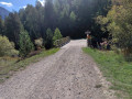
(S/E) Cross the road and enter the campsite. Continue to the Pont Sergent Jean Tane. Cross the Clarée via this bridge and continue through the forest, ascending very slightly. Join theGR®57, turn right to reach the Pont de Fortville. Cross the Clarée again and turn left until you reach the next junction.

(1) Cross the road and take the Impasse du Cros opposite. Start by climbing the tarmac road; at the last houses, you’ll come to a wide stony track. Continue north on this track and, after a short but steep climb, join the cross-country path.

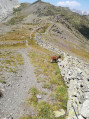
(2) Turn right onto it, following the sign for Les Thures. Navigate two or three tight hairpin bends to cross the Combe de la Ruine. You will then enter the forest and, via a splendid, almost level path, reach the junction with the Creux des Souches path.

(3) Carry on straight ahead, leaving the Creux des Souches path on your right (which is, incidentally, in poor condition), and begin a very gentle descent that ends at the banks of the Torrent de Lichos. Cross it to reach the Cabane Forestière.

(4) Turn right, following the red and white markings ofthe GR®57. Continue along the wide track until you reach the barrier blocking access to unauthorised vehicles.

(5) Stay on theGR® or take one of the many shortcuts, all of which lead to the car park at the start of the route, which comes into view quickly (S/E).

Waypoints

  1. S/E : mi 0 - alt. 5,194 ft - Shuttle bus car park – Cross the > - Clarée (rivière)
  2. 1 : mi 0.97 - alt. 5,210 ft - Le Cros
  3. 2 : mi 1.36 - alt. 5,574 ft - Trail junction
  4. 3 : mi 2.46 - alt. 5,994 ft - Creux des Souches crossroads
  5. 4 : mi 2.87 - alt. 5,696 ft - Forest chalet
  6. 5 : mi 3.25 - alt. 5,512 ft - Barrier
  7. S/E : mi 4.14 - alt. 5,197 ft - Shuttle bus car park

Notes

Normally, the fountain at the forest chalet is supplied with water, but this was not the case in the summer of 2017.
Tables and a picnic area at the forest chalet.

Worth a visit

The area around Névache is home to dozens of hiking routes: simply type ‘Névache’ into a search engine.

Always be cautious and plan ahead when you're outdoors. Visorando and the author of this route cannot be held responsible for any accidents occurring on this route.

The GR® and PR® markings are the intellectual property of the Fédération Française de Randonnée Pédestre.

Reviews and comments

4.4 / 5
Based on 4 reviews

Reliability of the description
4.3 / 5
Ease of following the route
4.8 / 5
Route interest
4.3 / 5
bernardino
bernardino ★

Please note that the shuttle bus is free from the Roubion car park to the Nevache Tourist Office, but there is a charge thereafter; the fare is updated annually and will be €12 in 2026.

Machine-translated

polclio
polclio

Overall rating : 4.3 / 5

Date of your route : Jul 05, 2026
Reliability of the description : ★★★★★ Very good
Ease of following the route : ★★★★☆ Good
Route interest : ★★★★☆ Good
Very busy route : No

Between the Combe de la Ruine and the Creux des Souches path, the trail – which is at times narrow, dusty and slightly sloping – requires a degree of caution but does not present any particular difficulties. However, after the forest hut, the GR is not directly accessible due to a landslide near the stream. You’ll need to head back up a little to go round it, turning left a little further up. The picnic area by the forest hut is very pleasant.
For your information, contrary to what “Ladilafee” says, the Clarée Valley is accessible by a free shuttle bus from the hamlet of Le Roubion, where you can park your car for free.

Machine-translated

Olive 34
Olive 34

Overall rating : 5 / 5

Date of your route : Aug 04, 2025
Reliability of the description : ★★★★★ Very good
Ease of following the route : ★★★★★ Very good
Route interest : ★★★★★ Very good
Very busy route : No

A pleasant short hike, partly through the forest. The elevation gain at the start of the trail may be surprising, but it doesn't last long. Contrary to what "yandre73" wrote, this hike does not present any particular danger. I wanted to clarify this because, after reading this alarmist comment, we almost gave up on this loop... and that would have been a shame!

Machine-translated

Ladilafee
Ladilafee

Overall rating : 4 / 5

Date of your route : Aug 05, 2024
Reliability of the description : ★★★☆☆ Average
Ease of following the route : ★★★★★ Very good
Route interest : ★★★★☆ Good
Very busy route : No

Described as a ‘walk’.
The climb takes place over a very short distance across open ground; it was very hot that day.
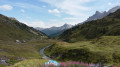
Otherwise, the route starts by following a small stream through a lush green meadow. And after the climb, you take a forest track. It was quite a nice walk.
We chose this walk out of frustration because the
Claree Valley is only accessible by shuttle bus at this time of year.
12 euros per person…
Hiking is set to become an activity reserved for those with a certain amount of money.
I think that’s a bit of a shame.

Machine-translated

Marisol
Marisol

Overall rating : 4.3 / 5

Date of your route : Jun 29, 2024
Reliability of the description : ★★★★☆ Good
Ease of following the route : ★★★★★ Very good
Route interest : ★★★★☆ Good
Very busy route : No

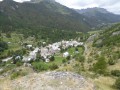
A very easy route to follow; it’s signposted for most of the way, with views of Nevache and the surrounding area, and plenty of flowers towards the end.
I mainly use the GPX file – it’s very handy if I’m in any doubt.
A nice little walk with some balcony-like sections; take care when crossing the Roubion as there’s a lot of water this year.
Thanks for this description

Machine-translated

yandre73
yandre73

I’ve just been on the Nevache Balconies “walk” this morning
I’d like to point out that this isn’t a walk but a hike “involving significant risk”.
On a walk, I can take my children without holding their hands
Here, there is a very high risk of falling
In some sections, you can’t even place one foot next to the other, with a massive drop below (a fall of over 100 metres with no way to break your fall).
I’ve spoken to a mountain guide who also agrees that there are quite a few ‘dangerous’ sections
I wanted to point this out
Enjoy your hike, everyone

Machine-translated

Other walks in the area

For more walks, use our search engine .

The GPS track and description are the property of this route's author. Please do not copy them without permission.