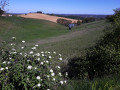
The Moncassin circular loop

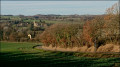
A circular path that begins with a beautiful view over the plain and the Pyrenees mountain range. The path first runs across the plain, then follows the Petite Baïse river before climbing up to the ridge paths for the return journey.

Details

1856985
Creation:
Last update:
Last review:
  • Walking
    Activity: Walking
  • ↔
    Distance: 9.32 mi
  • ◔
    Average duration: 4h 50 
  • ▲
    Difficulty: Moderate

  • ⚐
    Back to start: Yes
  • ↗
    Ascent: + 669 ft
  • ↘
    Descent: - 666 ft

  • ▲
    Highest point: 935 ft
  • ▼
    Lowest point: 571 ft

Photos

Description of the walk

Car park at the entrance to the village of Moncassin.

(S/E) Head west through the village to the end of the road.
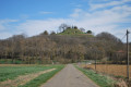
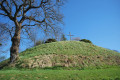
Turn left onto the path leading to the castle mound and climb to the very top for a beautiful view.

(1) Then head back down the same path to the village road. Follow the road back towards the village for about thirty metres.
Turn right onto the downhill path until you reach a road at a place called Caillots
Turn right and carry on straight ahead, passing the junction.

(2) At the three-way junction, take the small road branching off to the left. Carry on straight ahead to Lapalu Castle. Turn left for a few metres.

(3) Turn right, passing by the château. Follow this road, which takes a right-angle bend to the right. Continue to the next bend.

(4) Follow the road as it bends to the left and carry on along this track. Pass Lamajestère Farm. Carry on until you reach a junction with a track suitable for vehicles on the left.

(5) Take the track on the left which leads down to the river: the Petite Baïse. Follow the path which runs alongside the river until you reach a road.

(6) Once on the road, head straight ahead, pass in front of Pican Castle and continue up the road to the ridge. Ignore all roads to the left; pass in front of Verdier Farm. Continue to the junction.

(7) Turn left onto the downhill road. At the first junction, turn right onto the small uphill track. Pass the hamlet of Le Tajan and continue straight on along the track suitable for vehicles. Carry on until you reach the next junction.

(8) Take the path on the right leading downhill and stay on this path until you reach a tarmac road. Turn left at the hamlet known as La Guitare. Follow the road until you reach a very sharp bend to the right.

(9) At the bend, take the track suitable for vehicles that leads straight ahead. Continue along this track until you reach the small copse on the left. Walk alongside it, then at the end, turn left and follow the edge of the copse downhill. Near the pond, turn right and walk alongside the water’s edge until you reach a tarmac road.

(10) Turn right onto the tarmac road, pass the hamlet of Loubère and continue downhill to the junction with the D237.

(11) Turn right and continue for a few metres, then take the path on the left. Cross the bridge over the Ruisseau du Galinon, then follow the stream on your right until you reach the junction with a tarmac road.

(12) Cross the road, take the footbridge on the right which crosses the stream, then follow the stream on your left. At the junction of the paths opposite the embankment, take the path leading off to the left which joins a tarmac road.

(13) Follow this road to the right, then leave it to take a track suitable for vehicles which heads uphill to the right. Continue along this track, which goes round the water reservoir. Carry on downhill and cross a stream, then head back up the track opposite until you reach the tarmac road.

(14) At the road, turn right, then at the junction turn left to reach the village of Moncassin. (S/E)


Waypoints

  1. S/E : mi 0 - alt. 804 ft - Car park at the entrance to the village
  2. 1 : mi 0.26 - alt. 846 ft - Motte cadastrale
  3. 2 : mi 0.67 - alt. 656 ft - Three-way junction
  4. 3 : mi 1.36 - alt. 604 ft - Turn right next to the castle
  5. 4 : mi 1.86 - alt. 614 ft - Turn left at the bend
  6. 5 : mi 2.46 - alt. 600 ft - Junction on the left: track suitable for vehicles leading to the - Petite Baïse
  7. 6 : mi 3.64 - alt. 571 ft - Crossroads opposite the castle
  8. 7 : mi 4.44 - alt. 705 ft - Turn left at the junction
  9. 8 : mi 5.48 - alt. 922 ft - Path on the right at the junction
  10. 9 : mi 6.35 - alt. 869 ft - At the bend, take the path opposite
  11. 10 : mi 6.85 - alt. 719 ft - Tarmac path, on the right
  12. 11 : mi 7.13 - alt. 719 ft - D237
  13. 12 : mi 7.51 - alt. 741 ft - Turn left at the footbridge
  14. 13 : mi 8.17 - alt. 856 ft - Turn right at the junction
  15. 14 : mi 9.14 - alt. 840 ft - Turn right at the junction
  16. S/E : mi 9.32 - alt. 804 ft - Finish at the car park at the village entrance

Notes

Shortcut option: At (4) on the bend, a path branches off to the right; this uphill path takes you back to the route at the junction on the ridge, 400m before (9). Circular route of 10.5km.

- Make sure you have a map of the route, as there are not signposts along the entire route.

- Avoid this walk in very hot weather.

Worth a visit

Panoramic view from the castle mound at the start.

Reviews and comments

4.2 / 5
Based on 3 reviews

Reliability of the description
4.3 / 5
Ease of following the route
4.7 / 5
Route interest
3.7 / 5
Dill
Dill

Hello
Thank you for your message. I’ve just made a correction to the route so that it doesn’t end up at a place called Loubère via the country lane.

Machine-translated

lecbalcaz
lecbalcaz

Overall rating : 4 / 5

Date of your route : Nov 11, 2021
Reliability of the description : ★★★★☆ Good
Ease of following the route : ★★★★☆ Good
Route interest : ★★★★☆ Good
Very busy route : No

A lovely walk
I can confirm that some of the signposts are missing
Reliable route description and GPS coordinates included; a trouble-free walk, except at a place called Loubère where we were
stopped by the landowner: “We were supposedly on a private track where access is prohibited, and
, plus there was a huge dog, for which the owner told us he wasn’t responsible”!!!!
We didn’t argue and carried on, finishing the walk without any trouble
So, a word of warning to other walkers!!!

Machine-translated

LaPierre
LaPierre

Overall rating : 4.3 / 5

Date of your route : Mar 21, 2021
Reliability of the description : ★★★★★ Very good
Ease of following the route : ★★★★★ Very good
Route interest : ★★★☆☆ Average
Very busy route : No

Hello,

I can confirm that there are no yellow markings from point 4 to point 9. Fortunately, the description is reliable, as is the map.
A peaceful, very quiet walk, although we do find ourselves very (too) often on small tarmac roads, but fortunately with no traffic at all.
An interesting historical spot is Lapalu Castle at point 3.
As for the elevation gain, although I haven’t measured it, it’s certainly closer to 500m than 190m… as labradornoir points out.

Machine-translated

labradornoir
labradornoir

Overall rating : 4.3 / 5

Date of your route : Aug 21, 2019
Reliability of the description : ★★★★☆ Good
Ease of following the route : ★★★★★ Very good
Route interest : ★★★★☆ Good

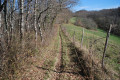
The route is unmarked for almost half the distance. Take care at point 5 – there are no signposts. Between points 5 and 6, the path is overgrown with tall grass. Signposting resumes at point 10.
Between 10 and 11, no maintenance at all! Nettles over a metre high!

Otherwise, there are some lovely views of the Pyrenees.
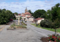
Lapalu Castle, even in poor condition, is worth a look. Moncassin is a very charming village.
Caution! The total elevation gain is 500m.

Machine-translated

Other walks in the area

For more walks, use our search engine .

The GPS track and description are the property of this route's author. Please do not copy them without permission.