The path from Saint-Jaymes Chapel to Saint-Michel

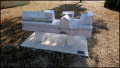
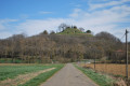
A circular route featuring a stretch through the woodland and a short detour to visit the modest Saint-Jaymes Chapel, of Romanesque origin.

Details

7248575
Creation:
Last update:
Last review:
  • Walking
    Activity: Walking
  • ↔
    Distance: 7.52 mi
  • ◔
    Average duration: 3h 50 
  • ▲
    Difficulty: Moderate

  • ⚐
    Back to start: Yes
  • ↗
    Ascent: + 456 ft
  • ↘
    Descent: - 440 ft

  • ▲
    Highest point: 876 ft
  • ▼
    Lowest point: 584 ft

Photos

Description of the walk

Start from the car park opposite the church.

(S/E) With your back to the church, take the street opposite, then the first street on the left. At the junction with the D 939, turn right, passing the village bakery.

(1) Take the path on the right. When you reach Tevet Farm, turn right onto the track that goes round the farm and continue straight on along this dirt track, leaving a dirt track on your right – this will be the route back. You’ll arrive at a place called Le Chapelat; then, at the junction, head straight ahead and continue to the T-junction.

(2) Turn right and, at the three-way junction with the D 237 road, go straight ahead. Continue to the fork in the road and turn left. Carry on straight ahead to the Saint-Jaymes Chapel.

(3) After visiting the chapel, retrace your steps and look for a dirt track branching off to the right, leading uphill towards a copse. Continue along this track until you reach a junction with a tarmac road.

(4) Turn right, carry on to the right-angled bend and continue along the path opposite. Stay on this path until you reach a tarmac road.

(5) Turn right and go straight on, then turn onto the country lane on the left which leads straight up to the hamlet of Le Lin. You’ll arrive level with the house known as Le Lin.

(6) Turn right and continue along this path through the woods. You’ll come to a stony track; carry on straight ahead until you reach a right-angled bend in the track.

(7) Turn onto this path on the right. Watch out for the signposting, which may be misleading. Continue along this path, which includes a ford, and follow it to the crossroads in the hamlet of Le Clérat.

(8) Turn right, then turn onto a path on the left and carry on straight ahead, crossing the Ruisseau de Pouyret, until you reach the junction of the country lanes you took on the way out. Turn left and follow the path back in the opposite direction to return to the village. Go round the Tevet farm and head back down the farm track to the D 939 road.

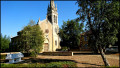
(1) Turn left, walk past the village bakery and take the first street on the left, then turn right. You’ll arrive at the car park opposite Saint-Michel Church (S/E).

Waypoints

  1. S/E : mi 0 - alt. 584 ft - Car park opposite the - Église Saint-Michel (Saint-Michel)
  2. 1 : mi 0.42 - alt. 600 ft - Fork in the path
  3. 2 : mi 1.92 - alt. 748 ft - T-junction
  4. 3 : mi 2.63 - alt. 728 ft - Chapelle Saint-Jaymes (Saint-Michel)
  5. 4 : mi 3.59 - alt. 876 ft - Le Touquet junction
  6. 5 : mi 4.14 - alt. 663 ft - Road junction
  7. 6 : mi 4.66 - alt. 761 ft - Le Lin junction
  8. 7 : mi 5.54 - alt. 633 ft - Crossroads in the forest
  9. 8 : mi 6.1 - alt. 663 ft - Le Clérat junction
  10. S/E : mi 7.52 - alt. 584 ft - Car park opposite the - Église Saint-Michel (Saint-Michel)

Notes

Please note the various types and colours of signposts; it is recommended that you follow the route description alongside the map.

Worth a visit

Reviews and comments

4.1 / 5
Based on 4 reviews

Reliability of the description
4.8 / 5
Ease of following the route
4 / 5
Route interest
3.5 / 5
labradornoir
labradornoir

Overall rating : 4 / 5

Date of your route : Nov 21, 2024
Reliability of the description : ★★★★★ Very good
Ease of following the route : ★★★★☆ Good
Route interest : ★★★☆☆ Average
Very busy route : No

very hilly.

Machine-translated

philippetalenton
philippetalenton

Overall rating : 4 / 5

Date of your route : Jul 16, 2023
Reliability of the description : ★★★★★ Very good
Ease of following the route : ★★★★☆ Good
Route interest : ★★★☆☆ Average
Very busy route : No

Machine-translated

D@niel
D@niel
• Edited:

Overall rating : 4 / 5

Date of your route : Aug 28, 2022
Reliability of the description : ★★★★☆ Good
Ease of following the route : ★★★★☆ Good
Route interest : ★★★★☆ Good
Very busy route : No

With enough shade to make it bearable on this sweltering day of 28 August 2022, this walk winds its way along all manner of paths, from the heat-retaining tarmac of the D239 to the clay-dust of tranquil woodland tracks, the long slopes of this corner of Astarac, before crossing – beneath the canopy of slender, mighty, straight-trunked oaks – the southern edge of the Armagnac state forest and finally reaching the beautiful Gascon church of Saint-Michel, at the foot of which the walk begins and ends...

Machine-translated

lecbalcaz
lecbalcaz

Overall rating : 4.3 / 5

Date of your route : Dec 12, 2021
Reliability of the description : ★★★★★ Very good
Ease of following the route : ★★★★☆ Good
Route interest : ★★★★☆ Good
Very busy route : No

The route is as described and is well signposted
Excellent in every respect

Machine-translated

Other walks in the area

For more walks, use our search engine .

The GPS track and description are the property of this route's author. Please do not copy them without permission.