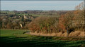
Chemin de Lourties-Monbrun

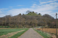
The Lourties-Monbrun path starts in Masseube. Before reaching the village of Lourties-Monbrun, you’ll walk alongside the aqueduct that carries water from the mountains for 70 km across Gascony. Most of the route follows pleasant little tarmac paths. On a clear day, you’ll be treated to a panoramic view of the Pyrenees.

Details

n°1759785
Creation:
Last update:
Last review:
  • Walking
    Activity: Walking
  • ↔
    Distance: 8.15 mi
  • ◔
    Average duration: 4h 15 
  • ▲
    Difficulty: Moderate

  • ⚐
    Back to start: Yes
  • ↗
    Ascent: + 548 ft
  • ↘
    Descent: - 564 ft

  • ▲
    Highest point: 974 ft
  • ▼
    Lowest point: 659 ft

Photos

Description of the walk

Park at Place du Foirail in Masseube.

(S/E) Take Rue de l’Estremau; at the end of the street, turn right and then take the first left.

(1) Continue along the Chemin de Lestive to the ‘Vierge’ crossroads.

(2) Turn right onto the Chemin de la Mirandette, passing the La Mirandète experimental farm. Stay on this path until you reach the crossroads by the small bridge over the Ferran stream.

(3) Cross the bridge and take the path on the left until you reach a small tarmac road. Walk past the chapel and continue to the next junction. Turn right onto the Chemin de Monbrun. You will reach the crossroads with the main road.

(4) Continue along the Chemin de Monbrun, passing through the hamlet of Sabaillan. At the next junction, turn left. Then turn right and you’ll reach another crossroads at a place called Les Hountaignéros.

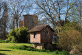
(5) Turn left onto the track, cross the Ruisseau de Larrazet and then reach the place known as Milhon. Continue along the footpath which runs alongside the tarmac road. Follow this footpath uphill, passing a wooden hut on the left, and carry on until you reach the crossroads.

(6) Turn left. Walk alongside the aqueduct to the village of Lourties-Monbrun on the Chemin de Masseube. Turn right.

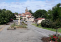
(7) Enter the village; at the junction in front of the town hall, turn left and walk past the church. Continue along the Chemin de Saint-Arroman to the hamlet of Haouès. Stay on this path until you reach a T-junction.

(8) Turn left onto the Chemin des Crêtes until you reach a three-way junction. Keep left to reach the hamlet of Escardénais. You’ll come to another three-way junction in the hamlet of Arné.

(9) Continue to the right along the tarmac track, which turns into a track suitable for vehicles; pass some farm buildings until you reach the tarmac track again. You’ll come to a cluster of houses.

(10) Turn onto Chemin de Lestive opposite and follow it to the crossroads by the statue of the Virgin Mary

(2) Follow the same path as on the way there until you reach Place du Foirail (S/E).

Waypoints

  1. S/E : mi 0 - alt. 676 ft - Car park at Place du Foirail
  2. 1 : mi 0.17 - alt. 659 ft - Turn left onto Chemin de Lestive
  3. 2 : mi 0.54 - alt. 696 ft - Crossroads at the end of the circular loop (statue of the Virgin Mary)
  4. 3 : mi 1.24 - alt. 741 ft - Bridge over the Ferran
  5. 4 : mi 2.01 - alt. 886 ft - Sabaillan crossroads
  6. 5 : mi 2.63 - alt. 810 ft - Crossroads at the hamlet of Les Hountaignéros
  7. 6 : mi 3.54 - alt. 883 ft - Turn left along the aqueduct
  8. 7 : mi 4.14 - alt. 902 ft - Lourties-Monbrun
  9. 8 : mi 5.54 - alt. 971 ft - Three-way junction
  10. 9 : mi 6.08 - alt. 928 ft - Arné
  11. 10 : mi 6.92 - alt. 807 ft - Group of houses
  12. S/E : mi 8.15 - alt. 676 ft - Car park at Place du Foirail

Worth a visit

The Lourties-Monbrun aqueduct.
Panoramic view of the Pyrenees mountain range from the Chemin des Crêtes.

Reviews and comments

3.7 / 5
Based on 2 reviews

Reliability of the description
3 / 5
Ease of following the route
4.5 / 5
Route interest
3.5 / 5
yvesrégine
yvesrégine

Overall rating : 3.7 / 5

Date of your route : Mar 20, 2023
Reliability of the description : ★★★☆☆ Average
Ease of following the route : ★★★★☆ Good
Route interest : ★★★★☆ Good
Very busy route : No

The route description wasn’t very clear at the start – it mixed up ‘left’ and ‘right’ – and there was no mention of crossing a bridge followed by an unmarked junction.

Machine-translated

Roroboubou
Roroboubou

Overall rating : 3.7 / 5

Date of your route : Oct 08, 2020
Reliability of the description : ★★★☆☆ Average
Ease of following the route : ★★★★★ Very good
Route interest : ★★★☆☆ Average
Very busy route : Yes

(S/E) “Turn left, then take the first right”? Shouldn’t it be to the right, then the first left?
(3) “Cross the bridge”: didn’t see a bridge, so didn’t turn left.
Traffic: on foot, no; no walkers, but a huge number of vehicles travelling along all these small roads which make up practically the entire route.
Interest: it depends on personal taste; for me, there’s not much appeal in tarmac in the countryside.
Thanks, however, to the author for suggesting it.

Machine-translated

Other walks in the area

For more walks, use our search engine .

The GPS track and description are the property of this route's author. Please do not copy them without permission.