The short Moncassin circular path

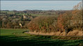
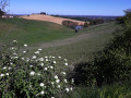
This circular route starting in Moncassin takes you via the castle mound to enjoy a panoramic view of the plain with the Pyrenees mountain range on the horizon. This route is designed to be rural, with a section through woodland.

Details

10712929
Creation:
Last update:
Last review:
  • Walking
    Activity: Walking
  • ↔
    Distance: 6.00 mi
  • ◔
    Average duration: 3h 10 
  • ▲
    Difficulty: Easy

  • ⚐
    Back to start: Yes
  • ↗
    Ascent: + 469 ft
  • ↘
    Descent: - 440 ft

  • ▲
    Highest point: 912 ft
  • ▼
    Lowest point: 597 ft

Photos

Description of the walk

Park in the town hall car park.

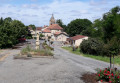
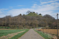
(S/E) From the car park, head west, crossing the village to the end of the road. Take the path on the left leading to the castle mound. For a lovely view, climb the mound to its summit.

(1) Head back down the same path to the village road, continue for about thirty metres and turn right onto the path leading downhill until you reach a road at a place called Caillots

(2) Turn right and carry on straight ahead, passing the three-way junction. At the three-way junction, take the small road that heads off to the left. Carry on straight ahead to Lapalu Castle. Turn left and continue for a few metres.

(3) Turn right before the small bridge, passing by the château. Continue along this road, which turns sharply right. Carry on until the next sharp right-hand bend.

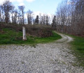
(4) At the bend, leave the road and take the path on the right; stay on this uphill path until you reach a junction with a track at the edge of the forest. Turn right and continue to the crossroads at a place called La Guitare.

(5) Turn left onto a tarmac road and carry on to the bend in the road. Continue along the path opposite and, just after a copse on the left, turn left and walk downhill alongside the copse. At the bottom of the descent, turn right, then walk alongside a pond, cross a tarmac road and take the grassy path opposite which runs alongside the stream. Continue straight on until you reach the D237 road.

(6) Cross this road and continue straight ahead for a few metres before turning right onto a grassy path that runs alongside the Ruisseau du Galinon. Stay on this path until you reach a junction with a tarmac road. Cross the road.

(7) Take the footbridge over the Ruisseau du Galinon, turn left and follow the stream on your left. At the junction of the paths opposite the embankment, take the path leading off to the left, which joins a tarmac track.

(8) Turn right and follow this road, then turn right onto an uphill track suitable for vehicles. Continue along this track, which goes round a water reservoir. Follow this track downhill, cross a stream, then head back up the track opposite until you reach the tarmac road.

(9) Turn right and, at the next junction, turn left to reach the village of Moncassin and the town hall car park (S/E).

Waypoints

  1. S/E : mi 0 - alt. 804 ft - Town hall car park
  2. 1 : mi 0.25 - alt. 814 ft - Castle mound
  3. 2 : mi 0.57 - alt. 650 ft - Caillots junction
  4. 3 : mi 1.36 - alt. 604 ft - Crossroads at Château de Lapalu
  5. 4 : mi 1.86 - alt. 614 ft - Junction of track and footpath
  6. 5 : mi 2.49 - alt. 883 ft - Crossroads at La Guitare
  7. 6 : mi 3.48 - alt. 699 ft - Crossing the D237 road
  8. 7 : mi 4.18 - alt. 745 ft - Footbridge over the Galinon Stream
  9. 8 : mi 4.83 - alt. 856 ft - Milhome junction
  10. 9 : mi 5.8 - alt. 840 ft - Marcadieu junction
  11. S/E : mi 6 - alt. 804 ft - Town hall car park

Notes

  • The grass may be a bit long on the sections running alongside a stream
  • Don’t forget the route map

Worth a visit

  • The castle mound.
  • The little village of Moncassin.

Reviews and comments

4.2 / 5
Based on 3 reviews

Reliability of the description
4.3 / 5
Ease of following the route
4.7 / 5
Route interest
3.7 / 5
Eric Martine
Eric Martine

Overall rating : 4.7 / 5

Date of your route : Sep 10, 2024
Reliability of the description : ★★★★★ Very good
Ease of following the route : ★★★★★ Very good
Route interest : ★★★★☆ Good
Very busy route : No

A short, easy and very pleasant route

Machine-translated

les sisters
les sisters

Overall rating : 3.7 / 5

Date of your route : Jul 02, 2024
Reliability of the description : ★★★★☆ Good
Ease of following the route : ★★★★☆ Good
Route interest : ★★★☆☆ Average
Very busy route : Yes

path, not mown yet... very tall grass... hence a few difficulties...

Machine-translated

loubens andre
loubens andre

Overall rating : 4.3 / 5

Date of your route : Jul 19, 2021
Reliability of the description : ★★★★☆ Good
Ease of following the route : ★★★★★ Very good
Route interest : ★★★★☆ Good
Very busy route : No

On Sunday, a group of eight of us set off on an adventure to the village of Moncassin and its short 9.5km walk, which we were discovering for the first time – thanks to the description and map we found on Vivorando! I’d give the route 9 out of 10, though there was a bit too much grass in places; we’ll be doing it again as the mayor gave us a very warm welcome! Thanks, Vivorando!

Machine-translated

Other walks in the area

For more walks, use our search engine .

The GPS track and description are the property of this route's author. Please do not copy them without permission.