Fontenay Circular

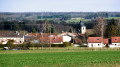
A family walk starting from Fontenay. You’ll explore the village and the forest that borders it.

Details

2373575
Creation:
Last update:
Last review:
  • Walking
    Activity: Walking
  • ↔
    Distance: 4.17 mi
  • ◔
    Average duration: 2h 15 
  • ▲
    Difficulty: Easy

  • ⚐
    Back to start: Yes
  • ↗
    Ascent: + 387 ft
  • ↘
    Descent: - 387 ft

  • ▲
    Highest point: 1,575 ft
  • ▼
    Lowest point: 1,188 ft

Photos

Description of the walk

To reach the start by car from Bruyères, head towards Thaon-les-Vosges. At Girecourt-sur-Durbion, head towards Épinal, then Fontenay. Once in the village, take the road leading to the town hall and park before you reach it, in front of the sports ground, on the left.

Green Disc signposting

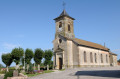
(S/E) Head towards the town hall, passing to the right of the Place du Tilleul.

(1) Turn left onto the street that runs right past the town hall, the Chemin du Quairon. At the junction, carry on straight ahead until you reach the entrance to the Fontenay Communal Forest.

(2) The road continues like this for 400 metres until you reach a junction; turn right and carry on for about fifteen minutes.

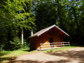
(3) You’ll see a picnic table in front of you at the start of a forest path; carry on along the road to your right. After 800 metres, you’ll come to Chemin de Senseaux: follow it.

(4) Once you reach the bottom of the descent, turn right again, heading north-west.

(5) You’ll come out of the communal woodland and find yourself in the middle of fields. Cross the D48 and carry straight on along the Chemin des Senseaux.

(6) At the Stop sign, turn right towards the centre of Fontenay.

(1) When you reach the town hall, turn left onto the Route de Dompierre and continue to your starting point (S/E).

Waypoints

  1. S/E : mi 0 - alt. 1,188 ft - City Stade
  2. 1 : mi 0.08 - alt. 1,191 ft - Fontenay Town Hall
  3. 2 : mi 0.77 - alt. 1,309 ft - Entrance to the Fontenay Communal Forest
  4. 3 : mi 1.65 - alt. 1,437 ft - Picnic table
  5. 4 : mi 2.12 - alt. 1,572 ft - Chemin des Senseaux
  6. 5 : mi 3.53 - alt. 1,316 ft - Exit from the Fontenay Communal Forest
  7. 6 : mi 4.01 - alt. 1,207 ft - Stop
  8. S/E : mi 4.17 - alt. 1,188 ft - City Stade

Reviews and comments

4.7 / 5
Based on 2 reviews

Reliability of the description
5 / 5
Ease of following the route
5 / 5
Route interest
4 / 5
Annahbel
Annahbel

Overall rating : 4.7 / 5

Date of your route : Jul 03, 2022
Reliability of the description : ★★★★★ Very good
Ease of following the route : ★★★★★ Very good
Route interest : ★★★★☆ Good
Very busy route : No

A very pleasant walk in the woods. We even had the pleasure of spotting two roe deer. However, I’d advise against doing this walk when it’s very hot, as there are quite a few sections without shade (particularly at the start and end).

Machine-translated

christopheprunauxcazer

Overall rating : 4.7 / 5

Date of your route : Feb 10, 2020
Reliability of the description : ★★★★★ Very good
Ease of following the route : ★★★★★ Very good
Route interest : ★★★★☆ Good

A very pleasant, easy walk with no difficulties

Machine-translated

Other walks in the area

For more walks, use our search engine .

The GPS track and description are the property of this route's author. Please do not copy them without permission.