Country:
 City:
City:


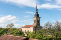
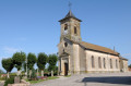
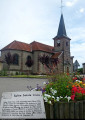
To return to the starting point by car from Bruyères, head towards Épinal on the N420 as far as Grandvillers (about 4 kilometres). In Grandvillers, opposite the Hôtel l’Écrin, turn right onto the D48 towards Rambervillers for 2 kilometres. Then turn left (C4) towards Pierrepont-sur-l’Arentèle. At the Stop sign, carry on straight ahead and park near the church or in the Place de la Mairie.
Yellow Ring signposting
(S/E) At the church, a sign will show you the way. Follow it and turn right at the first junction to reach the town hall. Carry straight on along either of the roads (they join up). You’ll come to a crossroads just before the power lines.
(1) Take the path on the right just before these power lines. Follow this path until you reach the forest.
(2) In the forest, carry on straight ahead, then turn sharply right onto the grassy path and follow it to Nonzeville.
(3) At the road, turn right towards the houses, then right again. Follow the Grande Rue from one end to the other to cross the village.
(4) On leaving Nonzeville, carry on straight ahead until you reach the D70, then turn left towards Destord.
Take care here: the road is a little busier.
(5) At the top of the hill, enjoy the 360° view. At the bend, take the path on the right to reach the copse ahead of you.
Note: On your right, you can see the first hills marking the start of the Vosges mountain range.
Walk along the edge of the copse and turn right in the middle of it.
(6) The path, running through the fields, leads to the Bois Malsieux directly ahead of you. After crossing the woods, follow the edge and head back to the car park at Pierrepont Church, which you can see ahead (S/E).


 Tourist office
 Moderate
 Visorando Member