Country:

 City:
City:


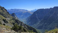
Start of the walk: the Croix de Chamrousse (2,250 m). From Le Recoin ski resort (1,650 m, Chamrousse), access is by cable car (€10.50 in 2026) or on foot for the more adventurous.
(S/E) Head east towards the Robert Lakes. Pass the Col des Trois Fontaines and then reach the Col de la Botte.
(1) Carry on straight ahead to climb La Botte. The path is clearly visible, with a few rocks to cross without difficulty. You’ll reach the rounded, grassy summit. Take in the 360° view.
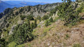
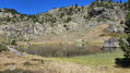
(2) Head to the right, heading south. Descend along the broad, grassy, undulating ridge. You’ll see Lake de l’Infernet below on the right – that’s where you’re heading. The ridge then narrows (about 400 m from the summit), becoming rockier and more wooded. Look out for a scree gully on the right which you can take to reach the lake, but it is better to continue for about thirty metres along the ridge to find a gap between the trees. Use your GPS to locate the correct spot to descend.
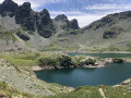
(3) Descend sideways along the mountainside heading north through a grassy area which joins the scree gully further down, where it is less steep. Watch out for slippery patches. Reach Lac de l’Infernet by following the bed of the Ruisseau de Moirin. Explore the area. To the west of the lake, join the path leading down from the Col de l’Infernet. You will reach a Y-junction.
(4) Turn left, heading south, and follow the path through the middle of a meadow as it approaches the cliffs. At the end, turn right; after a gentle climb, the track becomes less visible in the grass, but you must stay close to the line between the cliffs and the grassy mountainside. Look out for a large rock high up on the right with an opening in the middle.
(5) Follow the track leading in that direction to reach the stony, wooded summit. Head left and walk for about 100 m along the ridge. You’ll see an opening and a path on the right (just before the 2030 mark).
(6) Follow this path, which winds in short hairpin bends; it is steep and slippery at the start. Take great care. After a fork to the left, you’ll come to a steep but more accessible path that leads to Lake Achard, which you should walk alongside on the left. Cross the bridge at the southern end of the lake.
(7) Follow the signs for Roche Béranger (yellow markings), indicated by a signpost. The path alternates between flat sections and rocky sections which can be crossed without difficulty. On emerging from the forest, walk alongside the artificial lake of Roche (or Lauze) and arrive at the Route de la Croisette (Roche Béranger 1,750 m).
(8) Follow the D111a road to the left and continue down it all the way to a Fork in the road. Carry on straight ahead on the D111a towards the technical services, Rue des Brokentins. In a right-hand bend, after the last chalet, look out for a path leading down to the left.
(9) Follow this path, then turn immediately right heading north onto the Chemin du Renard, which leads to the Le Recoin resort (1,650 m) and the starting point of the walk (S/E).
 Visorando Member
 Difficult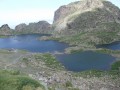

 Very difficult