Tour de Fresse

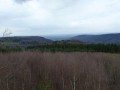
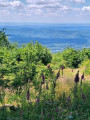
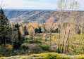
A route along the ridges of the mountains surrounding the village of Fresse, offering splendid views of the typical landscapes of the Vosges-Saônoises.
The planned starting point at the Col de la Chevestraye can easily be reached from the hamlet of Magny de Fresse for those coming from the Belonchamp area.

Details

954
Creation:
Last update:
Last review:
  • Walking
    Activity: Walking
  • ↔
    Distance: 18.79 mi
  • ◔
    Average duration: 11h 40 
  • ▲
    Difficulty: Difficult

  • ⚐
    Back to start: Yes
  • ↗
    Ascent: + 3,510 ft
  • ↘
    Descent: - 3,501 ft

  • ▲
    Highest point: 2,864 ft
  • ▼
    Lowest point: 1,388 ft

Photos

Description of the walk

Head for the Col de la Chevestraye between Plancher-Bas and Fresse (Haute-Saône), at the junction of the D97 and D98 roads.
Park your car in the small car park near the memorial stone honouring the soldiers of the 2nd Regiment of African Light Infantry, who liberated this part of France.

(S/E) Head down the road towards Fresse, following the red and white markings ofthe GR®59, and at the first hairpin bend, turn right onto the local track towards Montvilliers.

(1) About 200 m past the hamlet of Haut de la Chevestraye, leave the road and turn right onto an unmarked track used by 4x4s and quads, which climbs through the woods.
Halfway up, you could turn left, but it is better to continue climbing and cross the old pastures, some of which have been replanted with spruce trees and others left to run wild. There are some lovely views over the Planche-des-Belles-Filles and then, to the right, over the Lizaine valley. The slope levels out and you reach the crossroads at the top of the Prés Février.

(2) Turn left and follow theGR® (red and white markings) down through the fir plantation.

(3) After a few hundred metres, take the path on the right (marked with a Yellow Rectangle). A short climb through former pastures and hay meadows, now overgrown with ferns and dotted with service trees, takes you to the Plain de la Rise (alt. 875 m), offering a fine view of the Monts du Lomont.

(4) This is the section where you cross the Sapoz wood and the stream of the same name. The path leads onto a lovely forest track, which you should take to the right.

(5) Lined with fir trees, the track climbs steadily but pleasantly and takes us to the boundary between the villages of Fresse and Miellin.

(6) At the end of the track, follow the path on the left along the ridge to the Refuge du Grand Bois, a lovely spot for a short break.

(7) Leave the yellow markings on your right and follow the Blue Ring markings along the ridge. Stay on the boundary between the two municipalities.

(8) Here is the Caleuche farm. Continue along the road; note the building on the right which served as the resistance fighters’ command post. Here is the junction with the ‘Route du Souvenir’ which climbs up from Ternuay.

(9) Take this road to the left for a few tens of metres and take the time to head up to the left to the Montagne monument.

(10) (a memorial erected in honour of the FFI resistance fighters and civilians who died during the Battle of Montagne de Fresse in August 1944; beautiful views to the west and north).
Return to the crossroads.

(9) Continue westwards, first along the tarmac road and then along a good forest track (marked with Red Rectangles).
Pass through the hamlet of Montagne de Fresse.

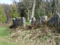
(11) Note on the left the fence of the old garden, made of large lava stones set vertically, which served both to keep out unwanted animals and to retain some warmth at night. After 300 metres, take the first unmarked road on the right to reach the boundary of the municipality and the Dame Louise farm.

(12) Then take the road on the left. After a slight flat section following the 660 contour line, the descent becomes easier. Follow the Yellow Ring signposting with the horseshoe symbol. A view opens up over the Ognon valley and the entrance to Ternuay.

(13) Do not be tempted to follow the path; instead, turn left towards Le Magny de Fresse, which you will reach after about ten minutes.
On the main road, turn left (Yellow Ring markings) and after 200 metres turn right towards the Auberge de la Bomilière.

(14) The path crosses the river ‘Le Raddon’ and a rather tricky, steep goat track (still marked with Yellow Rings) leads to the tarmac road; turn right here and follow it to the viewpoint, which serves as the launch site for hang-gliders.

(15) A short break at this rest area, situated in the shade beneath the beech trees, will help you recover from the exertions of the climb. But it’s time to set off again, and soon the farm and the Abbey of Mont de Vanne come into view.

(16) After a tour of the site and a moment of quiet reflection in the chapel, it’s time to leave this idyllic setting and return to the road. Turn right after about ten metres and then turn right again onto the path, which is occasionally used as a logging track (marked with Yellow Circle signs – direction Le Plainet, 4 km). Through the fir trees, you’ll remain at roughly the same altitude. Here is a lovely track which you take to the left to reach a junction with two tarmac roads. Do not head towards Ronchamp but carry straight on to reach the hamlet of Le Mavoy.

(17) Follow the signs for Le Plainet.

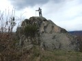
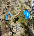
(18) At Le Plainet, you’ll come across the red and white markings ofthe GR®59, which climbs up from Ronchamp. Walk past the school. At the edge of the woods, leave the main path on your left and take the track that climbs up the hill (signposted ‘viewpoint, 10 mins’) on the border between the municipalities of Fresse and Ronchamp to reach the Roc du Plainet.

(19) After the Roc, continue along the path to rejoin theGR® (red and white markings) and follow it to the finish. On the right, a clearing offers a fine view of Champagney (view of the Alps on a clear day). Here is a section of the Remembrance Trail and the remains of the fighting from November 1944.

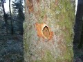
(20) (engraved trees, remains of trenches, shell casings) and, on the left, the ‘Chat’ spring used by the Maquis.

(21) At the Col du Coporot, cross the forest track. Here are further remains of trenches on the left; a little further down lies the site of the hamlet of Bois de la Dame, which was completely destroyed during the fighting in 1944.

(22) A very steep descent takes us straight back to the starting point (S/E).

Waypoints

  1. S/E : mi 0 - alt. 2,014 ft - Car park - Col de la Chevestraye (611m)
  2. 1 : mi 0.79 - alt. 2,159 ft - The hamlet of Haut de la Chevestraye
  3. 2 : mi 1.75 - alt. 2,746 ft - Prés Février crossroads. Turn left
  4. 3 : mi 1.94 - alt. 2,608 ft - Take the path on the right
  5. 4 : mi 2.23 - alt. 2,792 ft - Plain de la Rise (viewpoint)
  6. 5 : mi 3.16 - alt. 2,369 ft - Forest track
  7. 6 : mi 5.11 - alt. 2,779 ft - End of the track
  8. 7 : mi 5.98 - alt. 2,431 ft - Chalet des Grands Bois
  9. 8 : mi 6.44 - alt. 2,375 ft - La Caleuche Farm
  10. 9 : mi 6.84 - alt. 2,326 ft - Crossroads on the Route du Souvenir
  11. 10 : mi 7.02 - alt. 2,408 ft - F.F.I. memorial
  12. 11 : mi 8.15 - alt. 2,165 ft - The hamlet of Montagne de Fresse
  13. 12 : mi 8.65 - alt. 2,162 ft - Ferme de la Dame Louise
  14. 13 : mi 10.11 - alt. 1,473 ft - The hamlet of Magny de Fresse
  15. 14 : mi 10.77 - alt. 1,388 ft - Crossing the - Le Raddon de Fresse (rivière) - Affluent du Rhône par l'Ognon
  16. 15 : mi 12.5 - alt. 2,178 ft - Starting point for hang-gliding
  17. 16 : mi 12.87 - alt. 2,152 ft - Mont de Vanne Abbey
  18. 17 : mi 14.23 - alt. 2,247 ft - The hamlet of Le Mavoy
  19. 18 : mi 15.23 - alt. 2,238 ft - The hamlet of Le Plainet (School)
  20. 19 : mi 16.12 - alt. 2,562 ft - Roc du Plainet
  21. 20 : mi 17.34 - alt. 2,733 ft - A few remnants of the war
  22. 21 : mi 17.65 - alt. 2,674 ft - Col du Coporot
  23. 22 : mi 18.16 - alt. 2,333 ft - Ruins of the hamlet of Bois La Dame
  24. S/E : mi 18.79 - alt. 2,014 ft - Car park – Col de la Chevestraye

Notes

- A furnished chalet (table, benches, fireplace) at a place known as Le Grand-Bois (9.7 km).
- A lovely rest area equipped with tables and benches on the ascent to Mont de Vanne (km 19.5).

Worth a visit

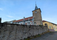
In Fresse church, there is a beautiful pulpit, an 18th-century sculptural work in solid oak, with remarkable chiselled woodwork. It is listed as a historic monument and originates from the Benedictine Abbey of Lucelle (Haut-Rhin).

The Roc de Plainet, a remnant of the glacial moraine, is said to have the power to make women fertile. In times not so long ago, this spot was a popular destination for Sunday walks. Taking advantage of the many secluded spots, couples would frolic, and it is said that it was here that many of Fresse’s residents were conceived...

Always be cautious and plan ahead when you're outdoors. Visorando and the author of this route cannot be held responsible for any accidents occurring on this route.

The GR® and PR® markings are the intellectual property of the Fédération Française de Randonnée Pédestre.

Reviews and comments

3.1 / 5
Based on 6 reviews

Reliability of the description
2.5 / 5
Ease of following the route
2.8 / 5
Route interest
3.8 / 5
Claude le Frisé
Claude le Frisé

Overall rating : 3.7 / 5

Date of your route : Mar 20, 2021
Reliability of the description : ★★★☆☆ Average
Ease of following the route : ★★★★☆ Good
Route interest : ★★★★☆ Good
Very busy route : No

It was quite a challenge for a first trek – as we hadn’t expected any snow, it really slowed us down, particularly on the first few climbs, which were quite gruelling.

The refuge at the 9th kilometre was a welcome sight.
A big thank you to Claude ‘the curly-haired one’ who tidied up after the heretics.

Apart from the Balrogs at night and the 1.80-metre-tall woodpeckers when we woke up, it was a peaceful night.

Machine-translated

bibi
bibi ★

Thank you for your feedback. Could you please elaborate by pointing out the areas where you feel the description lacks clarity? This will enable the author to focus their efforts on these points to expand and clarify the description. Thank you for your cooperation.
Kind regards

Machine-translated

follassone
follassone

Overall rating : 1.7 / 5

Date of your route : May 25, 2017
Reliability of the description : ★☆☆☆☆ Very disappointing
Ease of following the route : ★☆☆☆☆ Very disappointing
Route interest : ★★★☆☆ Average

An interesting route, but there were major problems with the directions; we got lost numerous times, had to turn back or cut across the woods to find the GPS signal, which wasn’t reliable either… As a result, we took long detours and ended up on dangerous paths. All this added considerably to the walking time – thank goodness we’d planned to camp halfway! The route is interesting, but the accuracy of the directions really needs to be reviewed! The elevation gain proved more challenging than expected, but there were some interesting views.

This needs reviewing to provide much more detailed instructions, referring to the current signposting!

Machine-translated

Pierrot DAVID
Pierrot DAVID
• Edited:

Hello,
Thank you for your feedback on this walk. As I was the second person to have encountered some issues, I went back over the route today with some friends. Apart from a broken sign near Saphoz, we didn’t notice any major problems.
Perhaps you could let us know which sections caused you the most difficulty so that we can look into them a bit more closely.
I have, however, added a few details to the route description and included some landmarks.
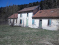
As for the Chalet des Grands Bois, I’m really sorry, but for us in this part of the Vosges Saônoises, it’s already a lovely shelter. Some are simply covered shelters. When it comes to accommodation, almost all the refuges belong to associations that reserve them for their members.
Don’t let this first setback put you off – see you soon on our trails.
Pierrot DAVID

Machine-translated

gazok54
gazok54 ★

It really is by doing that one becomes an expert
As for the signposting, what can I say, other than that it is not the responsibility of Visorando or the walk authors. So you shouldn’t give a walk a poor rating simply because of a lack of signposting.
I dare to hope that everything will go smoothly on your next walk.
Have a good evening.

Machine-translated

Lip
Lip

Yes, of course, the scenery was beautiful and the effort put in after the climbs was rewarded by the views over the valley. I’m simply noting the signposting and the information we were given because, for example, the mountain hut wasn’t even signposted 50 metres away, even though there were signs marking the paths. At some junctions we struggled to find our way, and at others we couldn’t find them on the map at all. It was our first hike, and perhaps if we’d been more experienced, the hike would have seemed easy to us. On a 30km hike, I thought the marked mountain huts were places to spend the night, not just to stop for a meal.
All the mistakes we made will serve as lessons for our future hikes.

Lip

Machine-translated

gazok54
gazok54 ★

Thanks, Lip.
Your last paragraph is very funny. What’s less funny, though, is the ‘Very disappointing’ rating given to this walk. I think that’s a bit harsh. It would have been great if, whilst the sun was shining on this Halloween scene, you’d jotted down a few notes to help us improve this description.

Machine-translated

Lip
Lip

Overall rating : 1.7 / 5

Date of your route : Nov 01, 2015
Reliability of the description : ★☆☆☆☆ Very disappointing
Ease of following the route : ★☆☆☆☆ Very disappointing
Route interest : ★★★☆☆ Average

The slopes were gentler than we’d expected. Despite a few slip-ups due to carelessness or inexperience, the route isn’t exactly easy to follow, and our uncertainty at several junctions meant we had to backtrack a few kilometres. After a phone call with the mayor of Fresse regarding the Grand Bois refuge – during which I made it clear that my main concern was whether or not we could sleep there – it turned out there were indeed ‘two windows and a door’.

So if you’re short of ideas for a Halloween night, I’d recommend getting lost, miraculously finding the refuge after dark, and spending 13 hours in total darkness waiting for the sun to rise.
All in all, for 31 October, it’s quite eerie and guaranteed to give you the creeps.

Lip

Machine-translated

gazok54
gazok54 ★

Hello and thank you, elainou54.
‘Moderate’ difficulty, ahh! Let’s say that as this was your first hike, a lack of experience may well be the cause of your difficulties.
Now, if you have any suggestions for improvement to share with us, we’d love to hear them
Enjoy your walks with Visorando.

Machine-translated

elainou54
elainou54

Overall rating : 3.7 / 5

Date of your route : Aug 19, 2015
Reliability of the description : ★★★☆☆ Average
Ease of following the route : ★★★★☆ Good
Route interest : ★★★★☆ Good

Without the GPS to help us find our way on the map, the hike would have been difficult to manage. However, as it was our first hike, we weren’t very experienced.
The first climb gets off to a steep start, as does the second one after the valley, but otherwise the route was perfectly manageable.

Machine-translated

Guillaume25
Guillaume25

Overall rating : 5 / 5

Date of your route : Oct 05, 2014
Reliability of the description : ★★★★★ Very good
Ease of following the route : ★★★★★ Very good
Route interest : ★★★★★ Very good

I wanted to try a long day’s hike over slightly rugged terrain, and I was thoroughly delighted. The Chalet du Grand Bois is very welcoming.
Thank you for the stories about the route. Someone who owns a second home on Le Plainet confirmed the legend of the schoolteacher and the details of the incident. The Mont de Vanne chapel was open (it’s very pretty inside). However, at the summit of Le Plainet, the vegetation blocks the entire view.

Machine-translated

POULIN Gérard
POULIN Gérard ★

Thank you, Pierrot, for your prompt response. The hiker ‘filfcsm’ will share their thoughts if they wish, but I can understand that, given the circumstances described, they must have been disappointed on arrival.

Machine-translated

Pierrot DAVID
Pierrot DAVID

I’m really sorry.
As the owner of a Gîte de France lodge, I often recommend this walk to guests who want to go hiking in the low mountains (the last time was in mid-August 2014).
I give them a 1:25,000 map and instructions from Visorando, and they’ve all returned delighted and without a hitch.
Even without a map, by following the signposting, they managed to complete the circuit.
It might be worth checking the GPS app, as it may have provided incorrect information.

Machine-translated

POULIN Gérard
POULIN Gérard ★

Oh dear, route description, map, compass, smartphone – nothing seems to be working to guide you on this walk – or on some others – what’s going on?
I hope the author will give us some more details.
The quality of the route descriptions is generally quite good across all the walks listed on this site.
The solution would certainly be to download the smartphone app or the full route onto your GPS, which would get round the lack of mobile coverage in certain areas.

Machine-translated

filfcsm
filfcsm

Overall rating : 2.7 / 5

Date of your route : Sep 06, 2014
Reliability of the description : ★★☆☆☆ Disappointing
Ease of following the route : ★★☆☆☆ Disappointing
Route interest : ★★★★☆ Good

Good evening,
I’m sorry about what I’m about to say, but I hardly ever managed to stay on the route. I’d downloaded the map from the website, along with the route description, but perhaps – or rather, certainly – I should have got a 1:25,000 map so I could mark out the route myself, because as it was, I rarely managed to work out where I was on the map. I’d even gone to the trouble of buying a compass, but in the end I gave up on that too and relied on the GPS built into my phone. Unfortunately, I had to contend with the technology, and from time to time I found myself with no signal; I decided to press on anyway, but what a surprise when I did manage to work out where I was!!! I invariably had to retrace my steps, which meant that after seven hours’ walking, I decided to complete the rest of the route entirely by road.
I still managed 31 km, but I’d barely covered 21 km in 7 hours, which means I covered the remaining 10 km in 2 hours.
It’s a real shame, as I was really keen to cover a long distance!
I hope to be able to do it again, but I think I’ll plan the walk myself using a 1:25,000 map.

As for the walks I’d previously downloaded and hadn’t yet commented on, we encountered some of the same problems, but we still managed to complete the walks without too much difficulty!

What I’d like to add is that, in my view, the instructions are too vague and not detailed enough!

Machine-translated

Other walks in the area

For more walks, use our search engine .

The GPS track and description are the property of this route's author. Please do not copy them without permission.