Country:

 City:
City:


Head to the hamlet of Sapoz, between Montaujeux and Montvilliers. Park on the lay-by near the small crossroads where logs are often stored.
(S/E) Set off due east towards Montvilliers. At the first fork, take the tarmac forest track that climbs to the left. Continue along this easy track through lovely woodland.
(1) Turn right, leaving the track to join the route marked with a Yellow Rectangle, and head uphill along this marked path through the woods.
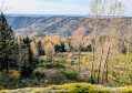
(2) In this vast clearing – a former fallow meadow, now partly replanted with spruce trees – look for the small path on the left, which climbs rather steeply at first. Continue along this path and make a short detour along the edge of the woodland to reach the small summit at 901 m, the highest point of the walk, offering panoramic views. Head back down, following the path.
(3) You’ll come to a flat area and a crossroads. Go straight on at the first junction, leaving the level path towards Belfahy on your left and a path leading downwards, signpostedGR®59, on your right. Fifty metres further on, take the first path on the right, which follows a long, gently sloping descent, almost straight ahead at the start. The path then curves to the right, heading due north and then north-east.
(4) After descending this easy path, which offers some lovely views, join theGR®59through the woodland and follow it to the left to continue the descent. Leave the GR®.
(5) In the hamlet of Montvilliers, turn right onto the road that climbs, passing several houses on the left, and follow this road as far as Le Sapoz. Here again, the road passes beneath beautiful trees after running alongside meadows that are in bloom in spring. You’ll cross the track you took at the start on your right and reach the starting point (S/E).


 Visorando Member

 Difficult
 Tourist office