Exploring the vineyards, episode 2.

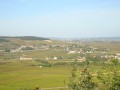
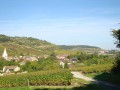
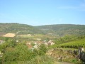
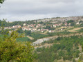
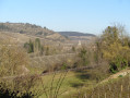
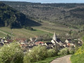
Discover this walk amongst vineyards, cycle routes and footpaths – a treat for both the taste buds and the eyes. Beautiful panoramic views over the vineyards.

Details

81635
Creation:
Last update:
Last review:
  • Walking
    Activity: Walking
  • ↔
    Distance: 17.63 mi
  • ◔
    Average duration: 9h 40 
  • ▲
    Difficulty: Difficult

  • ⚐
    Back to start: Yes
  • ↗
    Ascent: + 1,821 ft
  • ↘
    Descent: - 1,808 ft

  • ▲
    Highest point: 1,444 ft
  • ▼
    Lowest point: 774 ft

Photos

Description of the walk

When arriving in Gamay via the D906, park at the picnic area.

(S/E) Take the road leading to the village, then take the sharp right-hand bend at the first junction. Follow the road uphill until you reach the junction with another hiking trail.

(1) Turn left towards “la Pierre Liorca”. At la Pierre Liorca, turn left and then carry on straight ahead.

(2) When you reach the tarmac road, turn right and follow the road to Blagny. Turn right, then left.

(3) Do not follow the signs for Puligny-Montrachet. Further on, you will see Meursault.

(4) Leave thePR® and head straight on towards Meursault. You’ll rejoin thePR® a little further on.

(5) In Meursault, cycle past the church and a fountain, then continue straight on and follow the cycle-road signs on your right as far as Volnay.

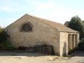
(6) At the chapel, cross the road and follow the cycle-road signs. At Volnay church, turn right then left, following the cycle-road signs for Pommard.

(7) In Pommard, cycle past the church and the monument, then take the first left (Rue Notre Dame) and turn left again (Rue du Charmillot). You are now on theGR®76. Follow the tarmac road uphill and

(8) turn left, following the signposts. If you carry on straight ahead, you’ll reach a housing estate, where this path rejoins the original route.

(9) 200 metres after the picnic area, leave theGR®76by turning right onto the PR®. At the next junction, go straight on towards Monthelie.

(10) In Monthelie, turn right onto the departmental road No. 23, which takes you back tothe GR®76.

(11) Turn left and follow theGR®76to Auxey-Duresses. In Auxey-Duresses, turn right when you reach the main road, then turn left at the cross. Follow the signposts leading to the church.

(12) Turn left before the church. At the bridge, turn right and follow the tarmac road uphill.

(13) Turn left into the forest, following theGR®76signposting. The slope is steep. When you reach the car park, you’ll see the statue of St Christopher.

(14) Take the botanical trail opposite. At the orientation board on the botanical trail, turn right and rejoin the forest path.

(15) Follow the path to the left towards Gamay.

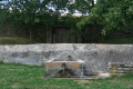
(16) At the wash house, turn left and head back to your car (S/E).
Waypoints

  1. S/E : mi 0 - alt. 863 ft - Picnic area
  2. 1 : mi 0.95 - alt. 1,043 ft - To the left
  3. 2 : mi 1.5 - alt. 1,227 ft - To the right
  4. 3 : mi 2.09 - alt. 1,089 ft - Do not go via Puligny-Montrachet
  5. 4 : mi 3.13 - alt. 1,056 ft - Straight ahead
  6. 5 : mi 4.49 - alt. 807 ft - Walk past the church
  7. 6 : mi 6.41 - alt. 879 ft - Opposite
  8. 7 : mi 7.56 - alt. 814 ft - Walk past the church
  9. 8 : mi 8.52 - alt. 1,237 ft - To the left
  10. 9 : mi 9.14 - alt. 1,220 ft - To the right
  11. 10 : mi 10.23 - alt. 948 ft - To the right
  12. 11 : mi 11.02 - alt. 1,056 ft - To the left
  13. 12 : mi 13.22 - alt. 850 ft - Turn left before the church
  14. 13 : mi 13.5 - alt. 935 ft - To the left
  15. 14 : mi 13.97 - alt. 1,204 ft - Botanical trail opposite
  16. 15 : mi 14.3 - alt. 1,253 ft - To the left
  17. 16 : mi 17.27 - alt. 886 ft - Washing place, on the left
  18. S/E : mi 17.63 - alt. 863 ft - Picnic area

Notes

In Gamay, during the hunting season in the woodland, theGR®76(the section on the Roche Dumay) is closed. There is an alternative route, which is clearly signposted. The detour follows a tarmac road, which takes away some of the charm of this section.
At Auxey-Duresses, at Mont Milan, take the botanical trail instead. It offers a beautiful panoramic view across the whole valley, rather than theGR®76, which is a forest track. You’ll get a glimpse of the villages you’ve passed through.

In wet weather, take care on the Roche Dumay and on the section through the woodland after Auxey-Duresses.

Worth a visit

Do take the time to wander through the streets of Volnay, Pommard and Monthelie, as some of the houses are well worth a look for their architecture.

In Pommard, one street on from the one you’re on, a sculptor has his works on display outside his house.

Always be cautious and plan ahead when you're outdoors. Visorando and the author of this route cannot be held responsible for any accidents occurring on this route.

The GR® and PR® markings are the intellectual property of the Fédération Française de Randonnée Pédestre.

Reviews and comments

4.7 / 5
Based on 2 reviews

Reliability of the description
4.5 / 5
Ease of following the route
4.5 / 5
Route interest
5 / 5
Gaudiau Gerard
Gaudiau Gerard

Overall rating : 5 / 5

Date of your route : Jun 07, 2021
Reliability of the description : ★★★★★ Very good
Ease of following the route : ★★★★★ Very good
Route interest : ★★★★★ Very good
Very busy route : No

A brilliant walk through the famous vineyards. The final stretch, back towards Gamay, should be avoided in wet weather as the limestone becomes very slippery…

Machine-translated

Bremontb
Bremontb

Overall rating : 4.3 / 5

Date of your route : Oct 21, 2017
Reliability of the description : ★★★★☆ Good
Ease of following the route : ★★★★☆ Good
Route interest : ★★★★★ Very good

Choose autumn in particular to enjoy the golden colours of the vineyards at this time of year

Machine-translated

Other walks in the area

For more walks, use our search engine .

The GPS track and description are the property of this route's author. Please do not copy them without permission.