La Barre et le Rocher d'Istein

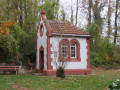
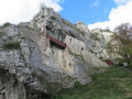
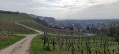
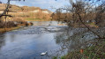
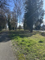
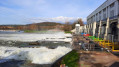
Départ et arrivée sous le Rocher d'Istein avec sa chapelle creusée dans la roche. Nous longeons le Rhin jusqu'à la Barre d'Istein (Isteiner Schwellen, formation rocheuse mise à jour par l'érosion) puis nous passerons dans le village d'Efringen-Kirchen et son vignoble pour atteindre le sommet du Rocher d'Istein (Isteiner Klotz).

Details

n°4185166
Creation:
Last update:
  • Walking
    Activity: Walking
  • ↔
    Distance: 6.71 mi
  • ◔
    Average duration: 3h 35 
  • ▲
    Difficulty: Moderate

  • ⚐
    Back to start: Yes
  • ↗
    Ascent: + 531 ft
  • ↘
    Descent: - 505 ft

  • ▲
    Highest point: 1,263 ft
  • ▼
    Lowest point: 761 ft

Photos

Description of the walk

Se garer au petit parking situé sous le Rocher d'Istein.

(S/E) Longer la rue sur 20 m puis prendre le petit sentier sur la droite et le suivre jusqu'à la route.

(1) Traverser la route et rejoindre le Rhin. Suivre le chemin sur la gauche vers l'amont.

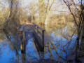
(2) Quitter le large chemin et serrer à droite sur le petit sentier qui descend et suit les berges du Rhin.

(3) Admirer la superbe vue sur la Barre d'Istein. Remonter sur le chemin par l'escalier pour atteindre la passerelle d'observation et profiter d'une vue différente sur le Rhin puis rejoindre le parking avant de passer sous l'autoroute. Suivre la route d'abord goudronnée qui fait un coude à gauche puis devient chemin de terre.

(4) Prendre à gauche, puis dans les champs à droite et encore à gauche avant de traverser la route et arriver à Efringen-Kirchen par la Bahnhofstrasse. Obliquer à gauche dans la Markgrafenstrasse puis à droite dans Steingarten. Prendre à gauche au croisement.

(5) Obliquer à gauche juste après et suivre la voie cyclable qui passe sous la voie ferrée. Tourner à gauche et longer cette voie.

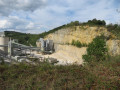
(6) Prendre le chemin sur la droite et débuter l'ascension à travers le vignoble. Sur la gauche, vous aurez un point de vue sur la ville de Bâle et dans un virage, une plateforme qui domine une carrière.

(7) Suivre le chemin de gauche qui surplombe la carrière.

(8) Ignorer le chemin qui part sur la droite et continuer toujours tout droit. Plus loin, dépasser à votre droite une chapelle et un petit cimetière.

(9) Devant le mur en pierres de taille, suivre le balisage "Isteiner Klotz" et monter, à droite, la petite pente pour visiter la chapelle St Nikolaus qui se trouve derrière le mur de pierres. Ensuite longer le terrain de sport sur votre droite.
Prendre le chemin de gauche pour entrer dans la forêt et toujours suivre le balisage "Isteiner Klotz" et parvenir au
sommet du Rocher d'Istein (Isteiner Klotz) où se trouve une table de pique-nique .

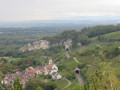
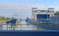
(10) Profiter de la vue sur la plaine d'Alsace, l'écluse et la centrale hydroélectrique de Kembs. Prendre le petit sentier qui descend : attention, risque de glissades par temps humide.

(11) Virer complètement à droite, suivre la voie ferrée sur 100 m et prendre le tunnel qui passe dessous. En sortie, tourner à gauche puis de suite à droite sur le Kapellenweg. Rejoindre le parking (S/E).
(S/E)Arrivée au parking. Visite de la chapelle troglodyte St Vitus qui surplombe le parking.


Waypoints

  1. S/E : mi 0 - alt. 781 ft - Car park under the Rocher d'Istein
  2. 1 : mi 0.19 - alt. 778 ft - Crossing the L137
  3. 2 : mi 0.77 - alt. 774 ft - Path on the bank of the - Rhin (fleuve)
  4. 3 : mi 1.49 - alt. 761 ft - The Istein bar
  5. 4 : mi 2.07 - alt. 791 ft - Rural road to the left
  6. 5 : mi 2.99 - alt. 827 ft - Railway line
  7. 6 : mi 3.31 - alt. 856 ft - Start of the climb
  8. 7 : mi 3.93 - alt. 1,122 ft - Left fork
  9. 8 : mi 4.4 - alt. 1,204 ft
  10. 9 : mi 4.88 - alt. 1,191 ft
  11. 10 : mi 5.06 - alt. 1,247 ft - Saint-Nicolas Chapel (St Nikolauskapelle)
  12. 11 : mi 6.1 - alt. 1,014 ft - Summit of Rocher d'Istein
  13. 12 : mi 6.38 - alt. 853 ft - Railway tunnel
  14. S/E : mi 6.71 - alt. 781 ft - Car park under the Rocher d'Istein

Worth a visit

Reviews and comments

4.2 / 5
Based on 7 reviews

Reliability of the description
4.3 / 5
Ease of following the route
4.1 / 5
Route interest
4.3 / 5
722ludovic
722ludovic
• Edited:

Overall rating : 4.3 / 5

Date of your route : May 05, 2025
Reliability of the description : ★★★★☆ Good
Ease of following the route : ★★★★★ Very good
Route interest : ★★★★☆ Good
Very busy route : No

After a short warm-up on the flat along the Rhine and in the fields, the climb is a leisurely one with beautiful scenery.
There are several places to picnic.

Machine-translated

dbaegser
dbaegser
• Edited:

Overall rating : 5 / 5

Date of your route : Feb 27, 2025
Reliability of the description : ★★★★★ Very good
Ease of following the route : ★★★★★ Very good
Route interest : ★★★★★ Very good
Very busy route : Yes

Very nice course with beautiful views

Machine-translated

Girardin  Jean  François
Girardin Jean François
• Edited:

Overall rating : 4.3 / 5

Date of your route : Dec 07, 2022
Reliability of the description : ★★★★☆ Good
Ease of following the route : ★★★★☆ Good
Route interest : ★★★★★ Very good
Very busy route : Yes

A pleasant walk, with no particular difficulties, to be done on a clear day to take in the superb views over the Rhine valley and the Basel conurbation. Don't forget to visit the charming little village of Istein with its beautiful old houses.

Machine-translated

Mickanside
Mickanside
• Edited:

Overall rating : 3.7 / 5

Date of your route : Jul 31, 2022
Reliability of the description : ★★★★☆ Good
Ease of following the route : ★★★☆☆ Average
Route interest : ★★★★☆ Good
Very busy route : Yes

Thank you for this hike! I'm sure it's pleasant when the weather's not too hot (20° max.) or cloudy. But on a sunny day (30°), I wouldn't recommend it at all!
Changes to be made to the route:
- The path that follows the banks of the Rhine (2) is impassable, at least in summer: the vegetation is too dense. We followed the cycle path as far as (3).
- At km 8.4, leave the track and follow the forest track: the path on the left no longer exists.
The troglodyte chapel at Rocher d'Istein is very beautiful: you have to push hard on the wooden door to enter.

Summary of my comments here (waypoints): https://www.visorando.com/randonnee-/246...

Machine-translated

CHOQUET
CHOQUET
• Edited:

Overall rating : 4.7 / 5

Date of your route : Oct 30, 2021
Reliability of the description : ★★★★★ Very good
Ease of following the route : ★★★★★ Very good
Route interest : ★★★★☆ Good
Very busy route : No

Lovely walk along the old Rhine and vineyards

Machine-translated

Anne S.
Anne S.
• Edited:

Overall rating : 3.3 / 5

Date of your route : Aug 26, 2021
Reliability of the description : ★★★☆☆ Average
Ease of following the route : ★★★☆☆ Average
Route interest : ★★★★☆ Good
Very busy route : No

beautiful panoramas. Easy trails

Machine-translated

Vtt1664
Vtt1664
• Edited:

Overall rating : 4.3 / 5

Date of your route : Oct 14, 2020
Reliability of the description : ★★★★★ Very good
Ease of following the route : ★★★★☆ Good
Route interest : ★★★★☆ Good
Very busy route : No

Hello,
The walk went very well, until I lost the map I'd printed out.
The rest of the walk was done by reading the description.
We knew how to get to the starting point.
The place is beautiful, a walk between orchards, fields, market gardening, forests ...
Beautiful scenery, do it again with the map.
DS

Machine-translated

Other walks in the area

For more walks, use our search engine .

The GPS track and description are the property of this route's author. Please do not copy them without permission.