The Red Witch’s Walk

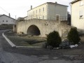
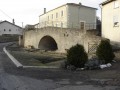
Famous for its witch festival, Fillières offers some lovely walking trails, including this one, which will take you past some idyllic spots and a particularly surprising tree.

Details

n°21957402
Creation:
Last update:
Last review:
  • Walking
    Activity: Walking
  • ↔
    Distance: 3.02 mi
  • ◔
    Average duration: 1h 40 
  • ▲
    Difficulty: Moderate

  • ⚐
    Back to start: Yes
  • ↗
    Ascent: + 358 ft
  • ↘
    Descent: - 361 ft

  • ▲
    Highest point: 1,175 ft
  • ▼
    Lowest point: 909 ft
  • ⚐ Country: France
  • ⚐ City: Fillières (54560)
  • ⚑
    Start/End: N 49.400753° / E 5.844883°
  • ❏
    IGN map(s): Ref. 3311O
  • Hour-by-hour weather

Description of the walk

Park near the Fillières cemetery.

(S/E) Facing the cemetery, turn right and follow the red markings.

(1) At the Croix des Allemands monument, continue along the country lane that descends to the left and enter the woods.

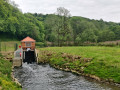
(2) Take the path on your right before reaching La Crusnes. Then take the path leading uphill on your right, still following the red markings, then turn left and begin a gentle descent.

(3) Turn left towards a small pond on your left. This lovely haven of peace is unfortunately private but offers a most relaxing view.
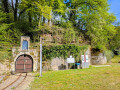
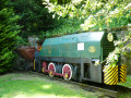
Then head back up to your right, running alongside the railway line, then turn right again into the woods. A little further on, on your right, you can admire a rather unusual mushroom-covered tree.
Further on, the woods open out onto a country lane which you should follow until you reach the road (D27).

(4) Follow it to the right with care, then turn right, after the ‘Fillières’ sign, onto the Chemin de Ronde, which will take you straight back to the cemetery (S/E).

Waypoints

  1. S/E : mi 0 - alt. 1,175 ft - Fillières Civil Cemetery
  2. 1 : mi 0.32 - alt. 1,158 ft - Monument
  3. 2 : mi 0.85 - alt. 925 ft - Crossroads, turn right. Near the - Crusnes (rivière)
  4. 3 : mi 1.52 - alt. 974 ft - Turn left at the fork
  5. 4 : mi 2.61 - alt. 1,175 ft - D27
  6. S/E : mi 3.02 - alt. 1,171 ft - Fillières Civil Cemetery

Notes

Water point at the cemetery.
Walking shoes.

Worth a visit

(1) German Cross monument.

(2) La Crusnes.

(3) Private pond.

Mushroom tree.

Reviews and comments

4.7 / 5
Based on 1 review

Reliability of the description
5 / 5
Ease of following the route
5 / 5
Route interest
4 / 5
Azimut71
Azimut71

Overall rating : 4.7 / 5

Date of your route : Sep 10, 2023
Reliability of the description : ★★★★★ Very good
Ease of following the route : ★★★★★ Very good
Route interest : ★★★★☆ Good
Very busy route : No

The signposting is very good: not excessive, but there where it’s needed.
Three walking routes start at the cemetery, though there aren’t many parking options…

Machine-translated

Other walks in the area

For more walks, use our search engine .

The GPS track and description are the property of this route's author. Please do not copy them without permission.