The 1000-step walk in Saint-Germain

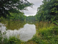
Travel at nature's pace through the ponds, forest and peat bog of La Grande Pile, a true natural gem of the Southern Vosges. Along the route, there are eight information stations to discover so you don't miss any of the wonders of the La Grande Pile Regional Nature Reserve.

Details

28046988
Creation:
Last update:
Last review:
  • Walking
    Activity: Walking
  • ↔
    Distance: 3.22 mi
  • ◔
    Average duration: 1h 35 
  • ▲
    Difficulty: Easy

  • ⚐
    Back to start: Yes
  • ↗
    Ascent: + 98 ft
  • ↘
    Descent: - 75 ft

  • ▲
    Highest point: 1,122 ft
  • ▼
    Lowest point: 1,043 ft

Photos

Description of the walk

The walk starts from the Petit Saint-Maurice pond in Saint-Germain.

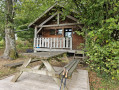
(S/E) From the car park, go to the hut to see the map of the route and the first information point, "Le Temps d'un souvenir" (Time for a memory). Head north and walk along the Étang du Grand Saint-Maurice pond on your left. You will reach the information point "Le Temps de l'étang" (Time for the pond) (information on the flora and fauna).

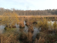
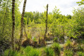
(1) Continue along the lake before heading into the undergrowth. After crossing a forest road, enter the forest to reach the bog (interpretation station "Le Temps des saisons" (Time of the Seasons). The path allows you to walk along this heavily wooded part of the bog. Continue along the path until you reach the sign indicating that you are entering the bog. Please keep your dogs on a lead to avoid trampling the vegetation and to respect the peace and quiet of the wildlife. Go around the bog on the left and follow a path on the right. Then continue straight ahead.

(3) Turn right and head for the fourth information station, "Le Temps des vies" (The Time of Lives). Continue along the path until you reach a wooden footbridge.

(4) Continue to the end of the pontoon. You will be rewarded with a magnificent view of the bog and the fifth information point, "Le Temps en musique" (Time in Music). Continue along the path and, at the next intersection, take the path on the right.

(5) At the next intersection, continue straight ahead, take another footbridge and you will soon reach the "Voyaging through time" information point.

(6) Retrace your steps to the previous intersection.

(5) Turn right. Cross a path. You will come to a forest road; follow it to the right.

(7) At the next intersection, turn left. Cross a path and continue south. You will come to a forest road; follow it to the left to reach the last interpretive station, "Time to Grow Up".

(8) Leave the forest road by turning right onto a path leading towards a wood. Continue to the small road that leads to the Monts Reveaux pond. When you reach this road, turn right to return to the car park (S/E).

Waypoints

  1. S/E : mi 0 - alt. 1,047 ft - Étang du Petit Saint-Maurice
  2. 1 : mi 0.26 - alt. 1,047 ft - Étang du Grand Saint-Maurice
  3. 2 : mi 1.08 - alt. 1,083 ft - Peat bog
  4. 3 : mi 1.47 - alt. 1,106 ft - Intersection
  5. 4 : mi 1.76 - alt. 1,066 ft - Wooden jetty
  6. 5 : mi 2.03 - alt. 1,079 ft - Intersection
  7. 6 : mi 2.08 - alt. 1,066 ft - Travelling through time
  8. 7 : mi 2.41 - alt. 1,115 ft - Intersection
  9. 8 : mi 2.77 - alt. 1,083 ft - Time to Grow
  10. S/E : mi 3.22 - alt. 1,047 ft - Time for a memory

Worth a visit

Pond and nature reserve.

Reviews and comments

4.6 / 5
Based on 6 reviews

Reliability of the description
4.7 / 5
Ease of following the route
4.8 / 5
Route interest
4.3 / 5
le saut de bonneille

Overall rating : 4.7 / 5

Date of your route : Dec 28, 2025
Reliability of the description : ★★★★★ Very good
Ease of following the route : ★★★★★ Very good
Route interest : ★★★★☆ Good
Very busy route : No

The path was not busy given the date of the hike, but I think that in the summer there must be more people.
The route is easy and pleasant, with no difficulties.
Very well marked, which is nice.
I recommend it.

Machine-translated

Alain et Nadine
Alain et Nadine

Overall rating : 4.7 / 5

Date of your route : Nov 12, 2025
Reliability of the description : ★★★★★ Very good
Ease of following the route : ★★★★★ Very good
Route interest : ★★★★☆ Good
Very busy route : No

A very easy walk, well marked by Visorando, through woods and, above all, a passage through peat bogs, which is not common.

Machine-translated

User 17341172

Overall rating : 4.7 / 5

Date of your route : Nov 03, 2025
Reliability of the description : ★★★★☆ Good
Ease of following the route : ★★★★★ Very good
Route interest : ★★★★★ Very good
Very busy route : No

I only did part of this walk. It was a lovely, easy walk along a forest path that goes around a fairly large pond.
It should be noted that at the start of this walk, there was a rather off-putting sign indicating that it was hunting ground. In the end, on that day (a weekday), there were no hunters because the police were practising shooting in a clearly marked area, so we were able to walk safely in another part of the forest.

Machine-translated

christian90
christian90

Overall rating : 4.7 / 5

Date of your route : Aug 26, 2025
Reliability of the description : ★★★★★ Very good
Ease of following the route : ★★★★★ Very good
Route interest : ★★★★☆ Good
Very busy route : Yes

A lovely hike enjoyed by a group of 14 people.
Well-marked trails and very clean considering the season.
A great deal of effort has been put into restoration and documentation.
But there is a sense of nostalgia because the vegetation in the bog is no longer as open as it was ten years ago.
A small note: after returning to point 5, when you reach the forest road, you need to turn right.
However, on the other side of the road, facing us, there is a sign with an arrow pointing to the left.
You can trust the description, it is accurate.
Christian 90

Machine-translated

User 26422811
• Edited:

In the Vosges, there are no signs: none at all, or just one.
It is impossible to follow the suggested route.

Machine-translated

daniel70
daniel70

Overall rating : 5 / 5

Date of your route : Jun 16, 2025
Reliability of the description : ★★★★★ Very good
Ease of following the route : ★★★★★ Very good
Route interest : ★★★★★ Very good
Very busy route : Yes

Hello,

A lovely family walk, well signposted.
The information boards are very well done and provide lots of information about the peat bogs, their fauna and flora, and their scientific interest.
Most of the walk is in the shade, which is ideal when it's very hot, without being too difficult.
As the peat bog is a damp place, it is quite cool but there are a few mosquitoes, so make sure you bring mosquito repellent!
Thank you to everyone who contributed to the creation of this beautiful route.

Machine-translated

Jerome70
Jerome70
• Edited:

Overall rating : 4 / 5

Date of your route : Jun 02, 2024
Reliability of the description : ★★★★☆ Good
Ease of following the route : ★★★★☆ Good
Route interest : ★★★★☆ Good
Very busy route : Yes

Enjoy your family outing

Machine-translated

Other walks in the area

For more walks, use our search engine .

The GPS track and description are the property of this route's author. Please do not copy them without permission.