


 Country:
 City:
City:


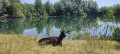

(S/E) From the Pont de l’Ognon car park, take the path that runs alongside the river to reach the Base de la Saline and its lakes.
(1) Take the path leading to the right, then walk behind the lakes and into the woodland. The other paths, to the left, will take you past the site’s facilities: multi-sports ground, pétanque court, water sports centre, restaurant… Continue along the same path until you reach the footbridge.
(2) After crossing the footbridge, take a stony path until you reach a road.
(3) Follow it straight ahead. You’ll see an old lime kiln on your right. Take the road on the right, skirting the pastures, towards the Butte de Vouhenans. After the bend, briefly leave the path to take the track on the right and take in the magnificent view from the Butte de Vouhenans. An information board helps you understand the landscape and identify the towns and villages, as well as the first peaks of the Vosges foothills.''
(4) Turn back, rejoin the path on the right and head back down towards the village of Vouhenans. Keep going straight ahead and cross the river.
(5) After the bridge, turn immediately onto the second path on the left. Walk alongside the meadows until you reach a footbridge.
(6) Enter the village again. At the end of the road, continue to the left, walk past the church, then take the first path on the right. You will gradually leave the village behind and head back towards the Butte de Vouhenans. Continue straight ahead until the end of the street.
(7) Turn left and then right to head back down towards the Base de la Saline. Return to the car park by following the route in reverse, and before taking the path along the river back to the car park, do feel free to make the most of the Base’s facilities, both for leisure and water sports ( S/E).

 A lovely walk with varied scenery (ponds, meadows, woods, village). Very easy as there’s very little change in altitude.
 Tourist office

 Visorando Member
 Association / Club / Walk leader
 Moderate
