Country:

 City:
City:



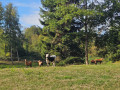

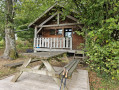
Park in the car park reserved for walkers at the entrance to the Domaine de la Patte d’Oie.
(S/E) Continue along the road.
(1) Take the road leading down to the right as you leave the Domaine de la Patte d’Oie. Once on the path, turn left at the three-way junction and join a small tarmac road.
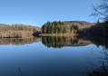
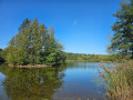
(2) Turn left, then right at the Fork in the road, pass the Morinteau buildings and reach the Étang de la Dame.
(3) Turn right onto the path leading downhill. From there, follow the “green fern” signposts. At the bottom of the descent, cross the D73 carefully towards Les Granges Baverey. Pass Moulin Bégeot, then a small pond on your left.
(4) Turn left, then take the forest track on the left at the top of the climb, continuing to follow the “green fern” markings. Keep right at the junction; further on, cross the Ruisseau de Chevigney.
(5) Ignore the path on the left, leave Moulin Grillot on your right and reach a tricky fork in the path.
(6) Be careful not to miss the small path on the left: use the gates reserved for walkers to cross the pasture. When you reach the road, continue to the left and you’ll come out onto the RD73.
(7) Head left and walk through the village of Écromagny. Walk past the church, then turn right in front of the town hall and follow the banks of the Étang Pellevin.
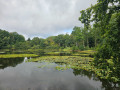
(8) Turn left at the end of the embankment, then keep left at the three-way junction. Carry on straight ahead, following the ‘Fougère verte’ signposts, until you reach the Étang la Dame.
(3) Follow the path which climbs up to the right after the pond’s dyke and leads to Les Noies Jean.
(9) Turn left and continue to the RD72.
(10) Follow this road, turning left, then turning left again after about 150 metres and continuing straight on to reach the junction where the circular route begins.
(1) Turn right and return to the car park (S/E).
 Tourism professional
 Easy
Easy 
 Visorando Member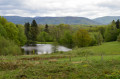
 Tourist office