The Èvre at the Courossé site

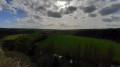
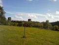
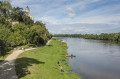
The Èvre, the iconic river of the Mauges region, stretches for 120 km, meandering through the plateau. It ends its course in the Loire, a stone's throw from Saint-Florent-le-Vieil. The Courossé site covers one of the most beautiful meanders of this pretty river and offers a panoramic view of the surrounding countryside and its many bell towers
30 Sept 2025: This route has too many recurring difficulties to make it enjoyable (unpaved roads, trees cut across the route, dykes that are often impassable, animals in the meadows crossed, etc.), so I strongly advise against venturing there until these problems have been resolved.

Details

844693
Creation:
Last update:
  • Walking
    Activity: Walking
  • ↔
    Distance: 4.26 mi
  • ◔
    Average duration: 2h 15 
  • ▲
    Difficulty: Moderate

  • ⚐
    Back to start: Yes
  • ↗
    Ascent: + 302 ft
  • ↘
    Descent: - 295 ft

  • ▲
    Highest point: 220 ft
  • ▼
    Lowest point: 33 ft

Photos

Description of the walk

Parking is available at the car park near the Moulin de Gévrisse.

(S/E) Go up the path that leads to the car park, then follow the road to the right that goes up to the Massonnière farm. Below the farm, the road runs along the top of the cliff, about fifty metres above the Èvre. The wooded slope offers a glimpse of the sparkling water below.
Continue along the road to the next crossroads and turn right towards the Courossé farm.

(1) At the pond below, take the path to the left of the road, which descends along the boundary between two plots of land. When the grass is high, this path may be less visible. Follow the boundary between the plots and then the stream that flows from the pond to the river and continue along the right bank to the old Courossé mill.

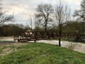
(2) Cross to the left bank via the footbridge at the mill. For part of the year, the parapets of this footbridge are lowered so as not to obstruct the flow of the river when it overflows its banks. A sign prohibiting passage is posted on each side. The footbridge remains passable but at your own risk (very limited if the water does not rise above it).
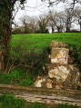
Climb up the cliff via the steep Way of the Cross, which leads to the Croix de Courossé. This Way of the Cross, which starts to the left of the old mill, is marked by mosaic stations created by a local artist. Take the time to admire them.

(3) Once you reach the cross, you will be rewarded with a beautiful view. The farm located in the middle of the meander is called "Ferme du Pape" (Pope's Farm), in memory of the gift made by the former owner to Leo XIII.
With your back to the cross, take the beautiful avenue that leads up to the Château de la Baronnière.

(4) Facing the castle gate, take the path on the right that leads down to the river.

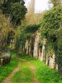
(5) Shortly before the mill, turn left at the ruins leaning against the cliff. The path continues along the left bank, following the trail and then the meadows that run alongside the Èvre. There are passages allowing you to cross the fences. If there are animals, avoid them and do not cut across the herds.

(6) The crossing to the other bank is via the dyke that blocks the river upstream from the Gévrisse mill. Although the central spillway is usually under water, this is not the case for this dyke, which can be crossed for most of the year. If it is covered by water (and if you did not check this before starting the route), you will have to retrace your steps.
Once you reach the right bank again, go up the path that passes in front of the buildings, then turn right again to cross the developed area. Before you reach the car park, note the pleached hedges that line the path. The plants are cut to lie horizontally, but they remain alive and produce new wood. Together, they form almost impenetrable hedges (S/E).

Waypoints

  1. S/E : mi 0 - alt. 46 ft - Car park at the Gévrisse rest area
  2. 1 : mi 0.97 - alt. 194 ft - Intersection
  3. 2 : mi 1.56 - alt. 43 ft - barrage sur l'èvre pour moulin à eau
  4. 3 : mi 2.27 - alt. 46 ft - Passerelle du Moulin de Courossé
  5. 4 : mi 2.39 - alt. 187 ft - Croix de Courossé
  6. 5 : mi 2.56 - alt. 207 ft - Gate - Château de la Baronnière
  7. 6 : mi 2.81 - alt. 43 ft - Courossé Mill
  8. 7 : mi 3.96 - alt. 39 ft - Moulin de Gévrisse dyke
  9. S/E : mi 4.26 - alt. 46 ft - Car park at the Gévrisse rest area

Notes

(S/E) Rest area near the Moulin de Gévrisse.

This route should be taken when the water level in the Èvre is low, returning via the Moulin de Gévrisse dyke, which may be covered with water. If in doubt, take a look at this section, located about 300 m north of the start, going down the path that leads from the car park to the river

As the route crosses hay meadows, boots or gaiters may be essential before mowing and in wet or dewy weather, if you don't want to end up with wet feet.
Dogs are not allowed on the route due to passages through meadows where animals may be present.

Worth a visit

A stone's throw from the Croix de Courossé is the Château de la Baronnière. It was from here that General Bonchamp, one of the Vendée leaders, set off to battle, spurred on by the men of the Chapelle Saint-Florent. Although located in Maine-et-Loire, the Mauges region was one of the key locations in the Vendée wars. The red colour of the famous Cholet handkerchiefs is said to come from the blood of the soldiers killed in battle.

Reviews and comments

4 / 5
Based on 18 reviews

Reliability of the description
3.9 / 5
Ease of following the route
4.1 / 5
Route interest
3.9 / 5
Samantha
Samantha
• Edited:

Overall rating : 3.3 / 5

Date of your route : Sep 12, 2025
Reliability of the description : ★★★☆☆ Average
Ease of following the route : ★★☆☆☆ Disappointing
Route interest : ★★★★★ Very good
Very busy route : No

I strongly advise against this hike once July is over, and in general if you are not prepared to take risks. The first part is on a winding road with no pedestrian area, poor visibility and heavy traffic. It is a really dangerous section. The last part goes through a cow field. No big deal, you might say, except that the very narrow path was blocked by a herd of cows, forcing me to detour through private fields to continue without having to push the cows myself.
Finally, you have to cross a passage that is often submerged and very slippery. I found myself stuck there at the end of the day and had to call for help.

Machine-translated

User 6070190
• Edited:

Overall rating : 3.7 / 5

Date of your route : Sep 07, 2025
Reliability of the description : ★★★★☆ Good
Ease of following the route : ★★★★☆ Good
Route interest : ★★★☆☆ Average
Very busy route : No

It was very disappointing not to be able to complete the entire route because of the submerged dyke, even though I did this hike on 5 September after a dry summer (on that note, I don't know who to contact for information about this). Between 6 and 7, the path passes through fields occupied by cattle, which are of limited interest. Another detail, and not the least important, is that the small wood near the dyke has been completely devastated by illegal logging.

Machine-translated

godillot49
godillot49
• Edited:

Overall rating : 4 / 5

Date of your route : Jun 02, 2025
Reliability of the description : ★★★★☆ Good
Ease of following the route : ★★★★☆ Good
Route interest : ★★★★☆ Good
Very busy route : Yes

The route follows the river closely, but vegetation obscures it most of the time. Perhaps best to do in autumn! To cross the dam, the water level really needs to be low. On 30 May 2025, despite a serious drought, there was still a good amount of water on it, but the dam itself is not slippery and you can cross it if you don't mind getting a little wet.

Machine-translated

Senga 59
Senga 59
• Edited:

Overall rating : 4 / 5

Date of your route : Aug 25, 2024
Reliability of the description : ★★★★☆ Good
Ease of following the route : ★★★★☆ Good
Route interest : ★★★★☆ Good
Very busy route : Yes

It is a route with a lot of elevation changes

Machine-translated

MarieC83
MarieC83
• Edited:

Overall rating : 3.3 / 5

Date of your route : Jul 31, 2024
Reliability of the description : ★★★★☆ Good
Ease of following the route : ★★★★☆ Good
Route interest : ★★☆☆☆ Disappointing
Very busy route : No

We were very disappointed with this hike. The start is pleasant at the Grévisse mill. But then the hike begins on a dangerous road with bends. It continues on the left in a field of nettles. The only point of interest is the view of the Cirque de Courossé, which represents a small part of the hike with a climb to the cave and the cross. We also had to walk through a cornfield and a field frequented by cows. The hike ends with a dyke that blocks the river, which was flooded on this day at the end of July, and we had to cross it after some hesitation. We had to wade through 5 centimetres of water to cross it.

Machine-translated

Aurélie Dombes
Aurélie Dombes
• Edited:

Overall rating : 2.3 / 5

Date of your route : Aug 05, 2024
Reliability of the description : ★★☆☆☆ Disappointing
Ease of following the route : ★★★★☆ Good
Route interest : ★☆☆☆☆ Very disappointing
Very busy route : No

Only a small part of the hike is enjoyable; the rest is very disappointing. Much of the hike takes place between a cornfield and hedges of brambles that block the view of the Evre, on tarmac roads. There is little shade or wooded paths. In short, it is very disappointing and not recommended.

Machine-translated

yuggy
yuggy
• Edited:

Overall rating : 3.7 / 5

Date of your route : Aug 13, 2023
Reliability of the description : ★★★★☆ Good
Ease of following the route : ★★★★☆ Good
Route interest : ★★★☆☆ Average
Very busy route : Yes

the Courossé-Gevrise site is temporarily inaccessible. There are two reasons for this.
The first is that the staircase from the viewpoint to the abandoned village of Courossé is closed due to the risk of rockfalls. However, it is still possible to reach both sites. A path of approximately 500 metres circumvents this problem. The village and the Marian cave at the foot of the viewpoint are still open to visitors and are well worth seeing, if only for the serenity they exude.
The second is the passage over the Gévrise dam. In summer, there is no problem and the route is perfect. After heavy rain, it undoubtedly becomes more difficult to complete the circular. To be seen.
The end of the circular route through the interior of the cirque is less interesting. You follow the Evre river along the edge of fields and finish with at least two kilometres of tarmac. The passage through the Ferme du Pape would undoubtedly be more interesting.

Machine-translated

Lolorenzo
Lolorenzo
• Edited:

Overall rating : 3.7 / 5

Date of your route : Apr 18, 2023
Reliability of the description : ★★★★☆ Good
Ease of following the route : ★★★☆☆ Average
Route interest : ★★★★☆ Good
Very busy route : No

A beautiful hike combining two routes: Along the Laurent, starting from Botz-en-Mauges, then after point 5, we joined the Evreroute at the Courosséau site, point 7 (the crossing was tricky and risky with the current as we didn't have walking sticks). After the dyke, the trail is not maintained. We took the route in reverse towards point 6 and when we arrived (after point 1) south of the Courossé route, we continued south towards Basse Pouèze to finish the Au Fil du Laurent route.

We met many walkers leaving from the car park to the north and doing the 3-4-5-6 circular

Machine-translated

ROBERT Raymond
ROBERT Raymond
• Edited:

Overall rating : 4.3 / 5

Date of your route : Apr 17, 2022
Reliability of the description : ★★★★☆ Good
Ease of following the route : ★★★★★ Very good
Route interest : ★★★★☆ Good
Very busy route : No

Agreed on the points indicated in the discussions below.
The Courossé site appears to be in poor condition, if not abandoned. The large cross that dominated the site is no longer there, the mast has been broken (not recently) and there is no information on site

Machine-translated

manuuher
manuuher
• Edited:

Overall rating : 4 / 5

Date of your route : Mar 13, 2022
Reliability of the description : ★★★★☆ Good
Ease of following the route : ★★★☆☆ Average
Route interest : ★★★★★ Very good
Very busy route : No

A very pleasant and beautiful walk, especially around Courossé! I gave it 5 stars!
That said, I agree with the two previous comments and would add three more:

  1. I had a hard time finding the rest of the hike at the point (6). The GPX track is wrong. You have to leave the site once you arrive at the village and not continue on the main path. The path branches off to the left (go through a cattle grid), but it's barely visible. Once you arrive at the bridge (taken on the way there), you hesitate with another path that leads nowhere.
  2. I was "lucky" that the ford was passable. Especially since it's at the end of the route... I can't imagine if we'd had to turn back! That would have doubled the length of the walk! I don't see any other bridges that could shorten the walk. I should have read the comments before! But luckily everything went well. Bring good shoes or towels for those who want to go barefoot. That said, it's true that precautions were mentioned in the description at the end, but why not do the route in that direction? That would also have eliminated the previous point where I got lost.
  3. I agree that the first few kilometres are on a winding road, which is not very reassuring if a car is coming in the opposite direction (we did pass some motorbikes)
  4. Finally, the site was "more or less" closed to the public due to falling rocks. We ignored this because we would have been too disappointed not to be able to climb to the top of the site.
  5. You may find yourself surrounded by cows. Not for the faint-hearted.

That said, I still maintain that it's a really beautiful walk, and even original with the fording of the dam.

Machine-translated

Teouf
Teouf
• Edited:

Overall rating : 4.3 / 5

Date of your route : May 24, 2021
Reliability of the description : ★★★★☆ Good
Ease of following the route : ★★★★★ Very good
Route interest : ★★★★☆ Good
Very busy route : Yes

superb hike done backwards because it was impossible to pass certain underwater passages^^

Machine-translated

BB85
BB85
• Edited:

Overall rating : 4 / 5

Date of your route : Mar 15, 2021
Reliability of the description : ★★☆☆☆ Disappointing
Ease of following the route : ★★★★★ Very good
Route interest : ★★★★★ Very good
Very busy route : No

Hello
A very beautiful hike described in a clockwise direction...
The problem is that we arrived at the Grévisse road, which was covered with water, and according to the description, in this case you have to turn back...
We managed to get through 5 cm of water in less than ideal safety conditions...
Wouldn't it be better to do it the other way round, as the road is 500 metres from the car park, or to clearly indicate in red at the beginning of the description that the passage depends on the water level?
No one reads the entire description before setting off!
Kind regards

Machine-translated

ariégeoisAetD
ariégeoisAetD
• Edited:

Overall rating : 3.7 / 5

Date of your route : Jul 06, 2020
Reliability of the description : ★★★★☆ Good
Ease of following the route : ★★★★☆ Good
Route interest : ★★★☆☆ Average
Very busy route : No

We didn't do the whole hike... The Courossé site is very nice, as is the climb up to the cross, but the section of road (which we didn't do) seemed unpleasant to us, as it was narrow and winding and dangerous if you encountered a car...

Machine-translated

DRALLIBAG
DRALLIBAG
• Edited:

Overall rating : 3.7 / 5

Date of your route : Jun 22, 2020
Reliability of the description : ★★★★☆ Good
Ease of following the route : ★★★★☆ Good
Route interest : ★★★☆☆ Average
Very busy route : No

We didn't particularly like the first part, which was mainly on roads and then through fields, but from Courossé onwards it was really very good. Perhaps the start of the path along the Evre after Couroussé could be better signposted.

Machine-translated

GC44
GC44
• Edited:

Overall rating : 4.7 / 5

Date of your route : Jun 07, 2020
Reliability of the description : ★★★★★ Very good
Ease of following the route : ★★★★☆ Good
Route interest : ★★★★★ Very good
Very busy route : Yes

A very pleasant route winding along the banks of the Evre, with rolling countryside and beautiful views from the Courossé site. A highly recommended hike

Machine-translated

Other walks in the area

For more walks, use our search engine .

The GPS track and description are the property of this route's author. Please do not copy them without permission.