Boire and Coteaux in Bouzillé

The village of Bouzillé has many distinctive features. The route, starting from the picnic area at Square Gibot, will take you along dirt tracks to La Bourgonnière and its ‘Christ habillé’. The route will then lead you to a very peaceful spot in the countryside, namely La Boire Sainte-Catherine, a popular fishing spot on fine days. The rest of the walk will take you back to the 19th century, which marked the heyday of lime production in Anjou.

Details

4055922
Creation:
Last update:
Last review:
  • Walking
    Activity: Walking
  • ↔
    Distance: 9.16 mi
  • ◔
    Average duration: 4h 25 
  • ▲
    Difficulty: Moderate

  • ⚐
    Back to start: Yes
  • ↗
    Ascent: + 233 ft
  • ↘
    Descent: - 262 ft

  • ▲
    Highest point: 269 ft
  • ▼
    Lowest point: 26 ft
  • ⚐ Country: France
  • ⚐ City: Bouzillé (49530)
  • ⚑
    Start/End: N 47.338917° / W 1.108257°
  • ❏
    IGN map(s): Ref. 1322SB, 1323SB, 1422SB, 1423SB
  • Hour-by-hour weather

Photos

Description of the walk

Park in the car park near the tennis court on Route de Saint-Florent-le-Vieil.

(S/E) Cross Rue d’Anjou at the pedestrian crossing and enter Square de Gibot, where the funeral chapel of the family of the same name is located. On leaving the square, turn right towards Saint-Florent-le-Vieil, then turn right onto Chemin du Rabotteau, which takes you through the vineyards and eventually joins the D201, Route de la Chapelle-Saint-Florent.

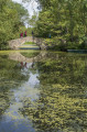
(1) Turn right onto this road and follow it to the Proutais wayside cross. Then go through the small gate on the left into the wooded grounds of the Château de la Bourgonnière. Walk the entire length of the grounds, passing close to the château and the pond, and continue to the main entrance on the D751.

(2) Cross this road carefully and take a quick first turn right then left to join the path leading to the hamlet of La Pohuère.

(3) Carry on almost straight ahead along the road towards L’Aubardière and turn onto the sunken track leading to the Guichetière stopover lodge.

(4) Leave this on your right, follow the road for about 400 metres, then turn right onto a stony track. Keep to the right at the next Fork in the road to come out onto the track leading to the hamlet of La Championnière.

(5) Turn right, pass through the hamlet, then cross the Motte bridge to reach a four-way junction.

(6) Turn left onto the Chemin des Sables, which joins the Route de la Rabotière. Follow it to the left for 200 metres and, at the entrance to the Fossé Neuf, turn right towards La Boire Sainte-Catherine.

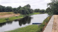
(7) Walk around this ‘boire’ (a waterhole fed by the Loire during floods). You’ll walk for about 2 km before reaching a Fork in the road. Take the path furthest to the right to rejoin the Rue des Fours à Chaux.

(8) Turn right onto Rue des Fours à Chaux. Cross Le Fourneau and continue straight on along Rue des Fours à Chaux for about 700 m. Turn right onto a dirt track to cut across the fields.

(9) Turn left onto Route de la Vasinière.

(10) At the junction with the Route de la Ménantière, carry on straight ahead onto a new dirt track. Continue to the Route de la Fontaine. Turn left, then right after 50 m towards Le Quarteron.

(11) Cross the hamlet and continue along the dirt track, between fields and woodland, until you reach the D751.

(12) Cross the road carefully and carry on straight ahead, skirting the vineyards for about 500 metres.

(13) Halfway up the hillside, turn left onto the path that joins the Chemin de la Crosse. At the end of this, turn left onto Rue des Mutreaux and continue for 50 m.

(14) Turn left onto Rue des Clérambaults and carry on until you reach Rue du Pressoir Neuf, which first turns left then right. Carry on straight ahead until you reach Rue d’Anjou (D751).

(15) Turn right and continue for 300 m until you reach the Maudinerie, where you should turn left. Follow the Maudinerie and continue along Chemin des Rousselières. Then turn right onto Rue Bellevue, which quickly turns left and then right as it crosses the housing estate, leading to the car park at the Bouzillé tennis courts (S/E).


Waypoints

  1. S/E : mi 0 - alt. 253 ft - Car park at the tennis court in Bouzillé
  2. 1 : mi 0.83 - alt. 200 ft - D201. Towards the - Château de la Bourgonnière
  3. 2 : mi 1.7 - alt. 62 ft - D751
  4. 3 : mi 2.01 - alt. 59 ft - La Pohuère
  5. 4 : mi 2.73 - alt. 59 ft - La Guichetière lodge
  6. 5 : mi 3.26 - alt. 69 ft - La Championnière
  7. 6 : mi 3.82 - alt. 30 ft - Crossroads, on the left
  8. 7 : mi 4.8 - alt. 30 ft - Boire Sainte Catherine (OREE D'ANJOU)
  9. 8 : mi 6.19 - alt. 43 ft - Rue des Fours à Chaux
  10. 9 : mi 6.87 - alt. 46 ft - Route de la Vasinière
  11. 10 : mi 7.05 - alt. 66 ft - Route de la Ménantière
  12. 11 : mi 7.29 - alt. 89 ft - Le Quarteron
  13. 12 : mi 7.52 - alt. 102 ft - D751
  14. 13 : mi 7.81 - alt. 213 ft - Vineyard
  15. 14 : mi 8.51 - alt. 259 ft - Junction of Rue des Clérambault and Rue des Mutreaux
  16. 15 : mi 8.7 - alt. 190 ft - D751, Rue d’Anjou
  17. S/E : mi 9.16 - alt. 253 ft - Car park at the tennis court in Bouzillé

Notes

29 per cent tar.

Worth a visit

Anecdote about the village of Bouzillé
The name Bouzillé initially elicits an expression of amused surprise. The village was first mentioned around 1100 under the name Buzilliacus.
Later, Rabelais took pleasure in imagining a gargantuan origin for this name. The well-known giant, Gargantua, was tasked with settling a dispute between the inhabitants of Liré and Saint-Florent-le-Vieil, who each believed they were halfway between Angers and Nantes. He placed one foot on Saint-Pierre in Nantes and the other on Saint-Maurice in Angers and relieved himself; whereupon ‘everyone cried out: “There’s dung there!”’.
On a more serious note, and going back to much earlier times – as confirmed by Célestin Port’s dictionary of Maine-et-Loire – the commune appears to have been inhabited by prehistoric people. Eight polished stone axes were found within the commune’s boundaries. Furthermore, the Gallo-Roman road from Liré to Le Marillais passed through Buzilliacus.

Square de Gibot
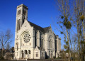
The funeral chapel was built in 1846 on the orders of Count Luc-Jean de Gibot, Lord of La Mauvoisinière, to serve as a burial place for his wife, the Countess de Gibot. This octagonal chapel, with a glass-roofed dome surmounted by the count’s crown, contains 24 niches built into the thickness of its walls. These were intended to house the coffins of family members and servants of the Château de la Mauvoisinière.

Chapel and Château de la Bourgonnière
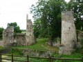
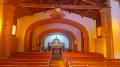
The château was rebuilt in the 19th century following the turmoil of the Revolution. All that remains of the original château is a 15th-century tower and the 16th-century chapel. Inside the chapel, visitors can admire the ‘Christ habillé de la Bourgonnière’: one of only a few of its kind in Europe. This château is privately owned, and the owners offer guided tours by appointment only (please telephone 06 84 46 57 99).

The lime-burning industry in Bouzillé
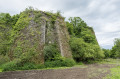
The first lime kiln, on the outskirts of the hamlet of Fossé-Neuf, is well preserved and visible from the road. Built in 1804 by Sieur Meslin, this kiln employed up to 50 people and ceased operations in 1939. It is particularly well-built and surprisingly durable: Mr Chené, a former employee, only ever saw it shut down once in 20 years, whilst the kiln chamber was being repaired. Around 1850, the Gontard brothers were granted permission to build two kilns near the Sainte-Catherine quarry, not far from the first one. These ceased operation during the War of 1870. Both kilns are still visible through the dense vegetation. The ancillary buildings, including an impressive number of horse stalls (30), are the last remaining evidence of the intense activity at these kilns.
Source: *La Chaux en Anjou, Une industrie oubliée* by G. Lemaire and P. Girault.

Reviews and comments

4 / 5
Based on 4 reviews

Reliability of the description
4 / 5
Ease of following the route
4 / 5
Route interest
4 / 5
bikeràpied
bikeràpied
• Edited:

Overall rating : 5 / 5

Date of your route : Mar 26, 2026
Reliability of the description : ★★★★★ Very good
Ease of following the route : ★★★★★ Very good
Route interest : ★★★★★ Very good
Very busy route : No

A lovely walk. La Bourgonnière Castle is truly magnificent. Thank you to the owners for letting us walk through their grounds. Just the sort of little paths we love. I didn’t see any barriers like those mentioned in earlier posts.
We got stuck at point 6 because of a large puddle. Ideally, should this walk be done from mid-April onwards?
The signposting on this PR route is really very well done; you can’t get lost. Thanks to the signposters from the local federation.

Machine-translated

GSO
GSO
• Edited:

Overall rating : 4.7 / 5

Date of your route : Mar 19, 2025
Reliability of the description : ★★★★★ Very good
Ease of following the route : ★★★★★ Very good
Route interest : ★★★★☆ Good
Very busy route : No

Please note: between points 5 and 6, the path was flooded at the stream. It was impossible to cross. In this case, you must return to point 5 and rejoin the route to Sainte Catherine via Rue de la Vallée.

There is no barrier on the path, contrary to earlier comments.

Machine-translated

SSSL
SSSL

Overall rating : 3 / 5

Date of your route : Mar 07, 2022
Reliability of the description : ★★★☆☆ Average
Ease of following the route : ★★☆☆☆ Disappointing
Route interest : ★★★★☆ Good
Very busy route : No

The route is blocked just after the chapel by a private individual.
I can confirm the previous comments.

Machine-translated

Dousset Paul
Dousset Paul

Overall rating : 3.3 / 5

Date of your route : Feb 20, 2021
Reliability of the description : ★★★☆☆ Average
Ease of following the route : ★★★★☆ Good
Route interest : ★★★☆☆ Average
Very busy route : No

It is impossible to reach the hamlet of La Pohuère via the signposted path. The new owner has blocked access to his land with a barbed-wire fence. It would be advisable to alter the route.

Machine-translated

Other walks in the area

For more walks, use our search engine .

The GPS track and description are the property of this route's author. Please do not copy them without permission.