Country:
 City:
City:


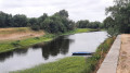
(S) Walk along the banks of the Loire, following the quays near the Julien Gracq Museum, then take the footpath and cycle path that continue from there. Head up the next road on the right and, at the end of it, turn left to rejoin Avenue de l’Europe.
(1) First turn left then right to cross the D751 and follow the signs for La Boutouchère. After leaving Saint-Florent-le-Vieil, take the path on the left.
(2) When you reach the road, take the GR®3 on the right towards La Bizerie.
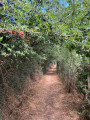
(3) Just before the hamlet, take the dirt track on the right, then keep to the left and head towards La Marcheboire.
(4) Leave the hamlet by taking the path on the left until you come out onto a road.
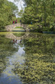
(5) Follow it to the right until it turns into a footpath. Walk round two ponds and reach the centre of the village of Saint-Laurent-du-Mottay. Then continue straight on until you reach Rue de la Mare.
(6) Take the D222 on the right, pass the local council offices and turn left towards Le Mesnil-en-Vallée. Leave the village by taking the second road on the right after the Château de la Barre and continue along the path on the right as you round the bend in the housing estate. Cross the stream and carry on until you come out onto a new road at Moulin Pineau.
(7) Cross it and carry on straight ahead. Reach Le Mesnil-en-Vallée and turn left towards the church. Then, keep left again until you find a small urban path on the right cutting across the plain. Go round the back of the church and go down the steps to turn right before the car park exit.
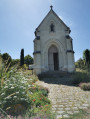
(8) Cross the D150 at the pedestrian crossing and take the cul-de-sac opposite to reach the edge of the stadium. Turn right and head towards the cemetery and its chapel on the left. At the next bend, take the grassy path on the right near the Château de Vaugirault and head towards La Gendronnière. Continue straight ahead.
(9) When you reach the vineyards, take the path on the right towards La Jolivetière. At the junction before you reach La Jolivetière, turn right and stay on the road until you reach the estate.
(10) Once past La Jolivetière, take the first path on the left. At the T-junction, take the path on the right, rejoin the road at the wayside cross and continue straight ahead.
(11) Reach La Gohardière and turn left onto the track leading down into the valley.
(12) At La Roissière, take the road on the right and then the next one on the left. Ignore the next gravel track, staying on the road round the bend, and continue to the end of the road, which gradually turns into a track.
(13) At the end, take the road on the right, then the next left towards La Rossignolerie. Then follow a footpath that crosses the small valley on the right. At the other end, continue straight ahead, keeping slightly to the right, following the path until it ends.
(14) Join the main street of La Pommeraye by turning left and then right. Take the street on the left at the next junction, then look out for a small path on the right after the stone wall. At the next T-junction, turn left to reach Rue des Mauges (E).
 Tourist office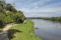
 Easy
Easy 
 Moderate
  Visorando Member