A circular walk through the bocage countryside starting from Cossé d’Anjou

Explore the outskirts of the village of Cossé d’Anjou.

Details

3525669
Creation:
Last update:
Last review:
  • Walking
    Activity: Walking
  • ↔
    Distance: 6.14 mi
  • ◔
    Average duration: 2h 55 
  • ▲
    Difficulty: Easy

  • ⚐
    Back to start: Yes
  • ↗
    Ascent: + 131 ft
  • ↘
    Descent: - 138 ft

  • ▲
    Highest point: 499 ft
  • ▼
    Lowest point: 338 ft

Photos

Description of the walk

Start near the church in Cossé d’Anjou and follow the yellow signposts.

(S/E) Walk up Rue Baron, which becomes Le Pain Bénit. Turn left at thefirst junction, opposite Le Pâtis. Continue for about 300 metres until you reach Le Plessis, then turn left at the junction.

(1) Take the path on the right. You’ll reach a place called La Joblerie; continue northwards along a small road. At the end (football pitch), turn left.

(2) Turn left onto Chemin de la Prée. The track curves to the right (west) and, after about 900 m, joins a small road.

(3) Follow the road to the right, pass the hamlet of Bellevue and carry on straight ahead. At the junction at the end of a left-hand bend, take the road on the right. Ignore a turning on the left and you’ll come to a crossroads.

(4) Head straight on into Rue de la Bretonnerie. Ignore two side streets on the left and then turn left. Cross the D756 (Moulin de la Bretonnerie) with care and continue straight on for 700 m.

(5) At the junction, take thesecond track on the right (north-east). Cross the Malaiserie stream, head uphill and you’ll reach a road (cross). Cross the road and take the road opposite.

(6) Just before thefirst houses in the hamlet of La Grande Louettière, take thesecond track on the left (east), which immediately turns right. Head south.

(7) Take thesecond track on the left (not shown on the map). At the end, follow a road to the right. Turn left when you reach a pond. At the end (waycross), turn right.

(8) Immediately afterwards, cross the D756. Cross a stream and turn right straight away (west).

(9) When you reach a cross, head left. At the Fork in the road, keep left. Carry on straight ahead, passing the turnings for Les Frêches and La Brie on your left. At the end of the road, turn left and return to the starting point (S/E).

Waypoints

  1. S/E : mi 0 - alt. 469 ft - Church of Cossé d’Anjou
  2. 1 : mi 0.58 - alt. 499 ft - Intersection
  3. 2 : mi 1.22 - alt. 417 ft - Chemin de la Prée
  4. 3 : mi 1.73 - alt. 443 ft - T-junction
  5. 4 : mi 2.52 - alt. 410 ft - La Bretonnerie
  6. 5 : mi 3.18 - alt. 367 ft - Intersection
  7. 6 : mi 3.95 - alt. 348 ft - La Grande Louettière
  8. 7 : mi 4.1 - alt. 381 ft - Intersection
  9. 8 : mi 4.63 - alt. 420 ft - Route D
  10. 9 : mi 5.27 - alt. 397 ft - Croix
  11. S/E : mi 6.14 - alt. 469 ft - Church of Cossé d’Anjou

Worth a visit

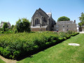
The Romanesque Church of Notre Dame:
Listed as a Historic Monument, the church, built at the end of the 11th century, has now been restored externally. The bell tower, dating from the 12th century, and its numerous external sculptures are among the building’s most remarkable features; since 2012, a restoration programme has been underway to preserve its exceptional interior wall frescoes.

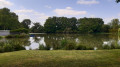
Coulvée Pond:
On the site of the Jumeau mill and its leat, a reservoir was created in 1954 to supply the town with water. Now disused, the dam reservoir has been transformed into a campsite and a pleasant leisure centre, with supervised swimming during the summer months.

The Camifolia Garden in Chemillé:
Set amidst lush natural surroundings, you’ll be able to touch, smell, taste and undoubtedly discover some fascinating plant species previously unknown to you across 3.5 hectares!
Explore the six themed gardens: the scent garden, the local crops garden, the poisonous and medicinal plants garden, the flavours garden, the fibres and colours garden, and finally the botanical garden.

Reviews and comments

4.3 / 5
Based on 3 reviews

Reliability of the description
4.3 / 5
Ease of following the route
4.7 / 5
Route interest
4 / 5
Citron10
Citron10

Overall rating : 4.3 / 5

Date of your route : Dec 22, 2025
Reliability of the description : ★★★★☆ Good
Ease of following the route : ★★★★★ Very good
Route interest : ★★★★☆ Good
Very busy route : No

A beautiful hike, but I preferred the Melay Panoramic Trail.
For both of these hikes, the GPX route to Chemin de la Prée de Melay needs to be slightly modified. Instead of avoiding the farm (by taking the path BEFORE the farm), the route encourages you to enter it.
This is especially true since, on the ground, a red and blue cross seems to indicate the wrong direction. On the other hand, all the crosses on a post about twenty metres away clearly indicate the wrong direction.
Waypoints 2 for the bocage circular starting from Cossé d'Anjou and 10 for the Melay panoramic trail should be moved 20 metres.

Machine-translated

manuuher
manuuher
• Edited:

Overall rating : 4.7 / 5

Date of your route : Nov 30, 2025
Reliability of the description : ★★★★★ Very good
Ease of following the route : ★★★★★ Very good
Route interest : ★★★★☆ Good
Very busy route : No

A pleasant hike that alternates between quiet roads, wooded paths and sunken lanes. Beautiful scenery from the higher points.
There was some roadworks in the village, but I was able to park right where the outward and return paths meet.

Machine-translated

les rand du lundi
les rand du lundi

Overall rating : 4 / 5

Date of your route : Aug 31, 2020
Reliability of the description : ★★★★☆ Good
Ease of following the route : ★★★★☆ Good
Route interest : ★★★★☆ Good
Very busy route : No

The colour of the signage is not specified.

Machine-translated

Other walks in the area

For more walks, use our search engine .

The GPS track and description are the property of this route's author. Please do not copy them without permission.