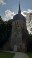
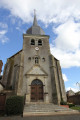
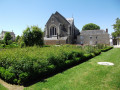
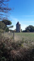
Les Quatre Croix as seen from La Salle-de-Vihiers

Discover the natural treasures around La Salle-de-Vihiers on a walk suitable for everyone.

Details

n°3527308
Creation:
Last update:
Last review:
  • Walking
    Activity: Walking
  • ↔
    Distance: 7.99 mi
  • ◔
    Average duration: 3h 55 
  • ▲
    Difficulty: Moderate

  • ⚐
    Back to start: Yes
  • ↗
    Ascent: + 299 ft
  • ↘
    Descent: - 302 ft

  • ▲
    Highest point: 633 ft
  • ▼
    Lowest point: 305 ft

Photos

Description of the walk

Starting from the forest leisure area, follow the blue signposts.

(S/E) Walk up Rue des Châtaigniers, cross Rue Sainte-Anne and continue along Rue de l’École until you cross the D756.

(1) Head left and turn right immediately; a few metres further on, you’ll find yourself facing the entrance to the Rose Giet residential complex.
Turn left, then carry on straight ahead, heading due north, for 3.5 km. Pass La Touche and La Croix Leroy. Ignore the turn-off for Les Petites Braudières and drive through the farmstead at Les Grandes Braudières.

(2) Immediately afterwards, take the first path on the right and carry on straight ahead until you reach the D171, which you should cross with care.

(3) Carry on straight ahead, passing the Croix Saunier, then continue straight on.

(4) Pass Les Tronjonnières, then continue for a few metres past the Ruisseau du Corail.

(5) Turn right onto the grassy track that runs between two fields.

(6) Turn right at Le Bail, then follow the Bodinerie. Turn left between the fields and head towards Le Paradis.

(7) Turn immediately right at the junction towards the Croix de Rocheplaud, then continue along the road. You’ll reach the entrance to the village of La Salle de Vihiers.

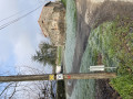
(8) Turn left, then cross the D756 at Les Coudreaux. At the foot of the pylon, take the road on the right and head for the forest recreation area (S/E).

Waypoints

  1. S/E : mi 0 - alt. 607 ft - Forest leisure area
  2. 1 : mi 0.43 - alt. 577 ft - Rose Giet Residence
  3. 2 : mi 2.76 - alt. 312 ft - Grandes Braudières
  4. 3 : mi 3.57 - alt. 328 ft - D171
  5. 4 : mi 4.62 - alt. 381 ft - Les Tronjonnières
  6. 5 : mi 4.87 - alt. 361 ft - Grassy path on the right
  7. 6 : mi 5.52 - alt. 404 ft - Lease
  8. 7 : mi 6.44 - alt. 561 ft - Paradise
  9. 8 : mi 7.26 - alt. 600 ft - At the entrance to the village, on the left
  10. S/E : mi 7.98 - alt. 604 ft - Forest leisure area

Worth a visit

The summit of Anjou:
On the Hunaudière trail, you’ll walk past the Angibourgère quarry – which is still in operation today – to reach the summit of Anjou at 216 m. You’ll be treated to a lovely view of the surrounding area. Do take a moment to look at the wooden information board!

La Tourlandry Castle:
Since 2018, the site, right in the heart of the village, has been brought back to life under the guidance of its dynamic owners. The château is a multi-purpose venue, serving as tourist accommodation, a cultural centre with a permanent exhibition on the history of science and technology from the Second Empire to the digital age, and a reception area for visitors. The grounds are also well worth exploring, with their vegetation and water-filled ditches.

The Coulvée Pond in Chemillé:
On the site of the Jumeau mill and its leat, a water reservoir was created in 1954 to supply the town. Now disused, the dam’s reservoir has made way for a campsite and a pleasant leisure centre, with supervised swimming during the summer months.

Reviews and comments

4 / 5
Based on 3 reviews

Reliability of the description
4.3 / 5
Ease of following the route
3.7 / 5
Route interest
4 / 5
christu
christu

Overall rating : 4 / 5

Date of your route : Sep 28, 2026
Reliability of the description : ★★★★☆ Good
Ease of following the route : ★★★★☆ Good
Route interest : ★★★★☆ Good
Very busy route : No

A pleasant walk

Machine-translated

manuuher
manuuher

Overall rating : 4 / 5

Date of your route : Apr 06, 2025
Reliability of the description : ★★★★★ Very good
Ease of following the route : ★★★★☆ Good
Route interest : ★★★☆☆ Average
Very busy route : No

Well, this route is a series of roads interspersed with ‘tractor tracks’ (judging by the ruts). Fortunately, the roads aren’t very busy, but they’re roads all the same. There are some lovely unobstructed views here and there at the start and end (don’t hesitate to look back), but that’s about it.
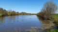
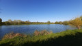
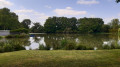
Oh yes, there is one lovely spot: the starting (and finishing) point – a lake and leisure area that you can walk round. If you’ve still got a bit of energy left at the end, it’s well worth the detour.

Machine-translated

chelde
chelde

Overall rating : 4 / 5

Date of your route : Dec 16, 2024
Reliability of the description : ★★★★☆ Good
Ease of following the route : ★★★☆☆ Average
Route interest : ★★★★★ Very good
Very busy route : No

All clear

Machine-translated

Other walks in the area

For more walks, use our search engine .

The GPS track and description are the property of this route's author. Please do not copy them without permission.