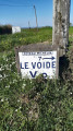
The Hunaudière Cross at the start of the trail from Tourlandry

This route will allow you to discover the rich heritage and natural beauty of La Tourlandry.

Details

3517228
Creation:
Last update:
Last review:
  • Walking
    Activity: Walking
  • ↔
    Distance: 7.32 mi
  • ◔
    Average duration: 3h 35 
  • ▲
    Difficulty: Moderate

  • ⚐
    Back to start: Yes
  • ↗
    Ascent: + 203 ft
  • ↘
    Descent: - 213 ft

  • ▲
    Highest point: 705 ft
  • ▼
    Lowest point: 505 ft
  • ⚐ Country: France
  • ⚐ City: La Tourlandry (49120)
  • ⚑
    Start/End: N 47.143126° / W 0.699955°
  • ❏
    IGN map(s): Ref. 1423SB, 1424SB, 1523SB, 1524SB
  • Hour-by-hour weather

Photos

Description of the walk

Park near the castle and the cemetery and follow the blue signposts.

(S/E) Head towards the old bell tower and take Rue de l’Abbé Vincent. Then turn left into Rue de l’Industrie.

(1) At the crossroads, head slightly to the left; immediately ignore the narrow lanes on the left leading to La Gagnerie and follow the Chemin de l’Ampintière. Cross a stream and head up to the hamlet of l’Ampintière.

(2) In the centre of the hamlet, head slightly to the left. Follow an uphill track heading west-north-west. At the end, turn right.

(3) Follow the D265 to the right. Cross the D65 (water tower) and continue straight on. The road then becomes a track; carry on eastwards.

(4) Pass through the hamlet of La Denéchère and continue north-east. At the junction at the end of the straight stretch, turn right.

(5) Cross the D133 and follow the road towards the Angibourgère quarry. Go round the quarry on the left (north). Continue straight on (east) until you reach the Hunaudière cross.

(6) Then turn right, pass through the hamlet of La Hunaudière and continue south.

(7) At the next junction, turn right. Pass the hamlet of Les Landes.

(8) Shortly afterwards, turn left towards L’Étang. The road bends to the right and, at the next Fork in the road, keep to the right to reach the hamlet of L’Étang.

(9) Between two farm buildings, veer right (west) towards La Maltrie. Pass through this hamlet.

(10) Shortly afterwards, when the road bends to the left, carry on straight ahead. Walk past a sewage treatment plant and continue westwards. Ignore a path branching off to the right, veer left and you’ll reach a road (with a wayside cross).

(11) Cross the road and continue along the path opposite. Then take thefirst path on the right to reach the hamlet of Le Chiron. At the entrance to the hamlet, take a path on the right and follow the signposts across the meadow. You’ll reach a roundabout at the southern entrance to the village.

(12) Go round the roundabout on the left and take thesecond exit, the Route de Vezins. At the junction, turn left onto the Route de Trementines. After about 150 m, turn right onto a dirt track. Pass the entrance to the castle, carry on straight ahead and head for the car park near the castle and the cemetery (S/E).

Waypoints

  1. S/E : mi 0 - alt. 607 ft - Cemetery - Château de La Tourlandry
  2. 1 : mi 0.19 - alt. 600 ft - La Gagnerie
  3. 2 : mi 0.6 - alt. 600 ft - L’Ampintière
  4. 3 : mi 1.09 - alt. 653 ft - D265 road
  5. 4 : mi 1.97 - alt. 696 ft - La Denéchère
  6. 5 : mi 2.47 - alt. 699 ft - D133 road
  7. 6 : mi 3.66 - alt. 679 ft - Hunaudière Cross
  8. 7 : mi 4.16 - alt. 630 ft - Junction
  9. 8 : mi 4.59 - alt. 653 ft - Junction
  10. 9 : mi 5.32 - alt. 522 ft - L’Étang. Towards the - Lys (rivière) - Affluent du Layon
  11. 10 : mi 5.71 - alt. 535 ft - Start of the trail
  12. 11 : mi 6.36 - alt. 600 ft - Path–road junction
  13. 12 : mi 6.83 - alt. 594 ft - Roundabout
  14. S/E : mi 7.32 - alt. 607 ft - Château de La Tourlandry

Worth a visit

La Tourlandry Castle:
Since 2018, the site, right in the heart of the village, has been brought back to life under the guidance of its dynamic owners. The château is a multi-purpose venue, serving as tourist accommodation, a cultural centre with a permanent exhibition on the history of science and technology from the Second Empire to the digital age, and a reception area for visitors. The grounds are also well worth exploring, with their vegetation and water-filled moats.

The old bell tower – Saint Vincent’s Church:
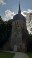
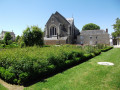
The church, built in the 19th century (pictured below) in the Byzantine Romanesque style, is the work of Father Vincent. Partially destroyed in 2010, its interior has been rebuilt in a contemporary style. You can visit it before or after your circular walk. You’ll actually start near the old bell tower (cover photo), which dates from an older building rebuilt in 1804.

The summit of the Anjou:
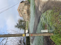
On the Hunaudière path, you’ll walk alongside the Angibourgère quarry – which is currently in operation – to reach the summit of Anjou at 216 metres. You’ll be treated to a lovely view of the surrounding area. Do take a moment to look at the wooden information board!

Reviews and comments

3.6 / 5
Based on 4 reviews

Reliability of the description
3.3 / 5
Ease of following the route
3.3 / 5
Route interest
4.3 / 5
manuuher
manuuher

Overall rating : 4.3 / 5

Date of your route : Jun 15, 2025
Reliability of the description : ★★★★★ Very good
Ease of following the route : ★★★★☆ Good
Route interest : ★★★★☆ Good
Very busy route : No

I don't really understand the previous comments, the route is perfectly well marked (in blue).
However, there is a pitfall, or rather an entirely official alternative route, between point (5) and point (6), as this alternative route is also marked in blue. I fell for it.
You need to leave the "official" route at a place called Angibourgère, continue straight ahead following the blue markings and you will arrive not far from the point (9).
The disadvantage of this alternative route is that it does not pass by the Hunaudière cross, but it does save at least 2 km.

Machine-translated

balou17
balou17

Overall rating : 2.3 / 5

Date of your route : Apr 16, 2024
Reliability of the description : ★☆☆☆☆ Very disappointing
Ease of following the route : ★☆☆☆☆ Very disappointing
Route interest : ★★★★★ Very good
Very busy route : No

No signposting, a guide riddled with inconsistencies. A very pleasant walk for the first two-thirds, with magnificent panoramic views,
which you’ll be following; the rest is a bit hilly.

Machine-translated

talie
talie

Overall rating : 4 / 5

Date of your route : Feb 19, 2023
Reliability of the description : Not used / Not applicable
Ease of following the route : ★★★★☆ Good
Route interest : ★★★★☆ Good
Very busy route : No

A lovely route through the countryside around La Tour-landry. It alternates between footpaths and small country lanes. The only problem is that the trail is signposted in the opposite direction to the route description! We decided to follow the on-the-ground signposting, which is fairly reliable. But that means the route description is now useless.

Machine-translated

HOUET
HOUET

Overall rating : 4 / 5

Date of your route : Mar 28, 2021
Reliability of the description : ★★★★☆ Good
Ease of following the route : ★★★★☆ Good
Route interest : ★★★★☆ Good
Very busy route : No

The route is very poorly signposted, particularly in the direction recommended in the guide.
Without a map, it is impossible to find the right path by relying solely on the markings

Machine-translated

Other walks in the area

For more walks, use our search engine .

The GPS track and description are the property of this route's author. Please do not copy them without permission.