Country:
 City:
City:


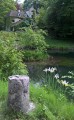
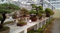
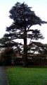
Starting point and access: Arboretum car park, 140 Avenue Jean-Jaurès.
- RER – Line B, Robinson station (terminus). Exit at the front of the train and head towards Rue Houdan. At the junction, turn left onto Rue des Quatre Chemins, then right onto Rue Anatole France. Follow this winding street to the end. Then turn left onto Rue Chateaubriand and join the route at the exit of the wooded park, just before the entrance to the arboretum. Allow for a walk of around 1 km.
- Bus – Route 194 or 294. Jean-Jaurès stop. From the roundabout, follow Avenue Jean Jaurès on the even-numbered side, heading in the direction of the increasing house numbers, and you’ll immediately come to the arboretum car park.
- By car – Take the D63 between Châtenay-Malabry and Robinson RER station, then turn onto Avenue Jean Jaurès at the roundabout.
N.B. There are a few directional and information signs along the route. The trees mentioned in the description, as landmarks or points of interest, are marked with signs on site.
(Out and back) From the car park entrance, turn right (north), follow a wide gravel path and walk past the arboretum’s reception hut. Ignore a path coming from the left (which you will take on the way back) and continue straight on towards the alder collection (sign).
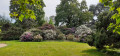
Take the next path on the left, leaving a Caucasian walnut tree on your right. Walk past a sequoia on the right-hand side. Then ignore a path heading right towards a small pond, and enter beneath the canopy of a weeping Atlas blue cedar (information board). At the fork in the road beneath the canopy (see photo), take the path on the right and walk alongside the pond on your right. Cross a small bridge on the right and step onto a small island.
(1) Turn right and begin walking round the island anti-clockwise. Two-thirds of the way round, cross the pond again via a second bridge, which is larger than the first.
As you come off the bridge, follow the path to the left and turn right immediately afterwards. Pass by the entrance to an old ice house on your right (information board). Go down a few steps and, at the bottom, turn left. At the T-junction that follows, turn right and walk alongside a small ditch a short distance away on your left.
After passing the base of a myrsine-leaved oak on your right, turn right at the T-junction. After a few metres, follow the path to the left, leaving a purple beech stump on your right.
After passing a tall hut on your left, leave the path and turn left onto a stony track which soon gives way to a wooden footbridge. Walk through the stand of alders, taking the right-hand path at each fork, alternating between sections on the boardwalk and the footpath, and at times following a fence on your right. You’ll eventually come out onto a concrete path; follow it to the right.
As you approach a sharp bend to the left, leave the path and take a concrete track on the right. Climb a few steps and, at the top, turn right. Pass through a turnstile to exit the arboretum, enter the wooded park and head towards Île Verte (signposted). At the T-junction that appears immediately, turn right. Turn left with the path and head for the first exit from the wooded park. Cross Rue Eugène Sinet (a cobbled street at this point) and enter Île Verte Park (information sign).
(2) Then turn right to go round a pond (not shown on the map), keeping it on your left. Walk slightly uphill along a cobbled path until you reach the foot of an unoccupied house. Go round the house to the right, following a paved path, and emerge into a cobbled courtyard (with a fountain on the right).
Before you have passed the end of the house, climb a flight of steps on the right, followed by a path, noting a well on the left and beehives on the right. At the top (gate opposite), head back down to the left along a paved path. Before a junction, take a paved path on the right at an acute angle and climb towards a small garden pavilion.
Walk past a greenhouse on your right. At the end, head back down and, after two flights of steps, turn left under an arbour. Halfway along, turn right and go round a fountain. At the end of the path, turn left. At the end, turn right under a leafy archway, then cross a small bamboo grove via a wooden footbridge. At the exit, turn left and head back to the park entrance.
(2) Cross Rue Eugène Sinet again and re-enter the wooded park. Begin your walk round the park in an anti-clockwise direction and ignore two exits on the right: the first onto Rue Sinet and the second towards the red-brick blocks on Rue Chateaubriand. Finally, take the third exit on the right, then turn left into Rue Chateaubriand. You’ll arrive in front of the entrance to the arboretum (on the left) and that of the Maison de Chateaubriand park (on the right).
(3) Turn left and re-enter the arboretum. Immediately after the reception hut, turn right onto a concrete path that zigzags through the meadow. At the end, follow a concrete path to the right which makes a wide circular loop to the left, skirting a sheep pen in the hollow.
At the next fork in the road (with another sheep pen opposite), turn right. Immediately ignore a path on the right and walk alongside a building on your right. Cross a drainage channel and emerge near the pond you crossed earlier.
Then turn right towards the bonsai collection (sign). On a cobbled path, walk past the base of a cedar tree on your left, turn left and walk alongside a building on your right. Pass another cedar tree, go through a gate and you’ll find a half-timbered house on your right.
When you reach this house, veer left onto a path interspersed with steps, which branches off between two wider paths running at right angles to each other. Amidst lush vegetation (including a few palm trees), at the successive forks in the road, turn right, then left and finally right to reach the tropical greenhouse. Continue for a few metres and you will find the entrance to the bonsai collection (information boards) on the left, in an open greenhouse.
N.B. The building shown on the IGN map is the tropical greenhouse; the open-air bonsai greenhouse is not shown.
On leaving the bonsai collection, turn left and walk round the open greenhouse, keeping it on your left (the path is circular and not straight as shown on the IGN map). At the fork in the road, turn right and pass a section of wall on your right. Walk alongside rows of upright flat stones (pseudo-menhirs?) on your left. At the end of the path, turn right and head back to the car park (S/E).




 Visorando Member

 Association / Club / Walk leader
 Moderate