Country:
 City:
City:



Starting point and access: Robinson station.
- RER – Line B, terminus of a section coming from Paris. Take Exit 2 onto Avenue de la Gare.
- Bus – Routes 128, 179, 192, 194, 195, 294, 395, 595.
No signposting
(S) On leaving the station, turn left onto Avenue de la Gare. Take thefirst right onto Rue des Clos-Saint-Marcel. Walk past Sceaux Cemetery and continue straight on until you reach the Coulée Verte, in a shaded area.
Red and white + green signposting
(1) There are two paths on the left: take thesecond one, which is reserved for pedestrians (thefirst is a cycle path). The tarmac path winds gently downhill. Cross a road and continue straight ahead. Cross Avenue Paul Langevin in two stages, then continue along the Coulée Verte on the concrete path on the right. At the end, take a footbridge with blue railings over the railway line. On the other side, walk down a sloping path that curves to the left.
No signposting
(2) Leave the Coulée Verte and turn left onto Rue Robert Marchand (signposted further on), passing a car park on your left. At the Stop sign, go straight on along the same street. At the traffic lights, cross Rue Antoine Petit in two stages and join Boulevard de la République. Walk up this road, lined with blocks of flats and a few fine houses.
At the junction, take thesecond left onto Rue Boris Vildé. After about fifty metres, turn right into Ruelle des Marinières, a narrow lane between two walls. Continue along a street that climbs quite steeply. At the top, turn left onto Rue de Bellevue. Pass a cul-de-sac on the left and immediately climb a flight of steps on the right. Then follow the Sentier des Richardes, between two high fences.
Yellow markings
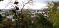
(3) At the top, take a sharp left-hand bend and follow a compacted path with a railing on the left-hand side: this is the Sentier du Panorama, from where you can enjoy, through a few gaps in the vegetation, a sweeping view to the left. When you reach an information sign, turn left. Further on, at a junction, go straight ahead onto the path closed to cyclists (chicane) and pass by the base of an aerial on the right-hand side. Then walk past a football stadium.
About 250 m after the chicane, go down a flight of steps on the left (the path continuing straight ahead is a dead end). At the bottom, turn right (the yellow arrow seems to suggest turning left, but it is intended for walkers coming from the opposite direction). Walk up Rue Jean Longuet.
No signposting
N.B. The neighbourhood you are passing through here, up to Avenue du Général de Gaulle, was still under construction in May 2021. Not all roads are shown on the map (OSM is more up to date than IGN). If diversions are in place, follow them.
(4) At the top, turn left onto Boulevard du Moulin de la Tour. Take thefirst right, at the corner of a large block of flats, onto a street with a 30 km/h speed limit. When the street bends to the left, carry straight on and take a footbridge over a body of water (this footbridge is not shown on the map). Step onto a small artificial island, turn left and take a second footbridge. Cross a road and continue straight ahead between two blocks of flats. Walk past the base of an imposing building on the left, with a grand pediment, and reach Avenue du Général de Gaulle.
Cross the avenue and the tram tracks at the traffic lights. Carry on down the street opposite and immediately ignore a side street on the left. Walk downhill alongside Clamart Cemetery.
Yellow markings
(5) Cross a wide avenue at the traffic lights and head down a street with a 30 km/h speed limit. At the bottom, cross a street in two stages, climb a path interspersed with wooden steps and enter the forest. At the top (small paved area), turn right. At the next junction (outdoor fitness equipment), continue straight ahead. Further on (sign with a map), cut across a path and, of the two paths ahead, take the one on the right (the map shows only one).
At the next junction, ignore a black arrow pointing to the right (adventure trail) and carry on straight ahead. Stay on the main path and ignore any side paths. At a crossroads, go straight ahead (follow the black arrow this time), walk alongside a small lawn on your left, then turn slightly right along the main path towards a Y-junction.
Yellow markings (intermittent)
(6) Veer to the left. At the next junction, there are three paths (the map shows only two): take the path furthest to the left, towards an outdoor fitness station with three green rings (ignore the path furthest to the right, which is more obvious and also marked in yellow). At the next junction, go straight on. You’ll come out onto a car park (with a shelter) and cross it diagonally to the left.
Cross a tarmac section, pass by a tree marked with the number 2, go through a forest gate and follow a stony path. At the end, cross at the traffic lights and, in two stages, a wide avenue. Continue along a wide path and go straight on at thefirst junction (with the Route de la Porte de Clamart on the map; the junction immediately before this on the map is either non-existent or very poorly marked). You’ll soon reach asecond junction (about 150 m after the avenue).
No signposting
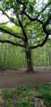
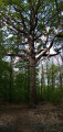
(7) You will then notice a majestic oak on the left; turn right onto a path that starts at the foot of a broken oak, broken about 4 m up. Further on, cross a wider path and continue along the path. At a slight fork in the road, keep to the right. Join a wider track, follow it to the left and you’ll soon reach a crossroads (with an oak tree in the centre; on the ground, the base of what must once have been a signpost). Turn left here and you’ll reach a tarmac road.
Cross the road (watch out for traffic) and go through the forest gate opposite. Then take the path on the right, which runs between two oak trees marked with numbers 4 and 5, respectively. At a three-way junction (oak marked no. 5), veer to the left. Stay on the main path, which winds gently downwards, and ignore any vague side paths. At a T-junction (central oak), turn left towards the next junction, which appears shortly afterwards.
(8) Turn right. Walk down a gentle slope, ignoring all side paths. At the junction at the bottom (with houses opposite), turn left. At a fork in the road, veer right, passing two benches on your left. Leave the forest on the right, going round a chicane formed by a large tree trunk lying on the ground.
Then turn left and walk down a wide path between two walls. At the bottom, follow Rue du Père Brottier to the left. Pass the gate of the Saint-Philippe Orphanage on your left, then a chapel on your right. Next, take thefirst right onto Rue Charles Infroit. Walk down the street, passing the swimming pool on your right.
(9) Immediately afterwards, turn left into Ruelle des Ménagères. Follow this path, which is relatively wide but winding. Opposite the entrance to Parc Paumier, turn right and continue downhill along the path, which narrows and ends in a flight of steps.
Then follow the road to the right and, at the junction that comes up shortly afterwards, turn right again. Ignore the side streets on the right and, at the crossroads (with a statue on the left), turn left to reach Meudon-Val Fleury station (E).
To get back home:
- RER – Line C, towards Paris, or Versailles-Château Rive Gauche, or Versailles-Chantiers and Saint-Quentin-en-Yvelines.

 Visorando Member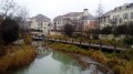
 Moderate
 Difficult