


Refine your search for walks in Kaunertal
Kaunertal walks


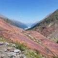
 Kaunertal Red Rock Loop
 Visorando Member
 3.68 mi
 +1,043 ft
 -1,037 ft
 2h 35
 Moderate
 Departure from Kaunertal (Bezirk Landeck)
This loop takes you through red rocks eroded by glaciers and offers beautiful views of the Kaunertal valley and the snow-capped peaks. At the end of June, rhododendrons and alpine flowers are in full bloom.
Wildes Mannle
 5.90 mi
+2,405 ft
-3,973 ft
4h 50
 Difficult
Departure from Sölden (Bezirk Imst)
Discover a superb peak overlooking the valley of the village of Vent. There are several ways to reach this peak:
- set off from Vent,
- or take the chairlift, which saves you about 400 metres of climbing.
Circular route from Obergurgl via the Nedersee and Sahnestüberl
9.46 mi
+3,251 ft
-3,274 ft
7h 10
Difficult
Departure from Sölden (Bezirk Imst)
This alpine walk climbs to 2,500 metres, with beautiful views and sections through stunning larch forests.
The route presents no particular difficulties but requires a good level of fitness.
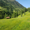
In the green valley of the Horlachbach stream - Ötzal - Tyrol
 9.54 mi
+3,291 ft
-3,274 ft
7h 15
Difficult
Departure from Umhausen (Bezirk Imst)
Starting from Niederthai, on easy tracks, you will pass through a green valley between meadows and forests, perpendicular to the Ötzal Valley. This hike can easily be shortened: the steep section at the end (about 3 km) can be skipped, but it allows you to admire the landscape from higher up.
Similarly, the hike can be extended if you wish to go as far as the Finstertaler Scharte pass. The cattle tracks are popular with cyclists in summer and skiers in winter.
Mutterberger Lake (Mutterbergersee)
 6.03 mi
+2,749 ft
-2,743 ft
5h 10
Difficult
Departure from Neustift im Stubaital (Bezirk Innsbruck-Land)
To the south-west of Innsbruck, this walk allows you to discover the treasures of the Stubai Valley, notably the stunning Mutterberger Lake. The walk begins with a challenging climb through the forest and ends by following the crystal-clear waters of the River Ruetz. On a clear day, most of the walk offers unobstructed views of the surrounding peaks.
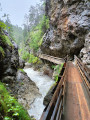
Rosengartenschlucht
 2.97 mi
+981 ft
-971 ft
2h 15
Moderate
Departure from Imst (Bezirk Imst)
This short walk starting from Imst forms a circular route above the village, climbing towards the Hoch-Imst resort through the Rosengarten Gorge – featuring footbridges overlooking the torrent – before returning via a quieter section through the forest.
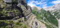
Hinteres Alpjoch circular loop
 Tourist office
 2.63 mi
+1,795 ft
-1,818 ft
2h 45
Moderate
Departure from Imst (Bezirk Imst)
A hike that’s a bit challenging in places but offers magnificent views over much of Tyrol. Please note that access to the start is via a cable car for which a fare is charged.
Algunder Waalweg
 5.44 mi
+883 ft
-899 ft
3h 15
 Easy
Departure from Algund - Lagundo (South Tyrol)
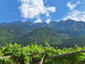
A "Waalweg" in South Tyrol is a path that runs alongside a small irrigation canal. These irrigation canals, often well hidden, were created on the hillsides to water the vineyards, orchards and fields; they operate thanks to a sophisticated system of slopes and sluice gates where each farmer can use the water for their crops.The Algund Waalweg is certainly the most iconic and offers a magnificent panorama of Algund, Meran and Dorf Tirol.
 Putzen Hütte
 7.28 mi
+2,228 ft
-2,221 ft
2.5 hrs
Moderate
Departure from Sankt Anton am Arlberg (Bezirk Landeck)
A magnificent snowshoe hike offering superb views of the Austrian Alpine massif in North Tyrol.
In particular, you will see the Hoher Riffler, which, at an altitude of 3,167 metres, is the highest point in the area.
A pleasant, easy walk along a well-groomed trail.