Iturburua in Bertiz Park

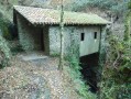
The name Iturburua translates from Basque as ‘the Spring’; it appears in numerous publications and is signposted on the ground. The route passes by a waterfall and runs alongside the remains of a charcoal kiln and shepherds’ huts.

Details

53262451
Creation:
Last update:
Last review:
  • Walking
    Activity: Walking
  • ↔
    Distance: 4.09 mi
  • ◔
    Average duration: 2h 25 
  • ▲
    Difficulty: Easy

  • ⚐
    Back to start: Yes
  • ↗
    Ascent: + 640 ft
  • ↘
    Descent: - 640 ft

  • ▲
    Highest point: 1,004 ft
  • ▼
    Lowest point: 476 ft

Description of the walk

Cross the border at Béhobie and take the N121A towards Pamplona (Iruña in Basque). Take the Oronoz-Mugairi exit and then follow the signs for Bertiz. Park in the large car park at the entrance to Bertiz Natural Park.

(S/E) Head north-west to the entrance to the nature park.

(1) Take the path branching off to the right alongside the botanical garden. Ignore a path branching off to the left and continue until you reach the reconstruction of the charcoal kiln, which has an information board.

(2) Turn left onto the path that runs alongside the charcoal kiln and winds its way up to some low walls, the remains of a structure, with an information board.
Continue along the forest track.

(3) Take the path branching off to the right, heading north-east and downhill, to the Suspiro stream (Suspiroko erreka in Basque).

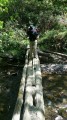
(4) Cross the footbridge and turn right, heading south-east. Continue along this track until you rejoin the charcoal kiln path.

(2) Return to the car park (S/E) via the same route you took on the way there.

Waypoints

  1. S/E : mi 0 - alt. 476 ft - Bertiz Park car park
  2. 1 : mi 0.11 - alt. 509 ft - Entrance to the Natural Park
  3. 2 : mi 0.44 - alt. 551 ft - Re-enactment of wood burning
  4. 3 : mi 1.82 - alt. 945 ft - Downhill path to the right
  5. 4 : mi 2.16 - alt. 758 ft - Footbridge
  6. S/E : mi 4.09 - alt. 476 ft - Bertiz Park car park

Notes

Drinking fountain and picnic tables next to the entrance to the Nature Park.

Worth a visit

Reviews and comments

4.7 / 5
Based on 2 reviews

Reliability of the description
4.5 / 5
Ease of following the route
4.5 / 5
Route interest
5 / 5
User 27863787

Overall rating : 4.3 / 5

Date of your route : Oct 27, 2025
Reliability of the description : ★★★★☆ Good
Ease of following the route : ★★★★☆ Good
Route interest : ★★★★★ Very good
Very busy route : No

Shaved

Machine-translated

teimahu
teimahu

Overall rating : 5 / 5

Date of your route : Jul 27, 2025
Reliability of the description : ★★★★★ Very good
Ease of following the route : ★★★★★ Very good
Route interest : ★★★★★ Very good
Very busy route : No

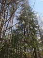
Magnificent forest, rolling hills, beautiful flora and fauna, we had a wonderful time.
The route alternates between steeply wooded areas and wider sections, with small steep paths and forest trails.
A few bridges, streams and small waterfalls punctuate the route.
Perfect for families with children aged 6 and 7.
The area also offers other trails, four in total, the longest of which is 22 km. This one is the second longest.
Spacious and free parking.
However, there is an entrance fee for Bertiz Park, which is adjacent to the forest.
A wonderful discovery, thank you.

Machine-translated

Other walks in the area

For more walks, use our search engine .

The GPS track and description are the property of this route's author. Please do not copy them without permission.