


Refine your search for walks in Hédé
Hédé walks


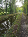
 The 11 locks and 7 mills of Hédé
 Visorando Member
 7.18 mi
 +207 ft
 -220 ft
 3h 30
 Easy
 Departure from Hédé (Ille-et-Vilaine)
Circuit exploring the 11 locks of the Canal d’Ille-et-Rance.
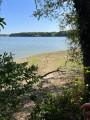
The chalets and Bazouges pond
 Association / Club / Walk leader
 7.05 mi
+141 ft
-138 ft
3h 20
 Moderate
Departure from Hédé (Ille-et-Vilaine)
A leisurely walk, partly along the towpath beside the Ille and Rance Canal and partly through the countryside around Bazouges-sous-Hédé.The eleven locks enabled barges to negotiate a 27-metre difference in height over a distance of 2 km. They are still in operation. The route is partly shaded and is well suited to morning walks on hot summer’s days.
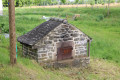
The eleven locks of Hédé-Bazouges
 6.07 mi
+102 ft
-108 ft
2h 55
Easy
Departure from Hédé (Ille-et-Vilaine)
Discovering the site of the eleven locks on the Ille-et-Rance Canal. Over a distance of 2 km, the eleven locks enable boats to negotiate a 27-metre difference in height via an astonishing ‘water staircase’ along the towpath.
Information boards are dotted along the route, providing details on biodiversity, the bocage landscape, agriculture, the canal, the architecture and community initiatives, as well as introductory guides to drawing and painting.
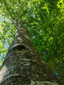
The Giants' Walk in the Bazouges Basin
 3.49 mi
+13 ft
-13 ft
1h 35
Easy
Departure from Hédé (Ille-et-Vilaine)
This short walk through the woods and along the water's edge will impress you. You will encounter giants: beech trees, oaks and a few chestnut trees over 25 to 30 metres tall. Some are grouped together, so in summer you find yourself under a cathedral of greenery.The Bazouges Basin, its wildlife, the reeds and the houses on its banks will naturally bring out your cameras. Full of freshness, this short hike is a pleasant little break on hot days from June to October.
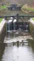
Hédé and its locks
 7.21 mi
+171 ft
-194 ft
3h 30
Moderate
Departure from Hédé (Ille-et-Vilaine)
A pleasant hike where you can enjoy the paths and small roads to Hédé.
Then follow theGR®37trail, which will take you to the canal. Return along the towpaths to the starting point.
Don't forget your camera.
The Abbesse Bridge in Tinténiac
8.23 mi
+230 ft
-233 ft
4h 00
Moderate
Departure from Tinténiac (Ille-et-Vilaine)
A walk offering a varied route between the Ille-et-Rance Canal and the countryside around Québriac and Tinténiac. A stop in the historic centre of Tinténiac is a must to appreciate its rich architectural heritage.
Towards the Petit Châtelain in Tinténiac
8.77 mi
+98 ft
-98 ft
4h 05
Moderate
Departure from Tinténiac (Ille-et-Vilaine)
Although in some places the route follows small country lanes, it takes in some very pleasant scenery and makes use of the paths that give the Breton countryside its charm. The return journey along the Ille and Rance Canal offers peace and tranquillity.
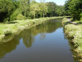
Étang des Noës in Québriac
 8.17 mi
+217 ft
-203 ft
3h 55
Moderate
Departure from Québriac (Ille-et-Vilaine)
A varied route between the peaceful Ille-et-Rance canal and the steep-sided Moulin-Neuf valley, with beautiful architectural heritage to discover along the way. A very shaded route with very little tarmac.
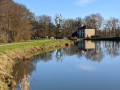
The Rigole de Boulet and La Motte aux Anglais, starting from La Plousière
 6.00 mi
+33 ft
-33 ft
2h 45
Easy
Departure from Guipel (Ille-et-Vilaine)
A short walk along the Rigole de Boulet, which feeds the upper section of the Ille and Rance Canal. Set amongst trees and following wide paths, this walk is magnificent in the colours of spring and autumn and well-shaded in summer. You’ll forget about tarmac roads the whole way.
You can extend the walk along the banks of the canal (at the Ville Morin lock) or along the Rigole de Boulet to the hamlet of Le Mée.
La Motte-Marcillé route
4.28 mi
+105 ft
-131 ft
2h 05
Easy
Departure from Gévezé (Ille-et-Vilaine)
La Motte-Marcillé is the name of a feudal motte. This short walk will introduce you to the village’s architectural and natural heritage. From the church, you’ll head out into the countryside along charming little paths.
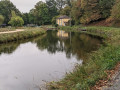
The five locks at Montreuil-sur-Ille
 5.21 mi
+69 ft
-82 ft
2h 25
Easy
Departure from Montreuil-sur-Ille (Ille-et-Vilaine)
A short walk to explore the Ille and Rance Canal, very close to its highest point and the leat that divides it. The route takes you past five locks near Montreuil-sur-Ille and along a very shaded towpath. The circular route is completed by paths and roads through the countryside.
An easy walk; very little tarmac. Shaded in summer.
Boulet Watercourse – La Motte aux Anglais Route
 6.94 mi
+85 ft
-98 ft
3h 15
Moderate
Departure from Dingé (Ille-et-Vilaine)
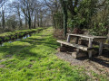
The Boulet Canal stretches for 17 km and connects Boulet Pond to the Île and Rance Canal, which it once fed.
This walk allows you to explore the area south of Dingé. The path follows the banks in the shade of two-hundred-year-old beech trees. It takes you past a few small engineering structures built as part of the watercourse.
It takes us to the Motte aux Anglais burial mound (11th century).
A very open walk in all seasons and shaded in summer.
8 km alternative route: see Information
Boulet Canal – From the Estate to Pas de l’Ille via Les Landelles
 4.87 mi
+23 ft
-23 ft
2h 15
Easy
Departure from Dingé (Ille-et-Vilaine)
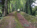
This walk follows the banks of the Rigole de Boulet to the east of Dingé. The well-maintained path runs alongside the meandering watercourse, passing wooden or iron sheet piling, and crosses several 19th-century engineering structures: siphons, aqueducts, drinking troughs…
You walk beneath a canopy of beech trees. The colours change from spring to autumn. It’s cool in summer.
La Bouhourdais in Saint-Domineuc
9.37 mi
+69 ft
-66 ft
4h 20
Moderate
Departure from Saint-Domineuc (Ille-et-Vilaine)
The route first follows the towpath along the Ille-et-Rance Canal – the very backbone of the region – which was built during the Napoleonic era (late 19th century) to link the English Channel to the Atlantic Ocean for merchant shipping, and continues through the countryside around Saint-Domineuc.
The Landehuan Canal in Dingé
 5.38 mi
+141 ft
-141 ft
2h 35
Easy
Departure from Dingé (Ille-et-Vilaine)
The Rigole de Boulet stretches for 17 km and links Étang de Boulet to the Ille and Rance Canal, which it once fed.
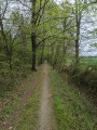
The Landéhuan Channel is a secondary channel that fed the Boulet Channel. The route follows the channel for 2 km, beneath 200-year-old beech trees.
It also passes through the hamlets of La Bouderie and Les Hauts Rochers, where you can see traditional local architecture: granite walls, arched doorways, well-tended gardens…