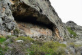
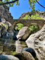
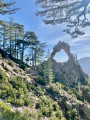
Scaffa Cave and Bocca Pastricciola

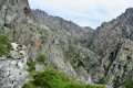
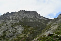
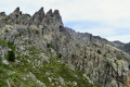
A challenging hike in the magnificent setting of the Popolasca Needles. It is, more or less, the only route that takes you into the heart of Popolasca.

Details

n°2158514
Creation:
Last update:
Last review:
  • Walking
    Activity: Walking
  • ↔
    Distance: 7.63 mi
  • ◔
    Duration according to the author: 6 hrs 
  • ▲
    Difficulty: Very difficult

  • ⚐
    Back to start: Yes
  • ↗
    Ascent: + 4,190 ft
  • ↘
    Descent: - 4,186 ft

  • ▲
    Highest point: 5,807 ft
  • ▼
    Lowest point: 2,303 ft
  • ⚐ Country: France
  • ⚐ City: Castiglione (20218)
  • ⚑
    Start/End: N 42.418248° / E 9.127537°
  • ❏
    IGN map(s): Ref. 4250OT, 4250OTR
  • Hour-by-hour weather

Photos

Description of the walk

Park at the entrance to the village of Castiglione in the visitor car park.

(S/E) Walk through the village, going down the steps, then turn right onto the local footpath known as the Terrivola path.
Continue along the path, which climbs gently, until you reach the Funtana di Paduli.

(1) At this fountain, in the chestnut grove, follow the cairns heading off to the left. The path is marked with cairns and is clearly visible, but is not signposted.
You’ll reach a first, very pretty clearing. Carry on, making a circular loop to the right and continuing to follow the cairns. You’ll reach asecond clearing.

(2) From here, tackle a steep and slippery climb.
Note: take particular care on the return journey when descending.
Further on, you’ll reach the junction with the old path.

(3) Continue the ascent, which quickly becomes less steep, to the Cabane d’Alsato.

(4) Tackle the most difficult section here, as the path narrows and is sometimes obscured by prickly broom. Continue to follow the cairns, which are fairly regular. Enter the area of the Aiguilles de Rundinaia. Continue the ascent, passing between the mountain walls. Follow the stream bed to reach the junction with the path to the Grotte de Scaffa.

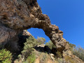
(5) Cross the stream and head up towards the cave, still on this barely visible and prickly path.
At the cave, continue to the left, climbing towards Bocca Pastricciola, which is visible in the distance, as there are no longer any cairns (no great difficulty apart from those pesky Corsican broom bushes).
Take the opportunity to admire Monte Padru.

(6) Begin the descent along the same route to return to the Castiglione car park (S/E).

Waypoints

  1. S/E : mi 0 - alt. 2,388 ft - Castiglione car park
  2. 1 : mi 1.18 - alt. 3,228 ft - Funtana di Paduli
  3. 2 : mi 1.51 - alt. 3,665 ft - Flat section no. 2
  4. 3 : mi 1.69 - alt. 3,990 ft - Junction with the IGN route
  5. 4 : mi 2.14 - alt. 4,245 ft - Alsato huts
  6. 5 : mi 3.49 - alt. 5,479 ft - Cave junction
  7. 6 : mi 3.68 - alt. 5,807 ft - Bocca Pastricciola
  8. S/E : mi 7.63 - alt. 2,388 ft - Castiglione car park

Notes

This hike is not suitable for everyone due to the difficulty of the path after the Alsato huts (4)
and the complete lack of signposting, or even an IGN route (2).

I strongly recommend wearing trousers because of the stinging broom (this will spare you the frustration of rolling stones under your feet and the broom sneakily scratching you).
Walking poles are also recommended for stability, especially on the descent, which is sometimes steep and slippery.

There are no water sources, so make sure to bring at least 2–3 litres of water per person.

The ascent took me 3 hours 30 minutes

Several possible routes from the Scaffa cave:
- Bocca a la Scaffa on the right: add 15–30 minutes to the ascent
- Bocca Pastricciola on the left: add 15–30 minutes to the ascent
- Cima a i mori: add 1 hour 30 minutes. Do not attempt this if you are not used to steep gradients on difficult terrain, as the descent is just as challenging.

Please note that the routes to Cima a i mori and Bocca Scaffa are visible on OpenStreetMap, as is the entire route from Castiglione.

Reviews and comments

4.2 / 5
Based on 2 reviews

Reliability of the description
5 / 5
Ease of following the route
3 / 5
Route interest
4.5 / 5
Reglis33
Reglis33

Overall rating : 4 / 5

Date of your route : Jun 26, 2022
Reliability of the description : ★★★★★ Very good
Ease of following the route : ★★☆☆☆ Disappointing
Route interest : ★★★★★ Very good
Very busy route : No

Unmarked route from Castiglione; trousers are essential even in summer due to the broom and scrub, which will scratch your shins if you’re hiking in shorts. Follow the cairns carefully. There are a few water sources, but they may be dry in the height of summer (Chataigneraie, along the stream in the valley between the peaks).

Machine-translated

Romain2b
Romain2b

Overall rating : 4.3 / 5

Date of your route : Feb 17, 2020
Reliability of the description : ★★★★★ Very good
Ease of following the route : ★★★★☆ Good
Route interest : ★★★★☆ Good

After the second plateau, you can follow the pink markings, but generally speaking, you should follow the cairns all the way along the walk. There should be an option to do a circular route from Castiglione via the ridges.

Machine-translated

Other walks in the area

For more walks, use our search engine .

The GPS track and description are the property of this route's author. Please do not copy them without permission.