Monte Padru from Asco

Monte Padru is an incredible summit, but one that has to be earned. The final section between (4) and (5) is reserved for experienced hikers.

Details

n°47742970
Creation:
Last update:
Last review:
  • Walking
    Activity: Walking
  • ↔
    Distance: 6.13 mi
  • ◔
    Duration according to the author: 10 hrs 
  • ▲
    Difficulty: Very difficult

  • ⚐
    Back to start: Yes
  • ↗
    Ascent: + 5,338 ft
  • ↘
    Descent: - 5,338 ft

  • ▲
    Highest point: 7,841 ft
  • ▼
    Lowest point: 2,503 ft
  • ⚐ Country: France
  • ⚐ City: Haute-Corse (2B)
  • ⚑
    Start/End: N 42.442552° / E 9.006584°
  • ❏
    IGN map(s): Ref. 4250OT, 4250OTR
  • Hour-by-hour weather

Photos

Description of the walk

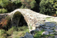
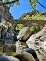
Park on the D147 after Asco, by a bridge at the junction with a track; there’s no designated car park, but there’s space for a few cars.

(S/E) Look out for the cairns marking the path on the right-hand side of the road. Please note that this path is not shown on the IGN map but is clearly marked on the OSM map.
Follow the cairns up a fairly steep slope along this path to reach the Ruisseau de Santonaccio.

(1) Cross the stream, then continue along the edge of the maquis, still following the cairns. Cross the Casanovaccia stream to reach the Entradra sheepfolds.

(2) Carry on and pass a section where you’ll need to use your hands. Continue through the maquis, still climbing steeply, to reach the clearing on the Plateau de Tula.

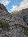
(3) Here, tackle the highly technical section leading to the summit. Cross the long scree slope on a mountainside, off the beaten track with little signposting; the very fine, slippery stones sometimes force you to take a step forward and then slide back just as far. Reach the final section below the summit.

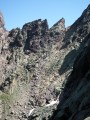
(4) Caution here: the final few metres involve climbing sections or horizontal traverses using your hands to finally reach the summit, and are only recommended for experienced hikers who are comfortable with this type of terrain.

(5) Follow the same route back as on the way up to return to the car park (S/E), taking great care on the highly technical descent over scree and rocky ground.

Waypoints

  1. S/E : mi 0 - alt. 2,503 ft - Car park at the bridge on the D147
  2. 1 : mi 0.65 - alt. 3,661 ft - First ascent
  3. 2 : mi 1.26 - alt. 4,570 ft - Bergerie de l’Entrada
  4. 3 : mi 1.88 - alt. 5,535 ft - Tula Plateau
  5. 4 : mi 2.85 - alt. 7,303 ft - Scree
  6. 5 : mi 3.02 - alt. 7,772 ft - Monte Padro
  7. S/E : mi 6.13 - alt. 2,503 ft - Car park at the bridge on the D147

Notes

(2) Bergeries de l’Entrada: there is a spring here where you can top up your water supplies. It is also a good place to camp overnight if you’re planning to reach the summit over two days.
Note: this trip took 8 hours’ walking (ascent/descent) plus a 2-hour break. Allow more time depending on your fitness level; some people complete it in 11 hours’ walking plus a 2-hour break. Set off at sunrise and ensure you’re on summer time to avoid crowds and to manage the snow.

Worth a visit

(5) The summit of Monte Padru: offers a magnificent view of the whole of Haute-Corse; it is possible to see both ends of Corsica, a view not available from all the island’s peaks.

Reviews and comments

4.7 / 5
Based on 1 review

Reliability of the description
5 / 5
Ease of following the route
5 / 5
Route interest
4 / 5
michel.arnaout
michel.arnaout

Overall rating : 4.7 / 5

Date of your route : Jul 15, 2025
Reliability of the description : ★★★★★ Very good
Ease of following the route : ★★★★★ Very good
Route interest : ★★★★☆ Good
Very busy route : No

This is a challenging hike, and the climb up the scree slope is particularly tiring, but I don't find the section between 4 and 5 to be that difficult. With sure-footedness and a little caution, there's not really any danger.

Thank you for the description!

Machine-translated

Other walks in the area

For more walks, use our search engine .

The GPS track and description are the property of this route's author. Please do not copy them without permission.