Pech Bruyer Wood in Pennautier

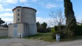
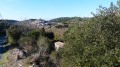
A walk through the wooded hills south of Pennautier, signposted in green by the “Pennautier Nature et Patrimoine (PNP)” association. The distance and elevation gain are minimal, making the route accessible to all. From the top (the easternmost vantage point on the route), you can see the whole of western Carcassonne (you can even make out the citadel). The route also takes you past an old, ruined bandstand.

Details

19002105
Creation:
Last update:
Last review:
  • Walking
    Activity: Walking
  • ↔
    Distance: 2.08 mi
  • ◔
    Average duration: 1h 05 
  • ▲
    Difficulty: Easy

  • ⚐
    Back to start: Yes
  • ↗
    Ascent: + 135 ft
  • ↘
    Descent: - 135 ft

  • ▲
    Highest point: 469 ft
  • ▼
    Lowest point: 322 ft
  • ⚐ Country: France
  • ⚐ City: Pennautier (11610)
  • ⚑
    Start/End: N 43.244494° / E 2.316128°
  • ❏
    IGN map(s): Ref. 2345O
  • Hour-by-hour weather

Description of the walk

Park in the municipal car park at the entrance to Pennautier.

Route signposted in green.

(S/E) Cross the bridge and walk up the roundabout on the right until you reach the town hall. Turn right onto Rue Jean Moulin. At the end of the street, turn right and walk alongside the wall of the castle grounds for about 200 metres before taking the path that climbs to the left.

(1) Walk up through the pine forest to the viewpoint, then continue along the path that leads back into the woods. Follow the green signposts to the ruined gazebo.

(2) Continue due east along the edge of the woodland, then turn left before the Chemin de Paretlongue and re-enter the woods to head back westwards. On emerging, follow the path behind the care home and the houses to reach Rue Maurice Grignon.

(3) Head straight north to the junction of the cemetery and Avenue du Portail d’Amont, then turn left to reach the village centre.

(4) When you reach the roundabout, walk through the old village via Place du Coustou, which offers a charming view of the Fresquel bridge. Cross the bridge to reach the car park (S/E).

Waypoints

  1. S/E : mi 0 - alt. 335 ft - Communal car park
  2. 1 : mi 0.47 - alt. 367 ft - Junction on the path
  3. 2 : mi 1.07 - alt. 469 ft - Ruined bandstand
  4. 3 : mi 1.66 - alt. 374 ft - Rue Maurice Grignon
  5. 4 : mi 1.88 - alt. 374 ft - Circulade
  6. S/E : mi 2.08 - alt. 335 ft - Communal car park

Reviews and comments

4.7 / 5
Based on 2 reviews

Reliability of the description
5 / 5
Ease of following the route
4.5 / 5
Route interest
4.5 / 5
Azimut71
Azimut71

Overall rating : 4.3 / 5

Date of your route : May 15, 2025
Reliability of the description : ★★★★★ Very good
Ease of following the route : ★★★★☆ Good
Route interest : ★★★★☆ Good
Very busy route : No

More illegal height restrictions limiting access to the car park to 2 metres!
Otherwise, driving in town is pleasant. Traffic is heavy on the bridge and roundabout, but non-existent in the village (streets are too narrow).

Machine-translated

Cecilia 11
Cecilia 11
• Edited:

Overall rating : 5 / 5

Date of your route : Mar 16, 2024
Reliability of the description : ★★★★★ Very good
Ease of following the route : ★★★★★ Very good
Route interest : ★★★★★ Very good
Very busy route : Yes

A very pleasant walk and very well signposted

Machine-translated

Other walks in the area

For more walks, use our search engine .

The GPS track and description are the property of this route's author. Please do not copy them without permission.