Country:

 City:
City:


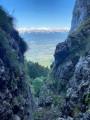
Car park near Méry church.
(S/E) From Méry church, head towards the Chemin de la Ponaise; on the right, a path runs alongside the Château de la Ponaise.
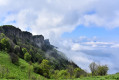
(1) At the edge of the woodland, follow the path on the left signposted ‘Le Malpassant’, and continue climbing towards the rocky outcrops until you reach them.
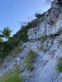
(2) Near the rocky outcrops, take care when using the cable-assisted passage before reaching the plateau. Make your way to the viewpoint on the right by following the edge of the cliff.
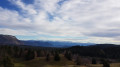
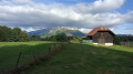
(3) Enjoy the view over the lake, then cross the meadow to the cross-country path.
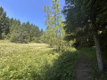
(4) Turn right and follow the path downwards as it gradually enters the woodland.
(5) At the three-way junction, turn left, then ignore the signpost for Pragondran and continue uphill. The path then veers right along the mountainside; about a hundred metres after a hairpin bend, you’ll find the start of a footpath on the right.
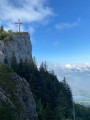
(6) Follow this path until you reach a junction of four paths in an open area, where a sign on the left points to the climb to the Croix du Nivolet.
(7) The cross is directly ahead; do not turn right, but carry on straight ahead towards the chimney.
(8) The chimney is not equipped with any cables or ladders. Proceed with caution and watch out for loose stones.
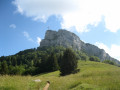
(9) Once you have passed the chimney, take the path on the right for a round trip to the Croix du Nivolet.
(10) Enjoy the view from the cross, then return to the exit of the chimney.
(9) On your return, take the path opposite and continue straight on until you reach the fork a few metres past the Chalet du Sire.
(11) Take the path on the right and head for the car park at the Sire ski resort. Turn left, cross a track and continue along the path which descends via the Pas du Croc. Join the route you took on the way there.
(4) Turn right, towards the Sentier des Torrents.
(12) A few metres after entering the woods, look out for a path branching off to the left towards the Passage de Malpassant and continue straight ahead on the track, which turns into a path.
(13) When you pass the beautiful tree, take the path on the right that leads uphill. At the top, near the bench, turn right and continue climbing.
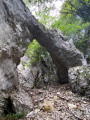
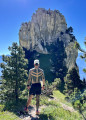
(14) At the cairn, look up and spot a tree marked in red. This is where the Pas du Rebollion begins. It’s rugged, treacherous and challenging. Pass through four sections secured with cables and a majestic natural arch.
The path is covered in trees, stones and leaves; follow the red markings to find your way.
(15) Cross the mountain pasture and the undergrowth to reach the junction signposted for Mont Revard.
(16) Continue to the left, towards Le Revard, and reach a car park by the roadside.
(17) Turn left onto the path running parallel to the road, which crosses the fields and leads to the Revard viewpoint.
(18) Enjoy the magnificent view, then turn back. Follow the same path back to the fork near the Pas du Rebollion.
(16) Turn left towards Le Pertuiset. Ignore the paths branching off to the left and continue to the edge of the cliff at the Col du Pertuset.
(19) Turn right onto the path leading downwards and return to the junction you previously passed beneath the Pas du Rebollion.
(14) Continue to the left, towards Mery. Follow the path back along the same route as on the way there until you reach the junction marked for the Malpassant Pass.
(12) Turn right and descend the Malpassant Pass via the cable-assisted section, then follow the path back along the same route you took on the way there to Mery (S/E).


 Visorando Member
 Moderate
 Difficult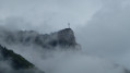
 Easy
Easy