


 Country:

 City:
City:


Park in the hamlet of Fournet: there is a small car park near the rubbish bins.
(S/E) Take the road leading into the hamlet (Rue du Lamphion) then, at the square after the bakery, follow the road on the right to reach the Sainte-Anne Chapel.
(1) Take the path that climbs steeply to your left.
(2) When you reach the embankment, turn right onto the track that enters the forest and continue to the next junction.
(3) Turn left and follow the narrow path which, after a few hundred metres, leads out onto the end of a wide track.
(4) First turn right then left, and follow the forest track, continuing towards the Grand Essart, until you reach the Chemin de Malpassant: a sign indicates that the real challenge begins!
(5) Turn right; the slope is steep for the first few metres. Follow the track as it winds steeply upwards and, just before the summit of the Malpassant, reaches a section secured with cables: this is a slightly tricky section as the track is often slippery.
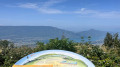
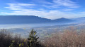
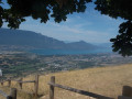
(6) Once at the summit, follow the track opposite which leads to the Chalet du Sire via the Passage du Croc. Enjoy the magnificent view over Lake Bourget and Aix-les-Bains, and perhaps a blueberry tart if the restaurant is open.
(7) Turn right onto the track leading to the paragliding take-off site.
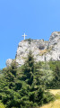
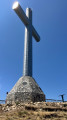
(8) Carry on towards the Chalets du Sire, pass Mont Kamuniak and continue along the track to the Croix du Nivolet: a magnificent panoramic view.
(9) Set off again along the track that descends to the left towards Pragondran and the Pas de l’Échelle.
(10) Descend these ladders and carry on until you reach a crossroads on the edge of the forest.
(11) Take the path that climbs slightly to the right.
(12) Pass the Chemin des Cheminées on your right and the Chemin du Garde straight ahead, then take the path on your left leading to Pragondran.
(13) Once in the village, follow the Chemin de l’École to the left, then the Chemin du Four to the right. At the junction, head straight on along the Chemin de l’Essarts until you reach the edge of the cliff.
(14) Pass the path on your right leading to the paragliding take-off area and turn left onto the Chemin des Crêtes. You’ll come to a junction where the signpost isn’t very visible.
(15) Turn right onto the path towards Méry and begin the steep descent along the first hairpin bends. You’ll come out at another junction.
(16) Turn right again and carry on straight ahead.
(17) Turn left at the three-way junction, ignore a path branching off to the left about a hundred metres further on, and you’ll reach the Chapelle Saint-Anne.
(1) Carry on to the left to return to the car park (S/E).
 Visorando Member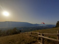
 Moderate

 Very difficult
 Easy
Easy 
