Country:

 City:
City:


You can park in Mery, near the church or in the car park close to the rubbish bins.
Then head towards the signs for the ‘Malpassant’, along the Route de la Ponaise.
(S/E) From Rue de la Ponaise, take the stony path below the Château de la Ponaise
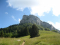
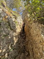
(1) At the junction, continue to the left and head towards the Malpassant. The climb is steep and leads beneath the rocky outcrop via a cable-assisted passage. Once you’ve emerged from the Malpassant onto the plateau, cross the path to head straight ahead towards the forest.
(2) Continue to the right, southwards, towards the Croix du Nivolet along a gently sloping forest track.
(3) Take the track on the left at the fork.
(4) At the junction, take the path that climbs up, due east, towards the forest, and follow it until you reach the foot of the Croix du Nivolet, keeping to the right and then to the left at the junctions.
(5) Take the unmarked gully opposite, heading due east, and then turn right towards the Croix du Nivolet.
(6) At this junction, take in the view of the Croix du Nivolet, then take the path on the left leading to the Col de la Doria.
(7) From the pass, head straight ahead along the forest track, which runs straight on, and leave the standard access path to Mont Peney by following the bear paw prints.
(8) At the junction, ignore the path leading down and head left towards the rocky outcrop. The path then becomes more challenging. First, follow the bear paw prints which lead to a semi-cave with a wooden carving. Then you must head back down and avoid the rocky spur, before climbing back up it via a faint track that winds its way through the foliage. This faint track leads to a few rocks to climb (followed by cairns), then you walk along the underside of the rocky outcrop, before reaching a ‘tricky’ section in front of a tree. This is where you climb using a rope positioned a few metres further on. Remember to look up!
(9) Here you’ll find the ‘Improbable Arch’ and the ‘Big Black Eyes’. The exit is via an exposed ledge beyond the ‘Big Black Eyes’, leading to an easy climbing move.
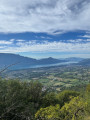
(10) This takes you onto the rocky ridge a few metres from Mont Peney, which you reach by turning right. Arrive at Mont Peney and enjoy the view over the Chambéry conurbation.
(11) Retrace your steps back to the previous junction.
(10) Carry on straight ahead to the Col de la Doria.
(7) Take the track on the left, heading due west, to the Cascade de la Doria.
(12) Head straight ahead towards the Croix du Nivolet via the ladders. At the next junction, go straight on (west). Stay on the main signposted path and ignore all side tracks.
(13) At a fork in the road, keep to the right (north-east). Pass the Pas de l’Échelle, which presents no difficulties and is well equipped.
(14) Turn left and head back towards the Croix du Nivolet.
(6) Follow the classic, well-used path northwards towards the Chalet du Sire.
(15) At a fork in the road, veer left and continue due north. Leave the Chalets du Sire on your right, turn left and arrive at a junction (elevation 1502).
(16) Continue to the right along the track and take the path on the left towards Le Sire.
(17) Take the path on the left, towards Verel. Keep to the right, then left, and straight ahead to rejoin the path you took on the way there further down on the plateau.
(2) Go straight on and follow the route back to the starting car park, in the opposite direction to the outward journey (S/E).
 Visorando Member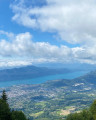

 Moderate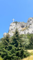
 Difficult