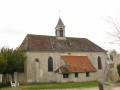
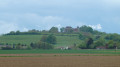
Long circular walk between Jouarre and Signy-Signets

This walk takes you through the plateaus and forests of the Pays Briard, as well as the military cemetery at Signy.

Details

n°17152402
Creation:
Last update:
Last review:
  • Walking
    Activity: Walking
  • ↔
    Distance: 10.70 mi
  • ◔
    Average duration: 5h 25 
  • ▲
    Difficulty: Moderate

  • ⚐
    Back to start: Yes
  • ↗
    Ascent: + 535 ft
  • ↘
    Descent: - 564 ft

  • ▲
    Highest point: 505 ft
  • ▼
    Lowest point: 197 ft
  • ⚐ Country: France
  • ⚐ City: Jouarre (77640)
  • ⚑
    Start/End: N 48.927666° / E 3.123594°
  • ❏
    IGN map(s): Ref. 2513OT, 2514SB
  • Hour-by-hour weather

Description of the walk

Park in the car park at the Jouarre industrial estate, Rue de la Croix de Mission, opposite the cemetery.

(S/E) On leaving the car park, turn right onto Rue de la Croix de Mission. At the junction, where the road bends to the left, turn right (west) onto a path marked in yellow. At the T-junction, turn right onto thePR® trail.

(1) At the end, turn left and walk alongside the D114p. After about a hundred metres, take a path on the left. The path turns right, heading due west. You’ll come out onto a road; follow it as it continues.

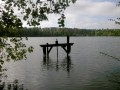
(2) Walk alongside the Étang de Péreuse, situated on the left behind the trees. You’ll arrive opposite the gate to the Château de Péreuse.

(3) Turn sharply right. At the next junction, turn left and leave thePR® route. Walk alongside a copse on your left and continue to the end of the wall surrounding the château grounds.

(4) Turn left to quickly reach the military cemetery. Return to the previous junction.

(4) Turn left to reach the village of Signy. At the junction, go straight on into Rue du Petit Montguichet. Continue to the junction with Rue de la Dhuis.

(5) At the junction of the paths, take the left-hand path along the embankment of the Dhuys underground aqueduct. Stay on this winding embankment and follow theGR®11and 14A (red and white markings). Cross the D21 with care and continue along theGR®. You will reach a road at the entrance to Signy-Signets.

(6) Cross the road and continue along the aqueduct embankment. Further on, cross another road and continue along the GR®. Enter a woodland.

(7) As you emerge from the woodland, turn right (north-north-east; leave theGR®). Walk alongside the woodland on your right and keep clear of the cultivated fields on your left. Stay on the edge of the woodland and take a series of right-hand bends. After a sharp left-hand bend, head between the fields until you reach a T-junction.

(8) Turn right. You’ll soon reach a road bordered by the Ru de la Bécotte; follow it to the right.

(9) After about 250 m, turn left onto a path at the edge of the woods. After a few bends, the path heads north-east and rejoins theGR®14Aat a riding centre. Follow it to the left for about 200 m and, at the entrance to Sammeron, you’ll reach a crossroads of paths.

(10) Leave theGR® and turn right onto a path. Join a small road and follow it as it continues. Cross the D21 with care. At the first Fork in the road, take the left-hand path (east). Cross the Ru de Péreuse.

(11) At the three-way junction (marker 73), veer right (south). The path turns left (east). Return to the tarmac road and join the D21a in the village of Sept-Sorts.

(12) Follow the road to the right. Shortly after the town hall, take thefirst street on the right. Turn left to pass in front of a wash house and continue south. Turn left, leaving a sports ground on your right, and climb the path that leads through the woods to the Dhuys aqueduct.

(13) Turn left onto theGR® path on the embankment of the underground aqueduct. Cross three small roads in succession.

(14) Cross the D402 – be careful as it’s a very busy road – pass a barrier and continue along the embankment (offthe GR®). Then go over the barrier and continue along the Dhuys for about a hundred metres. You’ll reach a T-junction.

(15) Turn right here (PR® marked in yellow). Return to the tarmac and continue straight on along Rue de Comporté. Cross the D402 again and carry on opposite along Rue Bicètre. At a cheese shop, join Rue Cécile Dumez and follow it to the right. On your left, you’ll find the car park for the Jouarre industrial estate (S/E).

Waypoints

  1. S/E : mi 0 - alt. 495 ft - Car park at the Jouarre industrial estate – Cemetery
  2. 1 : mi 0.57 - alt. 476 ft - D114p road
  3. 2 : mi 1.66 - alt. 404 ft - Étang de Péreuse
  4. 3 : mi 1.98 - alt. 449 ft - Château de Pereuse
  5. 4 : mi 2.31 - alt. 489 ft - Access to the - Cimetière militaire franco-anglais (Signy-Signets)
  6. 5 : mi 3.18 - alt. 397 ft - On the left, the embankment of the Dhuis underground aqueduct
  7. 6 : mi 4.24 - alt. 344 ft - Small road – Entrance to Signy-Signets
  8. 7 : mi 4.99 - alt. 453 ft - Edge of the woodland
  9. 8 : mi 5.86 - alt. 318 ft - T-junction
  10. 9 : mi 6.1 - alt. 259 ft - Start of the trail
  11. 10 : mi 7.02 - alt. 197 ft - Sammeron
  12. 11 : mi 7.72 - alt. 240 ft - Three-way junction after the - Ru de Péreuse
  13. 12 : mi 8.24 - alt. 308 ft - Sept-Sorts
  14. 13 : mi 8.63 - alt. 394 ft - Foy Wood
  15. 14 : mi 10.03 - alt. 404 ft - D402 road
  16. 15 : mi 10.27 - alt. 397 ft - End of Dhuys
  17. S/E : mi 10.7 - alt. 495 ft - Car park at the Jouarre industrial estate – Cemetery

Notes

Make sure you bring plenty of water and something to eat, as there are no shops along the route;
also make sure you have good walking shoes, as the route can become very slippery in wet weather.

Worth a visit

Étang de Péreuse Bird Reserve.
Signy Military Cemetery.
and (13) the Briard washhouse at Sept-Sorts and the Bois de Foy.
From to (7) and from (10 to) 15:: Dhuys Aqueduct, an underground water supply canal, and its distinctive siphons.
The views over the Marne valley.
(S/E) The crypts of Jouarre and its medieval keep.

Always be cautious and plan ahead when you're outdoors. Visorando and the author of this route cannot be held responsible for any accidents occurring on this route.

The GR® and PR® markings are the intellectual property of the Fédération Française de Randonnée Pédestre.

Reviews and comments

4.7 / 5
Based on 1 review

Reliability of the description
4 / 5
Ease of following the route
5 / 5
Route interest
5 / 5
ageep
ageep

Good evening, thank you for your comments.
The dhuis is mown in June, so it’s quite late in the season for walkers 😥
As for the TVX courts, I’ll look into it – the Dhuis is currently undergoing ongoing maintenance, but not for a tennis court!

Machine-translated

Domino V
Domino V

Overall rating : 4.7 / 5

Date of your route : Jun 04, 2023
Reliability of the description : ★★★★☆ Good
Ease of following the route : ★★★★★ Very good
Route interest : ★★★★★ Very good
Very busy route : No

The Visorando app is highly recommended. The vegetation along the Dhuis aqueduct – at least at this time of year – has not been mown. The grass is waist-high, making progress rather difficult, especially as this section of the route is quite long.
The final section (point 14). About 200 metres before point 14, it appears that a sports complex (tennis courts) has recently been built, preventing you from walking along the edge of the woodland. We had to turn back to the junction with the PR (Chemin du Passage du Roy), a quiet little road that leads directly to the finish.

Machine-translated

Other walks in the area

For more walks, use our search engine .

The GPS track and description are the property of this route's author. Please do not copy them without permission.