


 Country:

 City:
City:


Park in the car park below the town hall. There is a noticeboard listing the walks and even small laminated guides, provided by the town hall, which you can borrow for the duration of the walk (don’t forget to return them at the end!). A welcome initiative.
(S/E) Start by heading up towards the church, then, at the crossroads, head straight on towards the cemetery. At the roundabout by the cemetery, head straight on along Impasse de la Galoche. The road becomes a track suitable for vehicles. Turn right onto a road.
(1) At the ‘Give Way’ sign, cross carefully and carry on straight ahead towards ‘Merlande’ for about a hundred metres, then turn left onto the road towards ‘Abbaye de Merlande’. Continue to the first track on the right.
(2) Turn onto this track, just before a “speed bump” sign (with a yellow marker in the corner), and carry on until you reach a road.
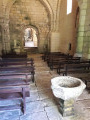
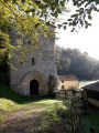
(3) Turn left, towards “Grande circular route of Merlande”, and pass the Granges de Merlande. After the descent, turn left and carry on to the Priory of Merlande, which is usually open. An information board outlines its history.
(4) From here, you can either continue along the yellow-marked circular path, taking the path that leads off above the priory, or choose a longer alternative route, indicated on the laminated guide available at the start, which, in our view, is well worth the effort!
To do this, return to the road you arrived on and follow it to the right, following the red and whiteGR® markings towards Merlande Nord.
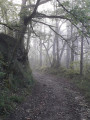
(5) Soon, take a path on the right (GR® markings), which becomes a track running alongside a meadow. Pass a path on your right that climbs into the woods (White Cross and Red Cross), and continue along the track that follows the fence to reach a tarmac road.
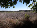
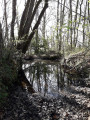
(6) Carry on straight ahead along a tarmac lane leading to the Domaine des Landes. The ‘private property’ sign applies only to the lawn. Go round the pond, then continue along a path, first through the meadows, then into the woods. At a three-way junction, turn right to come straight out onto a tarmac road, which you follow to the right.
(7) Take the path on the right, just after a lovely viewpoint over the Domaine des Landes (red mark on a tree). Join a road and follow it to the left for about 100 m.
(8) Turn onto the road that veers slightly to the right. At the next junction, take the road that climbs to the left. You’ll come across the yellow markers for the circular loop that you left behind at Merlande.
(9) Turn right after the first house (Rue de Baucherie Haute, yellow marker). At the next junction, turn right.
(10) Leave the road on your left and take the path opposite (yellow marker) which, after a descent through the woods, joins the road you have just left and which you follow to the right. Shortly afterwards, turn right onto Rue du Prieuré de Merlande, until you reach the start of a path on the left.
(11) Turn onto this path which climbs (yellow marker on the corner). At the crossroads, turn right, then turn right again opposite a shed (yellow andGR® markers). Walk round the hamlet of Fuselier.
(12) Leave the main path (GR®) to the right and take a path leading off opposite (bench on the corner and a White Cross and Red Cross on a tree). Turn left, towards “bourg de La Chapelle” (you can go straight on to reach the crossroads at Les Granges de Merlande and return more quickly to the starting point). Pass a path on the left, then another on the right, and continue straight on until you reach the road. Cross the D1 with care, then continue left for about a hundred metres (beware of heavy traffic).
(13) Turn right onto a path that runs between the houses. At the crossroads, turn right and follow the road to a pond. Go round it via the road on the right.
(14) Shortly after the “Blanchou” sign, take a path on the left (yellow marker in the corner). Turn right at the next crossroads and cut across a road.
(15) Carry on straight ahead and, at the Fork in the road shortly afterwards, turn right towards “bourg de La Chapelle Gonaguet”, and continue to the town hall car park, remembering to return the laminated guide (S/E).



 Visorando Member

 Easy
Easy 

 Difficult
