Country:

 City:
City:


Head to Puy-de-Fourches, between Château l’Évêque and Brantôme, just above the D939, which runs from Périgueux to Angoulême. Park in front of the town hall next to the Salle Polyvalente.
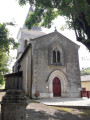
(S/E) Facing the town hall, head to the right, go round the Salle Polyvalente and then follow the small road on the left leading to the church. At the Stop sign, turn right and continue to the next Stop sign.
(1) Cross the road to join the path opposite. At the junction with a tarmac road, carry on straight ahead.
(3) At the junction with a wider track, carry on straight ahead again, leaving a less distinct track on your right. At the farm buildings at Les Terres Vieilles, carry on straight ahead. After the last building and a limestone esplanade, take the track that starts opposite. At Bost Vieux, carry on straight ahead along the track which runs alongside a fence and leads to a junction at a bridge situated right next to the Route d’Angoulême.
(4) Take a sharp right-hand bend to follow the path which leads into the woods, then curves to the left before coming out onto a road.
(5) Turn right, then shortly afterwards left into Impasse du Mas. Pass Impasse d’Incombas on your left and continue towards Le Mas. Walk through the hamlet.
(6) Shortly after the hamlet, the road bends to the left. Take the path that starts straight ahead and then veers to the right, following the edge of the woods until you reach the junction with a wider track.
(7) Pass the junction with the route to Eyvirat and Agonac on your left, and turn right towards Puy de Fourches and Château l’Évêque.
(8) At an electricity pole, take the path that starts on the right and heads towards the edge of the woodland. Follow the edge of the woodland until you reach a junction with a road. Continue along the path opposite. At the junction with the next road, turn left.
(9) Immediately afterwards, leave the road and take the path that starts on the left: be careful, it’s easy to miss it!
(10) At the junction with a larger path, carry straight on.
(10) At the road, turn left, then immediately afterwards, turn right. Then take the street that goes uphill to the right to return to the starting car park (S/E).
 Visorando Member
 Easy
Easy 
 Association / Club / Walk leader