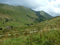
Aiguille Verte and Lac de Lessy

A circular walk starting and finishing at the ski resort of Chinaillon; between Le Grand-Bornand and the Col de la Colombiere. A varied and interesting walk with great scenery, wildlife and options to take in Roc des Tours.

Details

2037179
Creation:
Last update:
Last review:
  • Walking
    Activity: Walking
  • ↔
    Distance: 7.87 mi
  • ◔
    Average duration: 6h 40 
  • ▲
    Difficulty: Moderate

  • ⚐
    Back to start: Yes
  • ↗
    Ascent: + 3,488 ft
  • ↘
    Descent: - 3,504 ft

  • ▲
    Highest point: 6,690 ft
  • ▼
    Lowest point: 4,170 ft

Photos

Description of the walk

(S) From the parking at Chinaillon, cross the road and take the steps up and towards a resort complex. It looks like you are entering a private area but it is signposted and it is OK to follow the path.

It will take you through the complex of buildings and into a lightly wooded area. Just before a ravine the track turns back on itself and ascends through more light woodland before emerging onto the pasture beside a track.

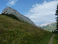
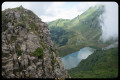
(1) Turn left and take the path beside the track, they run parallel but then the track veers off to the right and your path goes straight on over the top of the small ravine mentioned above. Follow the right path with open alpine pastures above you. It will turn uphill and ascend more steeply, turning to avoid rocky outcrops and zig-zagging on the steeper sections before ascending with crags below you on the left to a broad ridge. You may see Chamois on this part of the walk.

(2) At this point, the path split. Take the right-hand path up the prominent grassy ridge. There are a few paths leading off on the right that contour beneath the Aiguille Verte but keep going to a signpost.

(3) Take the path on the left up to the top of the Aiguille Verte

(4) Enjoy the views and then descend the same way back to the signpost. Take one of the traverse paths on your left across the hillside to a prominent col.

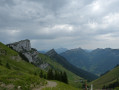
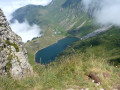
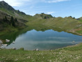
(5) Descend to the left at first and then take the right-hand path when it splits. This will take you around the lake, crossing a boulder-strewn scree slope to the Chalets de Lessy. Here you can buy light refreshments or eat you sandwiches beside the lake.

(6) From the chalets, take the right track which is continuing on the north side of the lake and makes a steady uphill ascent to Col de la Forclaz.

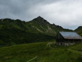
(7) At Col de la Forclaz, you may see birds of prey soaring the slopes and there are some good views down the valley and over to the Plateau des Glieres. Take the right track downhill to the Chalets de Mayse.

(8) From the Chalets de Mayse, turn left and start to ascend again with the large cliffs of the Roc des Tours above you on the left. The path climbs steadily over pasture before entering woodland. It turns abruptly left again and makes the final ascent to the col at Le Planay.

(9) Descend through woodland to a junction with a track.

(10) Take the left-hand track which borders woodland and fields until it joins a better track.

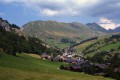
(11) Turn left and follow the track in its entirety, contouring the hillside and descending back to Chinaillon and the parking.

Waypoints

  1. S/E : mi 0 - alt. 4,193 ft - Chinaillon parking
  2. 1 : mi 0.32 - alt. 4,573 ft
  3. 2 : mi 2.11 - alt. 6,171 ft
  4. 3 : mi 2.28 - alt. 6,417 ft
  5. 4 : mi 2.41 - alt. 6,690 ft
  6. 5 : mi 2.94 - alt. 6,237 ft
  7. 6 : mi 3.54 - alt. 5,784 ft - Chalets de Lessy - Chalets de Lessy
  8. 7 : mi 4.09 - alt. 6,047 ft - Col de la Forclaz - Col de la Forclaz (Haute-Savoie)
  9. 8 : mi 4.96 - alt. 4,928 ft - Chalets de Mayse - Chalets de Mayse
  10. 9 : mi 5.69 - alt. 5,515 ft - Le Planay - Le Planay
  11. 10 : mi 6.21 - alt. 4,777 ft - La Culaz - La Culaz
  12. 11 : mi 6.65 - alt. 4,423 ft
  13. S/E : mi 7.87 - alt. 4,193 ft - Chinaillon parking

Notes

A well-signposted walk. The going underfoot can be rocky in places and I would recommend walking boots or good approach shoes.

Refreshments are available at two locations. We only tested those at Chalets de Lessy which were reasonably priced for drinks.

Reviews and comments

4.7 / 5
Based on 1 review

Reliability of the description
5 / 5
Ease of following the route
4 / 5
Route interest
5 / 5
Cocota
Cocota

Overall rating : 4.7 / 5

Date of your route : Dec 01, 2025
Reliability of the description : ★★★★★ Very good
Ease of following the route : ★★★★☆ Good
Route interest : ★★★★★ Very good
Very busy route : Yes

We did this hike on 9 November and met lots of people along the way, which was unusual for that time of year.
Be careful, the starting point is poorly marked...
We had a hard time finding the stairs that go up into the buildings to reach the trail.
A very beautiful hike with quite a bit of elevation gain, especially to climb up to the Aiguille Verte and then to points 8 and 9, before descending back to Le Grand Bornand with a steep slope of about 200 metres of elevation gain and a short, fairly steep section before entering the forest, where you have to use your hands to climb over the rocks... but it's not too difficult...
It can be tricky with children.
Also, be careful before point 11, you have to follow a trail to the right. If you see a "dead end" sign, you've missed the path, so go back down a few metres!

Machine-translated

Other walks in the area

For more walks, use our search engine .

The GPS track and description are the property of this route's author. Please do not copy them without permission.