Country:

 City:
City:


On the D942 road, about 2 km after Barret-sur-Méouge, turn right onto the D124a towards Saint-Pierre-Avez, which crosses the Méouge, then park a few hundred metres further on in one of the two hairpin bends.
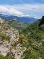
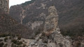
(S/E) Take the path marked with the Route de Saint-Pierre sign. Start with a slight and short descent to cross the Torrent d'Ourse via stepping stones. Climb up to a ridge and enjoy a wonderful view of the start of the gorges. You will easily reach the Gourgourian signpost crossroads.
(1): Turn right towards Saint-Pierre-Avez, then quickly take the track on the left. Leave theGRP® du Tour du Buëch and its red and yellow markings here. Begin a fairly steep climb, following the yellow markings to reach the hamlet of Rabiouchourin.
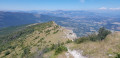
(2) Turn left towards Antonaves, still following the yellow markings. Continue climbing through the forest, avoiding the shortcuts, until you reach an old wooden sign marked 372. Continue to the right towards Pic Saint-Cyr. After a final short climb, you will reach the highest point at a place called Ourse.
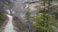
(3) Begin a very pleasant descent through the woods on a pleasant path to the Prairie marker. Enjoy the view here.
(4) Continue straight ahead to reach asecond signpost, La Prairie. Take the path on the left, which is initially slightly uphill. Continue downhill to the right towards the gorges, which offer superb views as you wind your way down.
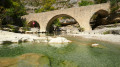
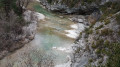
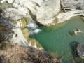
You will arrive at the banks of the Méouge.
(5) Make a quick return trip to admire the magnificent Romanesque bridge. Return to the path, still marked in yellow, and join theGRP® du Tour du Buëch. Follow it to the right along the gorges. Continue along the path that follows the gorges on the right bank. Reach a footbridge at the picnic area.
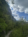
(6) Here you can make a short return trip on the footbridge. Then rejoin theGRP® and, via a series of ascents and descents along the gorges, reach La Roche Coupée, a rocky outcrop offering superb views.
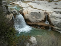
(7) Continue along this beautiful rollercoaster trail, which at one point comes close to the water. Then cross short sections equipped with cables, but these are easy to navigate and allow you to cross the ravines to the menhir-shaped Rocher du Château.
(8) Finish with a final climb to Gourgouriou, the crossroads you passed on the way there.
(1) Leave theGRP® here and continue to the right, following the yellow markings, taking the opposite route to the outward journey to return to the car park at the hairpin bends on the D124a (S/E).



 Visorando Member
 Difficult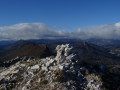
 Very difficult