


Refine your search for walks in Gentioux-Pigerolles
Gentioux-Pigerolles walks


 Pallier route
 Tourist office
 5.89 mi
 +525 ft
 -499 ft
 3h 10
3h 10
 Moderate
 Departure from Gentioux-Pigerolles (Creuse)
At the foot of the highest peaks of the Plateau de Millevaches, set off to discover the small village
of Pallier.
Route du Lac de Faux
 3.97 mi
+102 ft
-102 ft
1h 55
3.97 mi
+102 ft
-102 ft
1h 55
 Easy
Departure from Faux-la-Montagne (Creuse)
Easy
Departure from Faux-la-Montagne (Creuse)
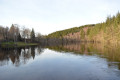
Faux-la-Montagne owes its name to its high altitude (over 700 metres above sea level) on the western edge of the Millevaches plateau. Around Lake Faux, beech and oak trees mingle with conifers, occupying what was still sheep pasture in the 19th century.
Montfranc Circular Loop
 Visorando Member
 4.41 mi
+285 ft
-305 ft
2h 15
Easy
Departure from La Nouaille (Creuse)
4.41 mi
+285 ft
-305 ft
2h 15
Easy
Departure from La Nouaille (Creuse)
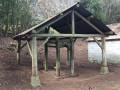
This lovely walk takes you to the southernmost village in the commune of La Nouaille (Creuse).Walkers will discover a ‘travail’ (a workshop used for shoeing cattle) that has been completely cleared. The walk alternates between passages through conifer plantations and beautiful open spaces. You can discover other walks in the commune of La Nouaille
The unmissable little Roman bridge at Senoueix
 10.73 mi
+512 ft
-515 ft
5h 25
Moderate
Departure from Saint-Marc-à-Loubaud (Creuse)
10.73 mi
+512 ft
-515 ft
5h 25
Moderate
Departure from Saint-Marc-à-Loubaud (Creuse)
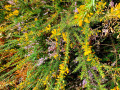
This tiny Roman bridge features on every postcard of the Creuse’s remarkable sites! The circular route therefore takes you there after a detour via Lake Lavaud Gelade, then back through meadows and young woodland. Although the walk begins with a short stretch of road (with little traffic), it then mainly follows paths and tracks lined with heather in bloom in autumn.
Tour of Lake Vaud-Gelade
 14.66 mi
+1,142 ft
-1,142 ft
7h 45
14.66 mi
+1,142 ft
-1,142 ft
7h 45
 Difficult
Departure from Saint-Marc-à-Loubaud (Creuse)
Difficult
Departure from Saint-Marc-à-Loubaud (Creuse)
Located on the Millevaches plateau, Lac de la Vaud-Gelade is an artificial lake, created between 1940 and 1944, with a surface area of 300 hectares. It is fed by the Thaurion and several streams.
It is used for electricity production. Its earthen dam with a granulite foundation holds 21 million cubic metres of water, which feeds Lac de Vassivière, depending on its water needs, through a 4km-long underground tunnel.
Circular route via the Puy de la Croix and Royère
8.17 mi
+663 ft
-653 ft
4h 20
Moderate
Departure from Royère-de-Vassivière (Creuse)
A walk starting from Lake Vassivière offering a variety of landscapes: the lake shore, heathland with heather or ferns, mixed woodland, pastures with Limousin cattle, peat bogs, and numerous ponds.
Le Puy de la Croix
1.39 mi
+194 ft
-194 ft
0h 50
Easy
Departure from Royère-de-Vassivière (Creuse)
A pleasant walk on the Puy de la Croix, which overlooks Lake Vassivière, along beautiful paths through heathland covered in heather and gorse (which flower in late summer), passing by the Puy de la Croix viewpoint and then along the lake’s shore.
Nergout - Vassivière Dam
 11.57 mi
+666 ft
-735 ft
5h 55
Difficult
Departure from Beaumont-du-Lac (Haute-Vienne)
11.57 mi
+666 ft
-735 ft
5h 55
Difficult
Departure from Beaumont-du-Lac (Haute-Vienne)
Nature and Land Art for this second stage, around the 5th largest artificial lake in France!
Route des 7 Peux
 7.98 mi
+538 ft
-538 ft
4h 10
Moderate
Departure from Royère-de-Vassivière (Creuse)
7.98 mi
+538 ft
-538 ft
4h 10
Moderate
Departure from Royère-de-Vassivière (Creuse)
The village of Royère-de-Vassivière was established on a strategic pass on the Millevaches plateau, at the crossing point of a prehistoric ridge path. The ridge paths (or pouges) allowed people to travel long distances. They favoured the granite peaks of the rounded hills, called Puy or Peux, and avoided the damp, peaty valley bottoms that only cattle frequented.
The Thaurion Valley
 8.57 mi
+692 ft
-676 ft
4h 35
Moderate
Departure from Royère-de-Vassivière (Creuse)
8.57 mi
+692 ft
-676 ft
4h 35
Moderate
Departure from Royère-de-Vassivière (Creuse)
The Rigole du Diable is a picturesque site situated in the upper Thaurion valley. This site is a Natura 2000 site and is listed in the ZNIEFF inventory. The Rigole du Diable and its tributary are strewn with pebbles and boulders. Here you’ll find the unusual Rocher du Diable near the old Planchette mill. Legendary stones are common in Limousin. These strangely shaped boulders, formed by the erosion of exposed granite, have often captured the imagination of local people.
The Chassagnas Peninsula on Lake Vassivière
 4.49 mi
+364 ft
-371 ft
2h 25
Easy
Departure from Royère-de-Vassivière (Creuse)
4.49 mi
+364 ft
-371 ft
2h 25
Easy
Departure from Royère-de-Vassivière (Creuse)
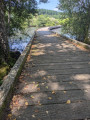
Chassagnas, of Latin origin, Cassania or Gallic Cassanus, refers to the oak tree. Chassagnas consists of a wooded slope down to the edge of Lake Vassivière and a partially cleared summit offering a 180° view of the lake.The Chassagnas peninsula, jutting out into the heart of Lake Vassivière, forms the boundary between Creuse and Haute-Vienne. Together with its twin, the Puy du Rocher, which overlooks Vauveix, it acts as a barrier between the lake's two main bays.
Masgrangeas Wood and Chassagnas Peninsula
7.97 mi
+761 ft
-781 ft
4h 20
Moderate
Departure from Royère-de-Vassivière (Creuse)
A walk on the Millevaches Plateau, mainly through woodland, passing through the pretty hamlet of Masgrangeas. After a circular route through the Bois de la Roche, the route continues with a circular route around the Chassagnas Peninsula, along Lake Vassivière, then a walk around the small Île de Vauveix.
Route des Tourbières - Vassivière
 8.83 mi
+837 ft
-843 ft
4h 45
Moderate
Departure from Royère-de-Vassivière (Creuse)
8.83 mi
+837 ft
-843 ft
4h 45
Moderate
Departure from Royère-de-Vassivière (Creuse)
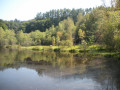
Peat bogs develop in granite basins called alveoli, where the acidic, poor soil provides favourable conditions for their growth. These fragile environments are home to a specific flora composed of very particular primitive plants: sphagnum mosses. The different stages are visible here: low marshes covered with quaking bogs, active raised bogs, and peat heaths bordered by willows and birches.
the Devil’s Channel
 1.82 mi
+246 ft
-236 ft
1h 05
Easy
Departure from Royère-de-Vassivière (Creuse)
1.82 mi
+246 ft
-236 ft
1h 05
Easy
Departure from Royère-de-Vassivière (Creuse)
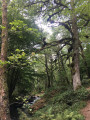
A fairly family-friendly hike. The outward journey is downhill along a bucolic stream, through a lush, almost tropical deciduous forest. The return is more austere, through a mysterious, moss-covered coniferous forest.
Rigole du Diable and the Mazure moors
7.40 mi
+558 ft
-548 ft
3h 55
Moderate
Departure from Royère-de-Vassivière (Creuse)
A very beautiful walk combining three circular loops and offering a wide variety of landscapes: gorges and rocky outcrops along the Rigole du Diable, followed by peat bogs, superb heather moors, wet meadows, and undergrowth of fir or deciduous trees of various species.
More walks in Gentioux-Pigerolles
Select a point of interest below: