


 Country:

 City:
City:


Park at Quai Edgard Quinet, near the Tourist Office and the mountain bike centre.
(S/E) Facing the Meuse, turn right and follow the quay. Walk past the Spanish House (Museum), continue towards the Fumay Bridge and walk under it.
(2) Immediately afterwards, turn right onto Rue des Remparts, then turn right again to reach the bridge deck, and cross the bridge: enjoy the view overlooking the Meuse.
(3) Once on the other bank, turn left and walk through the hamlet of Falières. Follow the path towards the information boards, where you’ll find some reading material on local history relating to the banks of the Meuse, the ‘Rivage d’en Bas’ and ‘Terre en Mouvement’, an interpretation of the geological landscape. You’ll reach the picnic area overlooking the Meuse.
(4) Head up to the right, stay on the route – marked in yellow on the trees – and follow the path that runs high above the Route de Falières.
(5) At the fork in the road, keep left, ignoring the path that climbs to the right – this will be your return route.
(7) Carry on straight ahead, avoiding the path leading down to the left towards the road. Follow the path which slopes to the right and runs alongside the Ruisseau de Fallière. You’ll reach a viewpoint overlooking the Revin valley.
(7) Continue along the path, which draws closer to the stream and leads to a junction shaped like an inverted Y.
(8) Turn right at the hairpin bend, then take a wide left-hand bend before coming out onto a forest track.
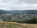
(9) Follow it to the right as far as the paragliding launch site, where, depending on the weather, you might be lucky enough to see a few paragliders taking off: a remarkable view over Revin.
(10) Take the ridge path which starts to the left of the mast (a wind vane used by paragliders to gauge wind direction), and follow it alongside the forest track. You’ll come to a junction
(11) Leave the path by heading down the Route Forestière du Bois Bryas to the right.
(12) Turn sharply right, staying on the forest track.
(13) Leave the forest track on the right to follow a path that descends towards the Meuse. You’ll reach a junction.
(14) Turn left and rejoin the route you took on the way there.
(5) Carry on straight ahead and follow this path in the opposite direction to return to the car park at Quai Edgard Quinet (S/E).
 Visorando Member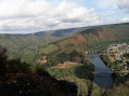

 Very difficult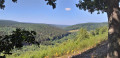
 Easy
Easy  Association / Club / Walk leader
 Difficult
