


Refine your search for walks in Fort Saint-Roch (Sospel)
Fort Saint-Roch (Sospel) walks


 Panoramas and Forts in the South-West of Sospel
 Visorando Member
 11.43 mi
 +3,182 ft
 -3,196 ft
 8h 00
8h 00
 Difficult
 Departure from Sospel (Alpes-Maritimes)
A route with many facets. The medieval history of Sospel, the magnificent panorama from the Tête de Nervina stretching across the Bévéra Valley, the paved slanting streets, and the forts dating from the last war will delight curious hikers.
Walks near Fort Saint-Roch (Sospel)
Sospel - Menton
 10.24 mi
+3,691 ft
-4,767 ft
7h 55
Difficult
Departure from Sospel (Alpes-Maritimes)
10.24 mi
+3,691 ft
-4,767 ft
7h 55
Difficult
Departure from Sospel (Alpes-Maritimes)
This is the last stage ofthe GR® 52. It is certainly not the highest in altitude, but it is difficult due to its distance and the passage of certain passes with steep ascents and descents. The Mediterranean views are splendid, especially those from the Col du Razet and Col du Berceau, which rises to 1,100 metres above the town of Menton, the end point of theGR®. You walk along the Italian border throughout the route.
Be warned, in summer this stage is very challenging due to the heat, especially the descent from the Col du Berceau.
Sospel – Menton
 12.54 mi
+3,671 ft
-4,816 ft
7 hrs
12.54 mi
+3,671 ft
-4,816 ft
7 hrs
 Very difficult
Departure from Sospel (Alpes-Maritimes)
Very difficult
Departure from Sospel (Alpes-Maritimes)
This route leaves theGR® 52 to head for Grammondo and cross over to the Italian side.
On the descent, there are almost constant views of the sea, ending in the very pretty town of Grimaldi.
From Castillon-village to Monti via Mont Mulacié
 9.66 mi
+3,589 ft
-4,764 ft
7h 35
Difficult
Departure from Castillon (Alpes-Maritimes)
9.66 mi
+3,589 ft
-4,764 ft
7h 35
Difficult
Departure from Castillon (Alpes-Maritimes)
A cross-country hike through the Menton region along a little-used route, passing through wild and unspoilt areas where traces of human habitation still remain.
The route also provides access to the summit of Mont Mulacié, the second-highest peak in the Menton region, which is very little visited as it lies off the official marked trails. The view from this summit is interesting, although less spectacular than that from its neighbour, the Grammondo.
Torri Superiore - Ventimiglia
 9.70 mi
+1,657 ft
-1,929 ft
5h 55
9.70 mi
+1,657 ft
-1,929 ft
5h 55
 Moderate
Departure from Ventimiglia (Imperia)
Moderate
Departure from Ventimiglia (Imperia)
This fifth stage will take you from Torri Superiore to the Mediterranean coast at Ventimiglia. Upon arriving in Bevera, you will find yourself at the confluence of the Bévera and Roya rivers. A final climb through the Ventimiglia hinterland will lead you to the Riviera dei Fiori and the town of Ventimiglia.
Coastline from Menton to Ventimiglia
 6.26 mi
+719 ft
-728 ft
3h 30
Moderate
Departure from Menton (Alpes-Maritimes)
6.26 mi
+719 ft
-728 ft
3h 30
Moderate
Departure from Menton (Alpes-Maritimes)
A beautiful seaside hike with some unusual sights to discover. While the coastal road from Menton to Ventimiglia is well known, the area below this road offers some little-known geographical and historical curiosities.
Rochetta Nervina - Torri Superiore
 10.60 mi
+3,789 ft
-4,213 ft
8h 10
Very difficult
Departure from Rocchetta Nervina (Imperia)
10.60 mi
+3,789 ft
-4,213 ft
8h 10
Very difficult
Departure from Rocchetta Nervina (Imperia)
This fourth stage will take you from Rochetta Nervina to Torri Superiore. Along the way, you’ll visit the picturesque village of Airole, which overlooks the Roya. You’ll stop off at the eco-village of Torri Superiore. This medieval village, which lay in ruins in the 1990s, has been entirely rebuilt by volunteers.
La Baisse de Camp d'Argent – Sospel
 13.53 mi
+1,670 ft
-6,289 ft
10 hrs
Very difficult
Departure from La Bollène-Vésubie (Alpes-Maritimes)
13.53 mi
+1,670 ft
-6,289 ft
10 hrs
Very difficult
Departure from La Bollène-Vésubie (Alpes-Maritimes)
The sixth stage ofthe GR®52, where the landscapes change dramatically. Due to its length and significant descent of nearly 2,000 metres, the stage is very difficult. The descent to Sospel, which makes up two-thirds of the route, puts a real strain on the knees and ankles. Please note, it gets very hot in summer on this section.
Saorge – Breil-sur-Roya
 5.75 mi
+2,343 ft
-3,009 ft
4h 40
Moderate
Departure from Saorge (Alpes-Maritimes)
5.75 mi
+2,343 ft
-3,009 ft
4h 40
Moderate
Departure from Saorge (Alpes-Maritimes)
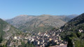
This is the Valléen trail, an easy route along the Roya.
Both towns are served by the ‘Train des Merveilles’. From Breil to Sospel: one stop (15 mins).
From Utelle to Nice Ville railway station
 21.50 mi
+3,806 ft
-6,385 ft
13h 10
Difficult
Departure from Utelle (Alpes-Maritimes)
21.50 mi
+3,806 ft
-6,385 ft
13h 10
Difficult
Departure from Utelle (Alpes-Maritimes)
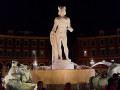
This twenty-first stage, once you have crossed the Vésubie, takes place in the Nice Pre-Alps and brings the GTA (Grande Traversée des Alpes) to a close by the sea. From the Place de la Fontaine in Utelle, the GR®5 heads west, then south, crossing a few small valleys to reach the hamlet of Cros d’Utelle. It crosses the Vésubie valley, climbs the opposite slope after the town of Levens, ascends through woodland to Colla Partida, passes beneath Mont Cima and descends to the beautiful circular fortified village of Aspremont. The path climbs the western flank of Mont Chauve d’Aspremont without reaching the summit. It descends the Crête de Graus until it reaches Château Renard and then La Bauma. The path enters a valley, which it follows eastwards, then due south towards La Fontaine Sainte, and crosses the bridge over the Autoroute de la Provençale. It enters the city of Nice, which it crosses from north to south to reach Nice Ville railway station.