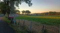
Soulouze Forest

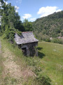
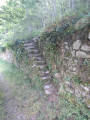
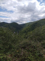
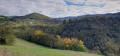
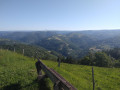
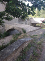
A walk through the Soulouze communal forest (sessile oaks, Corsican pines, chestnut trees, Atlas cedars, red oaks...) passing through the abandoned hamlet of Fonfrège. You’ll discover local architecture such as fish-scale slate roofs and dry-stone walls with their vine-covered stairways. A pleasant route along the left bank of the Lot with numerous views over the valley and the village of Entraygues-sur-Truyère.

Details

97455956
Creation:
Last update:
Last review:
  • Walking
    Activity: Walking
  • ↔
    Distance: 4.64 mi
  • ◔
    Average duration: 3h 10 
  • ▲
    Difficulty: Moderate

  • ⚐
    Back to start: Yes
  • ↗
    Ascent: + 1,155 ft
  • ↘
    Descent: - 1,158 ft

  • ▲
    Highest point: 1,942 ft
  • ▼
    Lowest point: 856 ft

Photos

Description of the walk

Leave the D904 and take the unpaved track beneath the municipal apiary, which leads to the car park in the Soulouze forest, where you’ll find picnic tables and toilets.

(S/E) With your back to the car park, follow the winding path through the oak and chestnut forest until you reach a junction at the end.

(1 Keep to the path on the right for 60 m and you will reach a junction.

(2) Turn right and follow the yellow markings, which wind twice to reach the abandoned hamlet of Fonfrège.

(3) Continue on to reach the plateau, where you’ll have a clear view of the villages of Ginolhac and Roussy.

(4) Turn onto the flat path on the left and continue south-east to the next junction on the edge of the Soulouze Forest.

(5) Turn left into the forest and you’ll reach a junction.

(6) Turn left and follow the winding path which joins the route taken on the way out.

(2) Turn right, heading in the opposite direction to the outward journey, towards the initial fork you passed on the way out.

(1) Turn right, heading due south, and head down towards a stream.

(7) Cross the stream and continue down towards a magnificent viewpoint over the Lot valley and the Méjanasserre vineyards. You will reach the small Route de Laplagne.

(8) Turn left, follow this road overlooking the Lot and arrive at the hamlet of Laplagne.

(9) Leave the road, turn left and go round the hamlet. Continue along a path that joins the D904; follow this to the left until you reach the car park (S/E)

Waypoints

  1. S/E : mi 0 - alt. 945 ft - Soulouze Forest car park
  2. 1 : mi 0.36 - alt. 1,237 ft - Junction
  3. 2 : mi 0.41 - alt. 1,276 ft - Crossroads of the circular loop
  4. 3 : mi 0.78 - alt. 1,552 ft - The hamlet of Fonfrège
  5. 4 : mi 1.27 - alt. 1,847 ft - Plateau with views of Ginolhac and Roussy
  6. 5 : mi 1.55 - alt. 1,942 ft - Soulouze Forest
  7. 6 : mi 1.9 - alt. 1,768 ft - Junction
  8. 7 : mi 2.88 - alt. 1,283 ft - Stream
  9. 8 : mi 3.71 - alt. 938 ft - Route de Laplagne - Lot (rivière)
  10. 9 : mi 4.45 - alt. 856 ft - The hamlet of La Laplagne
  11. S/E : mi 4.64 - alt. 945 ft - Soulouze Forest car park

Notes

Picnic tables and toilets at the car park.

Worth a visit

Take the time to visit the magnificent medieval village of Entraygues-sur-Truyère. You’ll find all the amenities there (cafés, hotels, restaurants, lodges). Not to mention essential services (doctors, pharmacy).

Other walks in the area

For more walks, use our search engine .

The GPS track and description are the property of this route's author. Please do not copy them without permission.