Country:

 City:
City:


Access: From the Plaine des Palmistes, take the Bébour-Bélouve Forest Road 2 and park at the end of the section accessible by car. This section may be closed at weekends (see practical information)
(S/E) Continue along the forest road and cross the Ravine Bringellier.
(1) Turn right onto the first path and keep to the right again to head towards the lodge.
(2) Then leave the track and the Somin Tamarin trail, which branch off to the left, and head for the lodge.
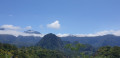
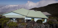
(3) Once there, enjoy a stunning view over Salazie and its peaks. Nearly 600 m below lies the village of Hell-Bourg. You can see the remains of the cable car that once linked Hell-Bourg to the lodge. From the viewpoint, take the path that descends to the left towards Hell-Bourg. Cross the Ravine de la Vierge and pass close to the old cable car. Begin the descent along switchbacks that are sometimes tight and feature high steps. This section of switchbacks ends at a cross. There are a few clearings offering views of Salazie. After the wayside shrine, the path becomes a little less strenuous. The switchbacks resume at a spring. Some sections are secured with cables to prevent you from falling. The final metres of the descent take you through fields of chouchou. Turn right onto the track at the end of the path.
(4) Then turn left onto Rue Auguste Lacaussade at a picnic area. Ignore a path on the right leading to a forest warden’s house, then keep right at the next junction. Cross the Bras des Demoiselles.
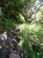
(5) After the ravine, take the first road on the left towards the stadium. Cross the stadium and turn left onto the path leading to Terre Plate. This path is quite overgrown and climbs via tight, slippery hairpin bends. Watch out for certain sections that have collapsed slightly. Much of the climb is under casuarina trees, with a few streams to cross.
(6) Ignore the path on the left which leads to Bémahot.
(7) You’ll reach the Terre Plate plateau after about 45 minutes’ walk. The entire plateau is covered in cryptomeria trees. Upon reaching the plateau, turn right to reach a shelter and a viewpoint overlooking the Cirque de Salazie. Take a break and then continue through the forest. Keep to the right of the track.
(8) The track is particularly muddy and slippery, despite a few improved sections. This stretch is, however, short. Also watch out for the numerous aerial roots of the cryptomeria trees. Take the first path on the right and cross the Ravine des Trois Cascades.
(9) Ignore the next path on the right, which leads to Ilet à Vidot and the Sources Manouilh. After crossing the Bras Sec, the path leaves the cryptomeria forest and climbs very steeply through the forest of coloured woods higher up. The most difficult part begins here. The slope becomes increasingly steep. The hairpin bends are sometimes very tight and you may need to use your hands towards the end of the climb. Occasionally, you can see the Croix du Cap Anglais and get a sense of how much of the climb remains. Keep going – this section is dreaded by many walkers, especially when tackled on the way up.
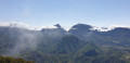
(10) Reach the top of the rampart. The views over Salazie are remarkable. Take a well-deserved break and turn left onto the path that leads back down to the Bélouve lodge. You’ll need to negotiate around fifteen ladders, which may be difficult for those prone to vertigo. Most of the route is downhill, but there are occasional short, fairly steep climbs. The path sometimes veers away from the Salazie rampart. To the right, there are views over the Plaine des Cafres and Piton de la Fournaise in the distance. The ground is sometimes marshy and very muddy: make sure you wear sturdy footwear. You may sink several centimetres into the mud. You may sometimes have to perform a bit of acrobatics to avoid the muddy patches. A few footbridges make it much easier to cross the wettest sections.
(11) Cross the Bras des Demoiselles and tackle a short but steep climb featuring a ladder. You’re now nearly halfway down the descent to Bélouve.
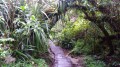
(12) Further on, cross the same ravine via a wooden footbridge. It is here that you’ll enter the ‘Forêt de Bois de Couleur des Hauts’. The forest is remarkable for its lush vegetation and its gnarled trees, which force you to duck.
(13) Continue straight on, ignoring the Sentier de la Tamarinaie which branches off to the right.
(14) At the end of the path, you’ll find a gazebo and a viewpoint overlooking Salazie. Then take the track on the right. The difficult part is now over.
(2) The track ends after a few minutes at the forest road near the Somin Tamarin, which is a path adapted for people with disabilities. It is a short circular path with several educational signs. Walk this circular path in a clockwise direction.
(2) Continue straight on along the Sentier de la Tamarinaie. This path crosses several ravines and passes close to several fanjan plantations.
Turn left when you reach the track, then turn right onto the forest road.
Follow this road to the Bélouve car park (S/E)

 Visorando Member
 Easy
Easy 
 Moderate
  Difficult