Chemin de la Minardière in Billy

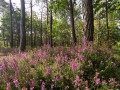
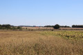
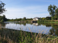
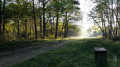
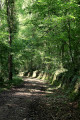
This nature trail, listed under the Departmental Plan for Sites and Routes (PDESI), is representative, in its first section, of the Cher Valley with its open spaces of farmland and small woods, and in its second section, of the typical Sologne landscape with its forest of oaks and birches. It is particularly popular when the heather is in bloom.

Details

39234900
Creation:
Last update:
Last review:
  • Walking
    Activity: Walking
  • ↔
    Distance: 7.33 mi
  • ◔
    Average duration: 3h 25 
  • ▲
    Difficulty: Moderate

  • ⚐
    Back to start: Yes
  • ↗
    Ascent: + 56 ft
  • ↘
    Descent: - 56 ft

  • ▲
    Highest point: 341 ft
  • ▼
    Lowest point: 269 ft

Photos

Description of the walk

From Selles-sur-Cher, take the D956 then the D119 towards Billy. The starting point is next to the church on the D59.

Signposting: yellow bar

(S/E) Walk past the church, keeping it on your right, and take the road towards Romorantin (D59). Ignore one junction, then turn right onto Rue de la Monière. Continue along this street, which turns into a track, until you reach a junction with a road. Carry on until you reach the road at Les Mares Jésus.

(1) Turn right and, at the next three-way junction, turn left. At a three-way junction, leave the road and take the track on the left into the small wood. You’ll arrive at: La Minardière.

(2) Turn left, then right, onto Rue de la Minardière. Pass a first cluster of houses, then in the hamlet of Les Bois, turn left, then left again, and right as you leave the woods. Continue along this track, skirting the forest. Turn right at the next two crossroads to reach a fourth.

(3) Turn left and carry on until you reach the old farm. Take the road on the left until the next junction with the D59.

(4) Head straight ahead onto the Chemin de l’Egrouin. At the hamlet, veer left and follow the track across the fields for about 900 metres.

(5) Then turn right and head into the woods. Keep to the right until you reach the edge of the motorway.

(6) Continue through the woods, turning left at the fork, and join the D119.

(7) Cross over to the opposite side and turn left. At the second crossroads, turn right, then, after 400 metres, turn left onto the grassy track. Continue to the right until you reach a four-way crossroads

(8) Turn onto the path slightly to the right, heading due south, and stay on this path until the next junction with the D119.

(9) Turn left onto the D119 to reach the (S/E).

Waypoints

  1. S/E : mi 0 - alt. 285 ft - Église Saint-Symphorien (Billy)
  2. 1 : mi 1.12 - alt. 279 ft - Les Mares Jésus
  3. 2 : mi 2.11 - alt. 272 ft - La Minardière
  4. 3 : mi 3.24 - alt. 292 ft - Crossroads in the forest
  5. 4 : mi 3.76 - alt. 308 ft - D59
  6. 5 : mi 4.23 - alt. 308 ft - Entrance to the forest
  7. 6 : mi 4.8 - alt. 305 ft - Directions – motorway
  8. 7 : mi 5.41 - alt. 325 ft - D119
  9. 8 : mi 6.27 - alt. 322 ft - Crossroads of four paths
  10. 9 : mi 7.17 - alt. 292 ft - directional information – D119
  11. S/E : mi 7.33 - alt. 285 ft - Église Saint-Symphorien (Billy)

Worth a visit

The Church of Saint-Symphorien, a listed historic monument, dates from the 11th century, when the nave was built. In the 13th century, the bell tower was added, and in the 15th century the chancel was rebuilt. In the 19th century, two chapels were added to form the transept. On the façade, three small sculpted figures can be seen.
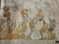
Fragments of 15th-century murals are still visible inside.
They depict, from left to right: a naked Saint Blaise being martyred by two executioners with carding combs. A crowned Saint Catherine holds a sword and stands near the wheel on which she was tortured, whilst Saint Barbara, holding a palm branch and a book, is depicted beside her tower. A set of 14 19th-century Saint Vincent candles is among the highlights not to be missed.

Reviews and comments

4.5 / 5
Based on 2 reviews

Reliability of the description
5 / 5
Ease of following the route
4.5 / 5
Route interest
4 / 5
User 23140607

Overall rating : 4.3 / 5

Date of your route : Aug 03, 2025
Reliability of the description : ★★★★★ Very good
Ease of following the route : ★★★★☆ Good
Route interest : ★★★★☆ Good
Very busy route : No

A lovely walk, mainly through the forest, peaceful, but the signposting isn't always clear due to some overhanging branches. We improvised an alternative route for the sections along the road, even though these weren't very busy. I'd recommend it!

Machine-translated

tcheuma
tcheuma

Overall rating : 4.5 / 5

Date of your route : Sep 02, 2024
Reliability of the description : Not used / Not applicable
Ease of following the route : ★★★★★ Very good
Route interest : ★★★★☆ Good
Very busy route : No

A lovely forest path. Despite it being quite late in the season, we still managed to see a few heather plants in bloom. We even spotted a roe deer! However, the path is sometimes poorly signposted – thank goodness we had the GPS. It’s worth noting that there was a bit too much road for my liking – just over 3 km in total.

Machine-translated

Other walks in the area

For more walks, use our search engine .

The GPS track and description are the property of this route's author. Please do not copy them without permission.