Vassieux-en-Vercors - The Chemin des Feuilles

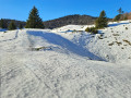
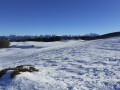
A forest walk with beautiful views over the Vassieux-en-Vercors plain. There are no navigation difficulties on this route, which mainly follows wide tracks. The aspect of the slope ensures good snow cover and, above all, helps to preserve the snow when it is scarce elsewhere.

Details

1214120
Creation:
Last update:
Last review:
  • Snowshoeing
    Activity: Snowshoeing
  • ↔
    Distance: 5.04 mi
  • ◔
    Duration according to the author: 4 hrs 
  • ▲
    Difficulty: Moderate

  • ⚐
    Back to start: Yes
  • ↗
    Ascent: + 879 ft
  • ↘
    Descent: - 879 ft

  • ▲
    Highest point: 4,531 ft
  • ▼
    Lowest point: 3,684 ft

Description of the walk

Snowshoe trail marker no. 2

(S/E) From the Poteau Balenne, head towards the sign for La Trompe (alt. 1,200 m) at the entrance to the Stade Raphaël Poirée, then, just before the biathlon stadium reception, turn right (east) onto a slope that climbs quite steeply for a few metres until it joins a track.

(1) Cut across the track and take the trail opposite, which continues to climb before descending onto the D76.

(2) Cross the road to reach the sign for Col Saint-Alexis (alt. 1,222m), then veer right to follow the track that runs along the side of the Montagne de Nève for 2.5 km.

(3) Turn right and head down through the woods to join another track in the Combe de Nève.

(4) Follow this track downhill.

(5) At the next junction, turn right, heading north-east, and take the ‘Chemin des Feuilles’. The path is mostly flat before beginning to descend, losing 10 metres in altitude.

(6) At the junction, turn right and head back up to the road.

(8) Cross the road and head straight ahead to return to the Balenne car park (S/E).

Waypoints

  1. S/E : mi 0 - alt. 3,875 ft - Poteau Balenne (alt. 1180m)
  2. 1 : mi 0.31 - alt. 3,993 ft - Cross-country ski trail
  3. 2 : mi 0.72 - alt. 4,012 ft - D76 crossing - Col de Saint-Alexis (1222m)
  4. 3 : mi 2.18 - alt. 4,505 ft - Turn right as you head downhill
  5. 4 : mi 2.72 - alt. 4,160 ft - Downhill track to the right
  6. 5 : mi 2.92 - alt. 4,045 ft - Turn right onto Chemin des Feuille
  7. 6 : mi 4.48 - alt. 3,688 ft - Junction of paths, turn right
  8. 7 : mi 4.75 - alt. 3,776 ft
  9. 8 : mi 4.8 - alt. 3,773 ft - D76 crossing
  10. S/E : mi 5.04 - alt. 3,875 ft - Poteau Balenne (alt. 1,180m)

Notes

In the event of an accident, call the resort on 04 75 48 24 64 and the emergency services on 112.
Hikers must be self-sufficient and responsible for themselves and any animals they bring with them. Respect for the natural environment and other users of the ski area is also part of responsible behaviour for hikers.
Snowshoes are not permitted on the ski runs.
Winter weather conditions can be changeable and challenging: check the forecast before setting off, adapt your equipment accordingly, take some provisions (water and sugary foods), carry your mobile phone, inform someone of your route before setting off, and avoid ridgelines.

- Col de Rousset Ski Resort
04 75 48 24 64 / lecolderousset@ladrome.fr

- Vercors Drôme Tourist Office
04 75 48 22 54 / www.vercors.com

Reviews and comments

4.3 / 5
Based on 2 reviews

Reliability of the description
4.5 / 5
Ease of following the route
4 / 5
Route interest
4.5 / 5
RemyValerie
RemyValerie

Overall rating : 4.7 / 5

Date of your route : Aug 15, 2020
Reliability of the description : ★★★★★ Very good
Ease of following the route : ★★★★☆ Good
Route interest : ★★★★★ Very good
Very busy route : No

Perfect for summer. Set in the woods and mostly in the shade. Peace and quiet

Machine-translated

danmarc38
danmarc38

Overall rating : 4 / 5

Date of your route : Feb 17, 2020
Reliability of the description : ★★★★☆ Good
Ease of following the route : ★★★★☆ Good
Route interest : ★★★★☆ Good

This walk is particularly appealing because of the snow conditions, which are often excellent.
However, the start and finish are tricky.
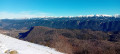
When I do this walk, I set off from the Col Saint-Alexis. I skip the start suggested by the guidebook, which involves a short but steep climb right at the start and, more importantly, a dangerous descent towards the pass as it is often poorly covered in snow. I take the hiking trail and follow it to the Col de Chirone, keeping to the left to join the GR93. At the Col de Chirone, if the weather is fine, there’s a magnificent view over the Diois. For the return journey, I take the same route as on the way there.
The return route suggested by the guide has, for me, an unpleasant ending: crossing a road, amongst other things.
I’ll be guiding a group on this route in March 2020 (eight octogenarians) for the third time.
Daniel Marty

Machine-translated

Other walks in the area

For more walks, use our search engine .

The GPS track and description are the property of this route's author. Please do not copy them without permission.