


Refine your search for walks in Étang de Villefermoy
Étang de Villefermoy walks


 Villefermoy Forest - Northern Circular Loop
 Visorando Member
 8.24 mi
 +102 ft
 -112 ft
 3h 55
3h 55
 Moderate
 Departure from La Chapelle-Rablais (Seine-et-Marne)
One of the few forest trails that can be followed in the heart of Brie. A route that is mainly in cool shade, with a brief stretch through the fields around the Ferme d'Heurtebise.
Walks near Étang de Villefermoy
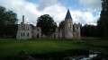
From Mormant to Marles-en-Brie via the Château du Vivier
 14.43 mi
+131 ft
-135 ft
6h 45
14.43 mi
+131 ft
-135 ft
6h 45
 Difficult
Departure from Mormant (Seine-et-Marne)
Difficult
Departure from Mormant (Seine-et-Marne)
A walk from station to station, along the back roads of the Brie region and through fields and woods. Several heritage highlights along the way, including some beautiful churches, a menhir and, as the highlight, the ruined château of Le Vivier.
From Verneuil-l’Étang to Melun via the GR®1
21.62 mi
+282 ft
-446 ft
10 hrs
 Very difficult
Departure from Verneuil-l'Étang (Seine-et-Marne)
Very difficult
Departure from Verneuil-l'Étang (Seine-et-Marne)
This is the longest stage on theGR®®1. It can be split into two by taking the bus halfway along the route at Blandy-les-Tours (check timetables). It is one of the most historically rich stages. Indeed, the route takes you through Melun, which boasts a very rich heritage, and also passes very close to the Château de Vaux-le-Vicomte and the Château de Blandy. Most of the route is through countryside, but a few wooded sections may be part of the walk.
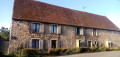
From Verneuil-l’Étang to Mormant via the Château de Beauvoir
 7.78 mi
+59 ft
-20 ft
3h 40
Moderate
Departure from Verneuil-l'Étang (Seine-et-Marne)
7.78 mi
+59 ft
-20 ft
3h 40
Moderate
Departure from Verneuil-l'Étang (Seine-et-Marne)
A walk from station to station that takes place mainly amongst cultivated fields, with beautiful farmhouses dotted here and there. You pass through several villages, each with its own old church, and walk past Beauvoir Castle after skirting its grounds.
From Verneuil-l'Étang to Fontaine-le-Port via Champeaux and Blandy-les-Tours
 16.48 mi
+72 ft
-220 ft
6 hrs
Very difficult
Departure from Verneuil-l'Étang (Seine-et-Marne)
16.48 mi
+72 ft
-220 ft
6 hrs
Very difficult
Departure from Verneuil-l'Étang (Seine-et-Marne)
A long walk from station to station, across the Brie plain with its sweeping horizons. Along the way, two superb monuments: the Collegiate Church of Saint-Martin in Champeaux and the fortified castle at Blandy-les-Tours.
From Donnemarie-Dontilly to Montereau-Fault-Yonne in Bassée-Montois
 16.56 mi
+669 ft
-850 ft
8h 10
Difficult
Departure from Donnemarie-Dontilly (Seine-et-Marne)
16.56 mi
+669 ft
-850 ft
8h 10
Difficult
Departure from Donnemarie-Dontilly (Seine-et-Marne)
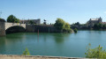
Twenty-fourth stage of the Grand Tour of Île-de-France via the GR®11, starting from Donnemarie-Dontilly after spending the night there at the end ofthe previous stage. This stage connects the Montois region to the Seine Valley and Montereau-Fault-Yonne, the confluence of the Seine and Yonne rivers. It thus transitions from an agricultural landscape to a marshland landscape in the valley, ending in a more urban environment.
From Fontaine-le-Port to Melun via the Cave locks
 7.88 mi
+82 ft
-72 ft
3h 40
Moderate
Departure from Fontaine-le-Port (Seine-et-Marne)
7.88 mi
+82 ft
-72 ft
3h 40
Moderate
Departure from Fontaine-le-Port (Seine-et-Marne)
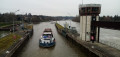
A hike from station to station, in two stages. In the first part, you climb slightly and stroll along a narrow path offering beautiful views of the Seine. The stretch above the Cave locks can be a spectacular sight at high water. In the second, less varied section, you follow the Seine along a tarmac path where you can admire some ‘stunning’ houses dating from the Belle Époque.
From Fontaine-le-Port to Champagne-sur-Seine via the hillsides on the right bank
 11.07 mi
+538 ft
-495 ft
5h 35
Moderate
Departure from Fontaine-le-Port (Seine-et-Marne)
11.07 mi
+538 ft
-495 ft
5h 35
Moderate
Departure from Fontaine-le-Port (Seine-et-Marne)
A hike from station to station high up on the right bank of the Seine, offering beautiful views of the river and the nearby Forest of Fontainebleau. The first and last thirds of the hike follow paths that wind through the forest. In between, the route alternates between fields, woods and residential areas, with some interesting heritage sites.
From the Barbeau Forest to Champagne-sur-Seine
10.97 mi
+584 ft
-531 ft
5h 35
Moderate
Departure from Fontaine-le-Port (Seine-et-Marne)
The Barbeau State Forest, as you follow the PR® route, offers magnificent views of the Seine. A stop in Héricy, with its 13th-century church and historic centre near the riverbanks. Views of the Île aux Barbiers as you walk along the Seine. A short climb towards the Rocher de Samoreau via the GR®2, then a return via Champagne-sur-Seine station.
From Champagne-sur-Seine to Bourron-Marlotte via the Restant du Long Rocher
 12.28 mi
+781 ft
-712 ft
6h 20
Difficult
Departure from Champagne-sur-Seine (Seine-et-Marne)
12.28 mi
+781 ft
-712 ft
6h 20
Difficult
Departure from Champagne-sur-Seine (Seine-et-Marne)
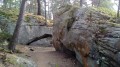
A hike from station to station, mainly through a section of the Fontainebleau Forest that is not among the most frequented. The forest route alternates between wide paths and trails that wind through rocky terrain. Before that, the crossing of Thomery offers beautiful heritage sites, including its grape walls and some beautiful views of the Seine.
From Champagne-sur-Seine to Fontainebleau
7.88 mi
+358 ft
-315 ft
3h 55
Moderate
Departure from Champagne-sur-Seine (Seine-et-Marne)
A lovely walk offering the chance to discover, along the way, the paths running alongside the walls and vineyards of Thomery, and the Château de Rosa Bonheur. The route follows the Seine to the Port du Pays de Fontainebleau, passing via the Butte de Montceau and through the Forest of Avon.