


 Country:
 City:
City:


Point de départ et accès : gare de Mormant.
- Transilien - Ligne P, sur le tronçon entre Paris-Est et Provins.
Emprunter l'unique sortie, du côté du bâtiment de la gare, en accès direct quand on vient de Provins (si l'on arrive en sens inverse, emprunter le passage souterrain).
Sans balisage
(S) Au sortir de la gare, se diriger vers la gauche. Au carrefour, traverser l'Avenue de la Gare et la suivre à droite (Sud).
Balisage Bleu
Au feu tricolore, continuer tout droit. Au croisement suivant, prendre à gauche la Rue du Moulin. Aller tout droit et ignorer rues et impasses sur les côtés.
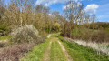
(1) Emprunter le pont qui enjambe la voie ferrée. La route devient alors plus étroite puis laisse place à un chemin herbeux entre les champs. Après un virage vers la gauche, ignorer un départ de chemin sur la droite, franchir le Ru d'Avon et longer un bosquet à main droite. Passer sous une ligne à haute tension puis sous une ligne électrique normale.
(2) Au croisement, emprunter à gauche une piste qui se dirige vers un corps de ferme. À l'angle du 1er bâtiment, tourner à droite. Laisser un bâtiment abandonné à main gauche puis une mare à main droite.
(3) Au "cédez le passage", suivre la D32E3 à gauche. Cette route semble peu passante mais le bas-côté n'est guère large : demeurer prudent. Au carrefour situé à l'entrée d'Aubepierre, prendre à droite le Chemin des Grands Bois. Ignorer les ruelles côté gauche et dépasser l'entrée du stade de foot. Au Stop, tourner à droite et dépasser le cimetière.
(4) Une cinquantaine de mètres après, quitter la route et obliquer à gauche sur une piste agricole. Suivre longuement cette piste au Nord-Est. À l'abord des premières maisons, longer un mur de parpaings à main gauche.
(5) À la patte d'oie, prendre à gauche la Rue du Jour. Au bout, suivre à gauche la Rue de l'Ormoy. Après une cinquantaine de mètres, prendre la 1re à droite, le Chemin du Bois de la Ville (stabilisé). Longer un muret à main droite et prolonger sur un chemin herbeux (très enherbé par endroits) avec une clôture côté droit. Au croisement en T, aller à gauche et aboutir aussitôt à un croisement peu marqué.
Balisage Bleu + Jaune
(6) Continuer tout droit vers un poteau électrique. Ignorer un chemin sur la gauche et descendre. En bas, traverser la D211 ( circulation rapide) et aller en face en direction de Courtomer. Franchir l'Yerres et, à l'angle d'une station d'épuration, continuer tout droit dans la Rue du Pont Neuf, en montée. Prendre ensuite la 1re à droite, la Rue de la Sirette. Dépasser la mairie puis gravir à droite un escalier qui conduit à l'esplanade de l'église. Laisser l'église à main droite et descendre un escalier sur la gauche.
(7) Au carrefour, suivre à gauche la Rue du Paradis, en descente, et croiser aussitôt la Rue du Pont Neuf côté gauche. Avant un panneau de limitation à 30 km/h, prendre à droite le Chemin de la Pierre Couvée. Le goudron laisse rapidement place à un chemin gravillonné qui devient herbeux plus loin. Effectuer un virage à droite puis un à gauche au pied d'un beau châtaignier. Poursuivre en lisière et atteindre le Menhir de la Pierre Couvée situé à gauche dans un champ (pas d'accès).
(8) Poursuivre en lisière puis entrer dans le bois. Longer bientôt un pré à main gauche puis monter régulièrement dans le bois. En haut, ignorer une flèche Bleue qui invite à tourner à gauche, continuer tout droit et aboutir aussitôt à une petite route.
Balisage Jaune
(9) Suivre la route à gauche, en lisière du bois.
Balisage Jaune + Rose
Côté gauche, croiser une route interdite aux plus de 3,5 t, continuer tout droit et ignorer une autre route sur la droite.
(10) À la hauteur d'un poteau téléphonique porteur d'une balise VTT, s'engager à gauche dans un sentier qui demeure parallèle à la route au début. Longer une clôture à main gauche, ignorer un chemin sur la droite puis longer clôtures et murs de jardin à main droite. Déboucher sur une petite route dans le village d'Arcy et la suivre à gauche sur une cinquantaine de mètres.
(11) Prendre alors à droite le Chemin du Lavoir. Ce chemin est gravillonné au début et devient ensuite herbeux. Longer un pré clôturé à main droite puis continuer entre les champs. Franchir la banquette du Ru du Miroir. Face à une barrière métallique, virer à gauche. Longer un pré clôturé à main droite, dans lequel se trouve une mare.
(12) À l'angle du pré, s'engager à droite dans un étroit sentier (la fin du chemin figuré en mauve sur la carte a été labourée). Se faufiler entre une haie sur la gauche et la clôture du pré sur la droite. Au bout, ignorer un chemin sur la gauche et aller tout droit dans le bois. Au croisement qui se présente après quelques mètres, obliquer à droite et cheminer au Nord-Est en longeant une clôture à main gauche. Poursuivre en lisière puis longer les pâturages d'un centre équestre à main gauche.
(13) Le chemin vire à gauche et pénètre à nouveau dans un bois. Dépasser deux mares côté droit, virer à droite avec le chemin et longer une clôture à main droite. Virer ensuite à gauche et franchir un ru. Aller tout droit avec une clôture à main droite et déboucher sur une route à l'entrée du lieu-dit Les Grands Champs.
Balisage Jaune
(14) Traverser la route (avec prudence) et la suivre à droite sur une trentaine de mètres. Tourner alors à gauche, passer une barrière métallique et aller tout droit dans un bois. Franchir un ruisseau puis virer à gauche (Ouest). Passer entre les deux murs d'un ancien pont de chemin de fer et poursuivre Ouest-Nord-Ouest. Traverser la route D436 ( route passante) et suivre la petite route en face vers le Château du Vivier.
(15) Virer à droite avec la route et noter sur la gauche les ruines du Château du Vivier. Virer à gauche avec la route et monter.
Balisage Rouge et Blanc
(16) Au Stop, tourner à droite et longer des pâturages à chevaux côté gauche. Suivre la route pendant environ 1 km.
Balisage Rouge et Blanc + Jaune
(17) Emprunter à droite la petite route en direction de Visy. Descendre, franchir une rivière et remonter de l'autre côté par la Rue du Bréon. À la hauteur d'un ralentisseur dans la rue, prendre à gauche le Chemin du Parc. Traverser une zone résidentielle, passer une barrière métallique et continuer sur un sentier. À une patte d'oie (cote 97), obliquer à gauche. Plus loin, franchir un ruisseau, passer une barrière métallique et franchir une rivière.
(18) Ignorer alors sur la gauche l'accès à une station d'épuration et remonter en face une petite route. Bientôt, longer le mur du parc du Château de Fontenay-Trésigny à main droite.
(19) Au "cédez le passage", suivre la D144a à droite. Ignorer tous les départs sur la gauche, entrer dans Fontenay-Trésigny et aboutir face à son église.
(20) Laisser l'église à main gauche et traverser le village par la Rue Bertaux. Passer un portail de pierre et, au rond-point qui suit, obliquer légèrement à gauche pour suivre l'Avenue du Général de Gaulle en direction de la N4 et de Nancy. Dépasser la mairie puis le bureau de poste côté gauche.
(21) À l'angle du n°14, emprunter à gauche la Rue Louis Braille. Au bout, suivre une avenue à gauche. Au rond-point, continuer tout droit et traverser l'Avenue du Général Leclerc pour la suivre sur son trottoir de droite. Passer sous le pont de la N4 et tourner tout de suite à droite en direction de Nancy. Suivre la route sur son bas-côté gauche et s'engager sur un sentier peu marqué derrière le rail de sécurité.
(22) Virer aussitôt à gauche le long d'une petit mur de béton côté gauche. Virer à droite à la hauteur d'un plan d'eau puis aussitôt à gauche. Suivre un chemin très enherbé entre le petit mur à main gauche et un champ cultivé à main droite (passage encombré et désagréable ; situation de juin et septembre 2020). Longer un bosquet à main droite, ignorer un chemin sur la droite et retrouver un chemin correct. Déboucher sur une route au lieu-dit La Croix Saint-Pierre.
(23) Traverser la route et la suivre à gauche jusqu'au carrefour. Traverser la D436 ( route passante) et suivre la D144a sur une vingtaine de mètres. Tourner alors à droite dans un chemin. À la fourche qui se présente aussitôt (non figurée sur la carte), choisir le chemin de droite qui revient vers la D436 puis repique à gauche. Suivre dans un bois un large chemin qui est la banquette d'une ancienne voie ferrée. Continuer en lisière puis entre les champs.
Sans balisage
(24) Au croisement, continuer tout droit (laisser le balisage partir à droite). Au bout du chemin, suivre une petite route à droite (D143). Au Stop, traverser une nouvelle fois la D436 et la suivre à gauche. Aller tout droit et, à l'abord du passage à niveau, obliquer à droite pour rejoindre la gare de Marles-en-Brie (E).
 Visorando Member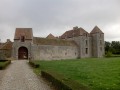
 Easy
Easy  Moderate
 Very difficult
