Country:
 City:
City:



Starting point and access: Fontaine-le-Port railway station.
- Transilien – Line R, on the section between Melun and Montereau via Héricy.
Take the exit on the side of platform 1, the one for trains travelling from Melun to Montereau (if arriving from the opposite direction, platform 2, take the underpass).
Red and white markings
(S) With your back to the railway line, turn right and cross the station car park. At the exit (traffic lights), turn left. Walk up the D116 for approximately 250 m, keeping to the left-hand pavement.
See an alternative route from (1) to (3) in the practical information section.
Unmarked
(1) When the road bends to the right (information sign for theGR®2), turn left onto a path that winds its way between a fence on the left and a property wall on the right. Head downhill and, at the junction where the fence meets the wall, go straight on. Stay on the narrow path, which is sometimes overgrown (beautiful views of the Seine below on the left).
(2) Pass by a clump of bamboo and continue along the path, which is overgrown here with very young bamboo shoots (as of January 2021): this section is short, so don’t hesitate to make your way through the tender vegetation. Further on, the path is bordered on the left by a chain marking the boundary of private property, which can be used to steady yourself on the slope. After that, a fence takes over on the left.
Red and white markings
(3) Ignore a flight of steps on the right-hand side, pass a hairpin bend and continue straight on along the path. Walk alongside a fence on your left and an open (but private) woodland on your right. At a Fork in the road near the hamlet of Les Petites Vallées, continue straight on (ignore the path leading down to the left). Further on, after a short descent, you’ll come out onto a small road.
(4) Follow the road to the left. Pass under the railway bridge, keeping behind the railing that protects the narrow pavement on the left. Continue along the tarmac road, going downhill.
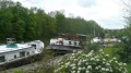
(5) At the Stop sign, cross the D39 and take the path through a hedge opposite, slightly to the right. Then follow the towpath alongside the Seine on your left. Pass a chain and turn left to stay as close as possible to the river on a compacted track. Pass the Chartrettes water sports centre, go through a metal barrier and rejoin the tarmac road.
Please note: there is a temporary change to the route (until 1 December 2021). The description below has been updated accordingly, but the route itself remains the same. Thanks to the hiker ‘ovil’ for reporting this change!
(6) Stay on the road (access to the footbridge is temporarily closed). Ignore an access road to the dam on the left and, at the next junction, turn left. At the end of the tarmac road, turn right and rejoin the towpath. Continue to a road bridge. Climb the steps and cross the bridge over the Seine along the D115. At the junction, turn right onto the Quai de la Ruelle and rejoin the main route at point (8).
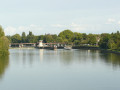
(6) When the access road curves to the right, as you approach the dam on the Seine, veer to the left. Go through a metal gate and then over a wooden footbridge spanning a leat of the river. Next, climb a spiral staircase and cross the Seine via the footbridge that spans the dam and then the two locks. On the other side, follow a small path to the right and, at the first bend, go down a flight of steps on the right. Cross a car park and follow the Quai Olivier Métra for about a hundred metres.
(7) When you reach a large red and white river sign (you’ll need to walk past it to see its coloured side), there are two options depending on the conditions:
- If the Seine is in flood, continue straight ahead along the quay. Rejoin the main route at (8).
- Otherwise, as shown on the map, turn right down a slight slope and follow a path not shown on the map as close as possible to the river. Pass under a road bridge, go slightly uphill and rejoin the quay (known here as the Quai de la Ruelle).
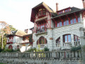
(8) Follow the quay and note several large houses, some with rather elaborate architecture (houses known as ‘les Affolantes’, information sign). Go straight on, ignoring all turn-offs to the left, and continue along the quay even when it is signposted as a dead end. Pass a sign indicating the hamlet of La Rochette (motor traffic is prohibited here except for residents).
(9) When the road curves to the left, carry on straight ahead, pass a chicane and follow a tarmac track closed to motor vehicles.
(10) Pass a small water-ski centre, go past a chicane and continue straight on along a track that is once again open to traffic (note the tall silos on the opposite bank). At the Stop sign, carry on straight ahead, preferably on the left-hand pavement. Go under the railway bridge and carry on straight ahead along a road with a speed limit of 70 km/h, using the left-hand pavement and then a good path running parallel to the road.
(11) At the ‘Camping’ bus stop, cross the road at the pedestrian crossing and take a path leading down to the Seine. Walk along the river on your right, then briefly alongside a wire fence on your left. Pass the Maison des Sportifs and return to the roadside.
No signposting
(12) Shortly afterwards, cross the road at the pedestrian crossing and follow Avenue de la7e Division Blindée Américaine towards Stade Paul Fischer. Walk alongside the stadium and then the tennis courts. Go straight on at every junction or roundabout (after the roundabout, you’ll be on Avenue de la Libération). At the end, head for Melun station (E).
To return home:
- Transilien – Line R, towards Paris-Lyon, Montargis or Montereau.
- RER – Line D, towards Corbeil-Essonnes or Paris and Creil.
- TER – Line towards Paris-Lyon or Laroche-Migennes.



 Visorando Member
 Easy
Easy